


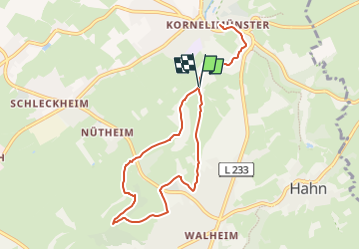

15,5 km | 19,8 km-effort
![Randonnée A pied Aix-la-Chapelle - [5] Itertalweg - Variante als Rundweg - Photo](https://media.geolcdn.com/t/1900/400/ext.pjpeg?maxdim=2&url=https%3A%2F%2Fmedia.geolcdn.com%2Ff%2F484480c9-a885-4696-8e01-a48866a6fd77.jpeg)

Tous les sentiers balisés d’Europe PRO


Application GPS de randonnée GRATUITE
 SityTrail
IGN / Instituts géographiques
SityTrail World
Le monde est à vous
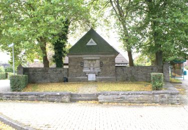
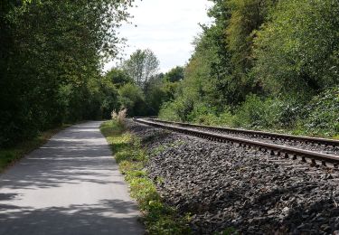
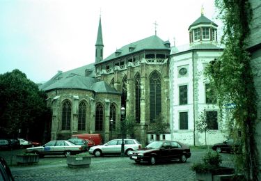
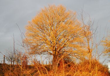
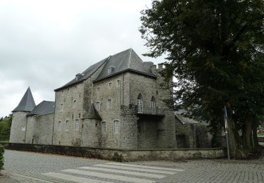
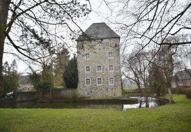
Randonnée A pied de 8 km à découvrir à Rhénanie-du-Nord-Westphalie, Région urbaine d'Aix-la-Chapelle, Aix-la-Chapelle. Cette randonnée est proposée par SityTrail - itinéraires balisés pédestres.
![Randonnée A pied Aix-la-Chapelle - [5] Itertalweg - Variante als Rundweg - Photo 1](https://media.geolcdn.com/t/2048/auto/291d9013-cc67-4688-ad53-faa85d893c18.jpeg&format=jpg&maxdim=0 "Randonnée A pied Aix-la-Chapelle - [5] Itertalweg - Variante als Rundweg - Photo 1")
![Randonnée A pied Aix-la-Chapelle - [5] Itertalweg - Variante als Rundweg - Photo 2](https://media.geolcdn.com/t/2048/auto/693d222e-0f3b-4c75-a0ce-fe3f29645097.jpeg&format=jpg&maxdim=0 "Randonnée A pied Aix-la-Chapelle - [5] Itertalweg - Variante als Rundweg - Photo 2")
![Randonnée A pied Aix-la-Chapelle - [5] Itertalweg - Variante als Rundweg - Photo 3](https://media.geolcdn.com/t/2048/auto/4f6fe56a-abd0-454e-a764-61f42a0a99ca.jpeg&format=jpg&maxdim=0 "Randonnée A pied Aix-la-Chapelle - [5] Itertalweg - Variante als Rundweg - Photo 3")
![Randonnée A pied Aix-la-Chapelle - [5] Itertalweg - Variante als Rundweg - Photo 4](https://media.geolcdn.com/t/2048/auto/f7b05888-8e01-452d-bab8-e082291e3b9b.jpeg&format=jpg&maxdim=0 "Randonnée A pied Aix-la-Chapelle - [5] Itertalweg - Variante als Rundweg - Photo 4")
![Randonnée A pied Aix-la-Chapelle - [5] Itertalweg - Variante als Rundweg - Photo 5](https://media.geolcdn.com/t/2048/auto/c6dc3e34-6d30-43c0-aa0c-0d1538b7b4fb.jpeg&format=jpg&maxdim=0 "Randonnée A pied Aix-la-Chapelle - [5] Itertalweg - Variante als Rundweg - Photo 5")
![Randonnée A pied Aix-la-Chapelle - [5] Itertalweg - Variante als Rundweg - Photo 6](https://media.geolcdn.com/t/2048/auto/ad9d4139-d165-454f-8b91-c3b3fe1d2c7f.jpeg&format=jpg&maxdim=0 "Randonnée A pied Aix-la-Chapelle - [5] Itertalweg - Variante als Rundweg - Photo 6")
![Randonnée A pied Aix-la-Chapelle - [5] Itertalweg - Variante als Rundweg - Photo 7](https://media.geolcdn.com/t/2048/auto/68efc7ab-b437-48e3-ac6a-51f059f06c88.jpeg&format=jpg&maxdim=0 "Randonnée A pied Aix-la-Chapelle - [5] Itertalweg - Variante als Rundweg - Photo 7")
![Randonnée A pied Aix-la-Chapelle - [5] Itertalweg - Variante als Rundweg - Photo 8](https://media.geolcdn.com/t/2048/auto/3b532600-9185-48db-a153-ace95aded16c.jpeg&format=jpg&maxdim=0 "Randonnée A pied Aix-la-Chapelle - [5] Itertalweg - Variante als Rundweg - Photo 8")
![Randonnée A pied Aix-la-Chapelle - [5] Itertalweg - Variante als Rundweg - Photo 9](https://media.geolcdn.com/t/2048/auto/0696819b-10e5-4a80-a6d5-c788d9c3eaff.jpeg&format=jpg&maxdim=0 "Randonnée A pied Aix-la-Chapelle - [5] Itertalweg - Variante als Rundweg - Photo 9")
![Randonnée A pied Aix-la-Chapelle - [5] Itertalweg - Variante als Rundweg - Photo 10](https://media.geolcdn.com/t/2048/auto/484480c9-a885-4696-8e01-a48866a6fd77.jpeg&format=jpg&maxdim=0 "Randonnée A pied Aix-la-Chapelle - [5] Itertalweg - Variante als Rundweg - Photo 10")
Marche
Marche
A pied
A pied
A pied
A pied
A pied
Marche