


18,2 km | 24 km-effort
Obernhof : découvrez les meilleures randonnées : 2 pédestres et 1 à vélo ou VTT. Tous ces circuits, parcours, itinéraires et activités en plein air sont disponibles dans nos applications SityTrail pour smartphones et tablettes.
A pied


• Randonnée créée par Tourist-Information Nassauer Land e.V.. Symbole: Gelbes Metallschild mit blauem Text "Vier-Täler...
A pied
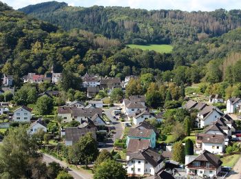
• Randonnée créée par Tourist-Information Nassauer Land e.V.. Symbole: Gelbes Metallschild mit blauem Text "Gelbachhöh...

Vélo
• More information on GPStracks.nl : http://www.gpstracks.nl
3 randonnées affichées sur 3
Application GPS de randonnée GRATUITE
 SityTrail
IGN / Instituts géographiques
SityTrail World
Le monde est à vous