Gaillon-sur-Montcient, Yvelines : Les meilleures randonnées, itinéraires, parcours, balades et promenades

Gaillon-sur-Montcient : découvrez les meilleures randonnées : 13 pédestres. Tous ces circuits, parcours, itinéraires et activités en plein air sont disponibles dans nos applications SityTrail pour smartphones et tablettes.


Les meilleurs parcours (13)

Randonnée Marche Gaillon-sur-Montcient - En passant par Dalibray - Photo
Marche 10.119
Km

Marche

Difficile
Gaillon-sur-Montcient, Île-de-France, Yvelines, France
10,1 km | 12,8 km-effort
2h 34min
204 m
201 m
Oui
Fky78

• Boucle en partant de Gaillon sur Montcient

Randonnée Marche Gaillon-sur-Montcient - Les 4 Villages - Photo
Marche 11.824
Km

Marche

Facile
Gaillon-sur-Montcient, Île-de-France, Yvelines, France
11,8 km | 15 km-effort
3h 15min
236 m
242 m
Oui
Fky78

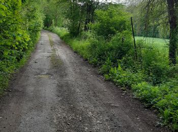
• Stationnement parking de la mairie, balade vallonnée sans difficulté pas trop de gadoue par temps humide sauf un pas...

Randonnée Marche Gaillon-sur-Montcient - Gaillon Hardricourt en passant par le cimetière  - Photo
Marche 8.93
Km

Marche

Moyen
Gaillon-sur-Montcient, Île-de-France, Yvelines, France
8,9 km | 11,2 km-effort
2h 14min
175 m
167 m
Oui
Fky78

• Le stop au cimetière n est pas obligatoire évidemment

Randonnée Marche Gaillon-sur-Montcient - Vallée de la Montcient - Photo
Marche 15.204
Km

Marche

Difficile
Gaillon-sur-Montcient, Île-de-France, Yvelines, France
15,2 km | 18,4 km-effort
4h 10min
237 m
237 m
Oui
Fky78

• Parcours longeant la Montcient et passant par la cave aux fées

Randonnée Marche Gaillon-sur-Montcient - Boucle en partant de Gaillon/Montcient  - Photo
Marche 10.43
Km

Marche

Facile
Gaillon-sur-Montcient, Île-de-France, Yvelines, France
10,4 km | 13,6 km-effort
2h 33min
239 m
244 m
Oui
Fky78

• rando assez vallonnée

Randonnée Marche Gaillon-sur-Montcient - Château de Villette - Photo
Marche 11.156
Km

Marche

Moyen
Gaillon-sur-Montcient, Île-de-France, Yvelines, France
11,2 km | 13,5 km-effort
2h 44min
178 m
176 m
Oui
Fky78

Randonnée A pied Gaillon-sur-Montcient - Boucle par Fremainville - Photo
A pied 12.821
Km

A pied

Facile
Gaillon-sur-Montcient, Île-de-France, Yvelines, France
12,8 km | 15,1 km-effort
3h 25min
170 m
162 m
Oui
Fky78

Randonnée Marche Gaillon-sur-Montcient - Gaillon/Montient -Les bois de jambville - Photo
Marche 12.955
Km

Marche

Difficile
Gaillon-sur-Montcient, Île-de-France, Yvelines, France
13 km | 16,6 km-effort
3h 46min
272 m
272 m
Oui
Fky78

Randonnée Marche Gaillon-sur-Montcient - Brueil aller retour - Photo
Marche 14.165
Km

Marche

Moyen
Gaillon-sur-Montcient, Île-de-France, Yvelines, France
14,2 km | 17,2 km-effort
3h 45min
230 m
230 m
Oui
Fky78

Randonnée Marche Gaillon-sur-Montcient - Boucle Gaillon Oinville - Photo
Marche 10.148
Km

Marche

Difficile
Gaillon-sur-Montcient, Île-de-France, Yvelines, France
10,1 km | 13,3 km-effort
2h 45min
234 m
234 m
Oui
Fky78

Randonnée Marche nordique Gaillon-sur-Montcient - En allant chercher le pain - Photo
Marche nordique 8.268
Km

Marche nordique

Facile
Gaillon-sur-Montcient, Île-de-France, Yvelines, France
8,3 km | 10,9 km-effort
2h 38min
197 m
198 m
Oui
Fky78

Randonnée Marche Gaillon-sur-Montcient - Château de Jambville - Photo
Marche 11.23
Km

Marche

Difficile
Gaillon-sur-Montcient, Île-de-France, Yvelines, France
11,2 km | 14,5 km-effort
3h 17min
244 m
248 m
Oui
Fky78

Randonnée Marche Gaillon-sur-Montcient - les 3 Vallons - Photo
Marche 11.441
Km

Marche

Facile
Gaillon-sur-Montcient, Île-de-France, Yvelines, France
11,4 km | 14,5 km-effort
3h 6min
233 m
229 m
Oui
Fky78

13 randonnées affichées sur 13

Application GPS de randonnée GRATUITE

Logo SityTrail SityTrail

IGN / Instituts géographiques

Télécharger SityTrail sur l'App Store Télécharger SityTrail sur Google Play

Logo SityTrail SityTrail World

Le monde est à vous

Télécharger SityTrail sur l'App Store Télécharger SityTrail sur Google Play Télécharger SityTrail sur Huawei AppGallery

Activités

Fermer
Mes abonnements