Linthal, Haut-Rhin : Les meilleures randonnées, itinéraires, parcours, balades et promenades

6 commentaires

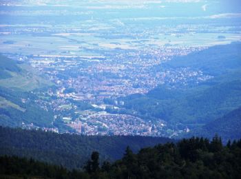
Linthal : découvrez les meilleures randonnées : 100 pédestres et 1 à vélo ou VTT. Tous ces circuits, parcours, itinéraires et activités en plein air sont disponibles dans nos applications SityTrail pour smartphones et tablettes.


Les meilleurs parcours (115)

Randonnée Marche Linthal - Markstein - Photo
Marche 14.018
Km

Marche

Moyen
(1)
Linthal, Grand Est, Haut-Rhin, France
14 km | 19,8 km-effort
4h 45min
435 m
442 m
Oui
VacheKiri67

• Faite le 13/04/2014 avec notre fils de 9 ans. D'après l'excellent ouvrage : Mes balades préférées dans les Vosges N°2...

Randonnée Marche Linthal - Tour de la grande Vallée de Munster (refuge du Hilsen - Munster) - Photo
Marche 18.09
Km

Marche

Difficile
(1)
Linthal, Grand Est, Haut-Rhin, France
18,1 km | 24 km-effort
5h 0min
285 m
974 m
Non
tracegps

• Boucle de 53 km au départ de Munster, passant par les sommets du Hohneck et du Petit Ballon ainsi que la route des cr...

Randonnée Marche Linthal - 68 Remspach - Hilsen - Photo
Marche 9.93
Km

Marche

Moyen
(1)
Linthal, Grand Est, Haut-Rhin, France
9,9 km | 14,6 km-effort
3h 3min
354 m
352 m
Oui
Seppala - Balades du jeudi

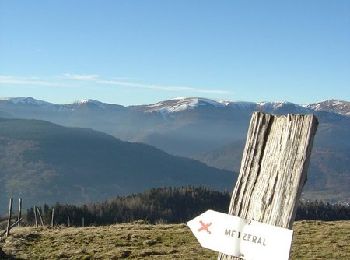
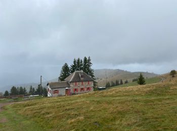
• Une balade connue, sans difficultés, pour rejoindre l'auberge du Hilsen. Le retour est rapide et le dénivelé est de ...

Randonnée Marche Linthal - Hilsen-Petit Ballon-Hilsen - Photo
Marche 9.464
Km

Marche

Moyen
Linthal, Grand Est, Haut-Rhin, France
9,5 km | 14,1 km-effort
3h 27min
345 m
345 m
Oui
griffet

• Une très belle balade vers le Petit Ballon

Randonnée Marche Linthal - rdpr lac de la lauch 210810 - Photo
Marche 11.768
Km
GUIDE

Marche

Difficile
Linthal, Grand Est, Haut-Rhin, France
11,8 km | 16,3 km-effort
4h 55min
343 m
345 m
Oui
stempfel52

Randonnée Marche Linthal - Linthal - Petit Ballon - Klintzkopf - Photo
Marche 22.561
Km

Marche

Difficile
Linthal, Grand Est, Haut-Rhin, France
23 km | 37 km-effort
5h 25min
1110 m
1108 m
Oui
Bart2015

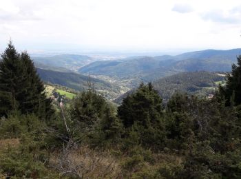
• Randonnée pour les amoureux de la marche avec de belles vues sur les montagnes alentour dont le Grand Ballon. La mont...

Randonnée Marche Linthal - rdpr linthal 2019 - Photo
Marche 8.887
Km
GUIDE

Marche

Moyen
Linthal, Grand Est, Haut-Rhin, France
8,9 km | 13,1 km-effort
2h 43min
317 m
309 m
Oui
stempfel52

Randonnée Marche Linthal - Markstein (30/08/2018) - Photo
Marche 17.178
Km

Marche

Difficile
Linthal, Grand Est, Haut-Rhin, France
17,2 km | 0 m-effort
4h 41min
0 m
0 m
Oui
Richard68500

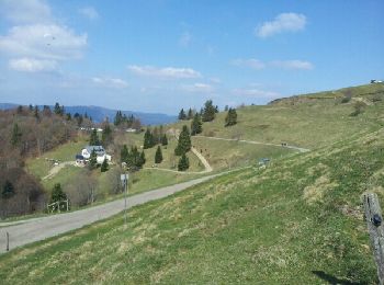
• Le Markstein est une station de sport d'hiver, d'été et de détente (luge d'été et parapente) française, située dans l...

Randonnée Marche Linthal - Markstein 29/12/2016 - Photo
Marche 17.214
Km

Marche

Moyen
Linthal, Grand Est, Haut-Rhin, France
17,2 km | 24 km-effort
5h 11min
512 m
506 m
Oui
Richard68500

• Belle balade sous le soleil, après une succulente escalope viennoise et une bonne bouteille de riesling offert par no...

Randonnée V.T.T. Linthal - Tour de la grande Vallée de Munster (refuge du Hilsen - Munster) - Photo
V.T.T. 18.09
Km

V.T.T.

Moyen
Linthal, Grand Est, Haut-Rhin, France
18,1 km | 24 km-effort
2h 0min
285 m
974 m
Non
tracegps

• Boucle de 53 km au départ de Munster, passant par les sommets du Hohneck et du Petit Ballon ainsi que la route des cr...

Randonnée Marche Linthal - Petit Balon depuis le Hilsen - Photo
Marche 3.869
Km

Marche

Moyen
(1)
Linthal, Grand Est, Haut-Rhin, France
3,9 km | 7,8 km-effort
1h 45min
382 m
30 m
Non
tracegps

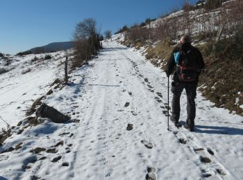
• Petite balade tranquille depuis le Hilsen, sur les hauteurs de Linthal, au fond de la vallée de Guebwiller. La durée ...

Randonnée sport Linthal - Remspach - Hilsen A/R - Photo
sport 7.393
Km

sport

Très facile
Linthal, Grand Est, Haut-Rhin, France
7,4 km | 11,9 km-effort
Inconnu
335 m
336 m
Oui
berni68

Randonnée Marche Linthal - Linthal boucle par col de lauchen - Photo
Marche 18.943
Km

Marche

Difficile
Linthal, Grand Est, Haut-Rhin, France
18,9 km | 30 km-effort
5h 21min
839 m
844 m
Oui
heurtinpatrick

Randonnée Marche Linthal - Dauviller - Markstein (25/08/2022) - Photo
Marche 10.634
Km

Marche

Moyen
Linthal, Grand Est, Haut-Rhin, France
10,6 km | 18,9 km-effort
3h 56min
622 m
621 m
Oui
Richard68500

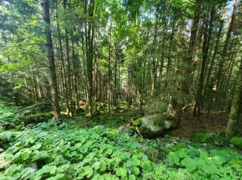
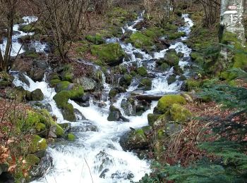
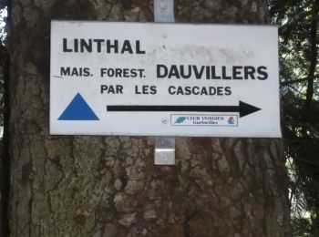
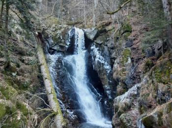
• Le long des cascades de la Lauch

Randonnée Marche Linthal - lac lauch - Photo
Marche 3.478
Km

Marche

Facile
Linthal, Grand Est, Haut-Rhin, France
3,5 km | 5,7 km-effort
1h 20min
169 m
166 m
Oui
MartineLeermakers

Randonnée Marche Linthal - 19.08.21.Hilsen - Photo
Marche 15.841
Km

Marche

Très facile
Linthal, Grand Est, Haut-Rhin, France
15,8 km | 24 km-effort
6h 4min
633 m
632 m
Oui
ROPPJP

Randonnée Marche Linthal - Obersengern AN Petit Ballon - Photo
Marche 12.147
Km

Marche

Difficile
Linthal, Grand Est, Haut-Rhin, France
12,1 km | 17,8 km-effort
3h 47min
423 m
426 m
Oui
domi68440

Randonnée Marche Linthal - 18.10.11.Linthal  - Photo
Marche 13.842
Km

Marche

Très facile
Linthal, Grand Est, Haut-Rhin, France
13,8 km | 21 km-effort
4h 44min
544 m
542 m
Oui
ROPPJP

Randonnée Marche Linthal - Hilsen. - Photo
Marche 11.779
Km

Marche

Très facile
Linthal, Grand Est, Haut-Rhin, France
11,8 km | 18 km-effort
6h 5min
453 m
519 m
Non
ROPPJP

Randonnée Marche Linthal - 2016 08 13 lac de la lauch - Photo
Marche 13.884
Km

Marche

Moyen
Linthal, Grand Est, Haut-Rhin, France
13,9 km | 19,4 km-effort
3h 54min
418 m
416 m
Oui
michelbauby

20 randonnées affichées sur 115

Application GPS de randonnée GRATUITE

Logo SityTrail SityTrail

IGN / Instituts géographiques

Télécharger SityTrail sur l'App Store Télécharger SityTrail sur Google Play

Logo SityTrail SityTrail World

Le monde est à vous

Télécharger SityTrail sur l'App Store Télécharger SityTrail sur Google Play Télécharger SityTrail sur Huawei AppGallery

Activités

Fermer
Mes abonnements