![](/images/other/stat-length.png)
- Randonnées
- Outdoor
- France
- Occitanie
- Gard
Gard, Occitanie : Les meilleures randonnées, itinéraires, parcours, balades et promenades
Gard : découvrez les meilleures randonnées : 5 134 pédestres, 951 à vélo ou VTT et 83 parcours équestres. Tous ces circuits, parcours, itinéraires et activités en plein air sont disponibles dans nos applications SityTrail pour smartphones et tablettes.
Les meilleurs parcours (6474)
![Randonnée Marche Navacelles - Les Aiguiéres au départ de Call - Photo](https://media.geolcdn.com/t/350/260/ext.jpg?maxdim=2&url=https%3A%2F%2Fmedia.geolcdn.com%2Ff%2Fceda67ec-d101-468c-8a83-e91809d135cb.jpg)
![Marche Marche](https://static1.geolcdn.com/sitytour/trail-icons/101.png)
Km
Marche
![](/images/other/stat-length.png)
![](https://static1.geolcdn.com/siteimages/upload/files/1508320355ic_sort_den_pos_24dp.png)
![](https://static1.geolcdn.com/siteimages/upload/files/1508320355ic_sort_den_neg_24dp.png)
![](https://static1.geolcdn.com/siteimages/upload/files/16400158638029165_repeat_loop_refresh_sync_direction_icon.png)
![Randonnée Marche Saint-Jean-du-Gard - rocher des chèvres - Photo](https://media.geolcdn.com/t/350/260/ext.jpg?maxdim=2&url=https%3A%2F%2Fmedia.geolcdn.com%2Ff%2Ff651fafb-b1d1-4725-b624-a9394b90fcdc.jpg)
![Marche Marche](https://static1.geolcdn.com/sitytour/trail-icons/101.png)
Km
Marche
![](/images/other/stat-length.png)
![](https://static1.geolcdn.com/siteimages/upload/files/1508320355ic_sort_den_pos_24dp.png)
![](https://static1.geolcdn.com/siteimages/upload/files/1508320355ic_sort_den_neg_24dp.png)
![](https://static1.geolcdn.com/siteimages/upload/files/16400158638029165_repeat_loop_refresh_sync_direction_icon.png)
• sentier de 4 km au départ du camping pour les résidents du mas de la cam
![Randonnée Marche Dourbies - DOURBIE LE SUQUET - Photo](https://media.geolcdn.com/t/350/260/ext.jpg?maxdim=2&url=https%3A%2F%2Fmedia.geolcdn.com%2Ff%2F3aec8218-95f7-47b5-aefb-d575744fb544.jpg)
![Marche Marche](https://static1.geolcdn.com/sitytour/trail-icons/101.png)
Km
Marche
![](/images/other/stat-length.png)
![](https://static1.geolcdn.com/siteimages/upload/files/1508320355ic_sort_den_pos_24dp.png)
![](https://static1.geolcdn.com/siteimages/upload/files/1508320355ic_sort_den_neg_24dp.png)
![](https://static1.geolcdn.com/siteimages/upload/files/16400158638029165_repeat_loop_refresh_sync_direction_icon.png)
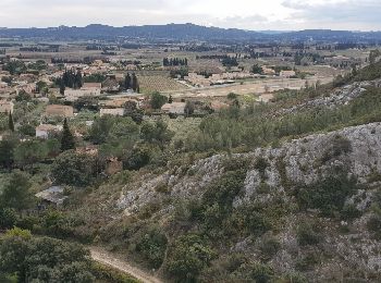
• TRES TRES BELLE RANDO TRES BEAUX PANORAMAS BEAUX SENTIERS
![Randonnée Marche Dourbies - RANDO DOURBIE - Photo](https://media.geolcdn.com/t/350/260/ext.jpg?maxdim=2&url=https%3A%2F%2Fmedia.geolcdn.com%2Ff%2F14771d8a-2437-4736-82a2-63176b47cad0.jpg)
![Marche Marche](https://static1.geolcdn.com/sitytour/trail-icons/101.png)
Km
Marche
![](/images/other/stat-length.png)
![](https://static1.geolcdn.com/siteimages/upload/files/1508320355ic_sort_den_pos_24dp.png)
![](https://static1.geolcdn.com/siteimages/upload/files/1508320355ic_sort_den_neg_24dp.png)
![](https://static1.geolcdn.com/siteimages/upload/files/16400158638029165_repeat_loop_refresh_sync_direction_icon.png)
• très belle rando beaux sentiers
![Randonnée Marche Le Vigan - le vigan circuit de l'arre-6km - Photo](https://media.geolcdn.com/t/350/260/ext.jpg?maxdim=2&url=https%3A%2F%2Fmedia.geolcdn.com%2Ff%2Fdeeb0779-403b-4a37-a4a4-fd5b9ea59268.JPG)
![Marche Marche](https://static1.geolcdn.com/sitytour/trail-icons/101.png)
Km
Marche
![](/images/other/stat-length.png)
![](https://static1.geolcdn.com/siteimages/upload/files/1508320355ic_sort_den_pos_24dp.png)
![](https://static1.geolcdn.com/siteimages/upload/files/1508320355ic_sort_den_neg_24dp.png)
![](https://static1.geolcdn.com/siteimages/upload/files/16400158638029165_repeat_loop_refresh_sync_direction_icon.png)
• trés belle ballade de 6 km au départ de le vigan
![Randonnée Marche Saint-Côme-et-Maruéjols - Saint Côme et Maruéjols - Photo](https://media.geolcdn.com/t/350/260/ext.jpg?maxdim=2&url=https%3A%2F%2Fservices.sitytrail.com%2FGeolivesWS%2FDownloadMedia.ashx%3FTrailID%3D981964%26Media%3Dfix__20180607151110.jpg)
![Marche Marche](https://static1.geolcdn.com/sitytour/trail-icons/101.png)
Km
Marche
![](/images/other/stat-length.png)
![](https://static1.geolcdn.com/siteimages/upload/files/1508320355ic_sort_den_pos_24dp.png)
![](https://static1.geolcdn.com/siteimages/upload/files/1508320355ic_sort_den_neg_24dp.png)
![](https://static1.geolcdn.com/siteimages/upload/files/16400158638029165_repeat_loop_refresh_sync_direction_icon.png)
• 6 juin 2018
![Randonnée Marche Rochefort-du-Gard - Ballade familliale autour des Eynavays et des falaises - Photo](https://media.geolcdn.com/t/350/260/ext.jpg?maxdim=2&url=https%3A%2F%2Fservices.sitytrail.com%2FGeolivesWS%2FDownloadMedia.ashx%3FTrailID%3D925085%26Media%3Dfix__20180318125343.jpg)
![Marche Marche](https://static1.geolcdn.com/sitytour/trail-icons/101.png)
Km
Marche
![](/images/other/stat-length.png)
![](https://static1.geolcdn.com/siteimages/upload/files/1508320355ic_sort_den_pos_24dp.png)
![](https://static1.geolcdn.com/siteimages/upload/files/1508320355ic_sort_den_neg_24dp.png)
![](https://static1.geolcdn.com/siteimages/upload/files/16400158638029165_repeat_loop_refresh_sync_direction_icon.png)
• Alternance de monotraces et de DFCI tres agréables et accessible aux enfants.
![Randonnée Marche Vers-Pont-du-Gard - Rando pont du Gard - Photo](https://media.geolcdn.com/t/350/260/ext.jpg?maxdim=2&url=https%3A%2F%2Fservices.sitytrail.com%2FGeolivesWS%2FDownloadMedia.ashx%3FTrailID%3D895180%26Media%3Dfix__20180128154606.jpg)
![Marche Marche](https://static1.geolcdn.com/sitytour/trail-icons/101.png)
Km
Marche
![](/images/other/stat-length.png)
![](https://static1.geolcdn.com/siteimages/upload/files/1508320355ic_sort_den_pos_24dp.png)
![](https://static1.geolcdn.com/siteimages/upload/files/1508320355ic_sort_den_neg_24dp.png)
![](https://static1.geolcdn.com/siteimages/upload/files/16400158638029165_repeat_loop_refresh_sync_direction_icon.png)
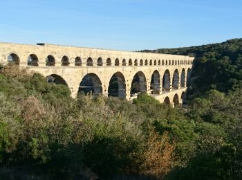
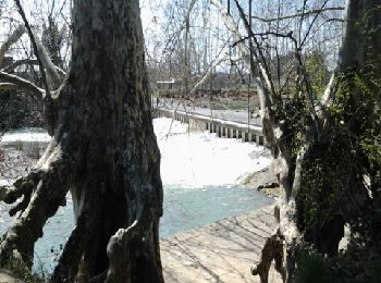
• Superbe petite ballade autour du pont du Gard
![Randonnée Marche Fontanès - FONTANÉS 30 - SALINELLES - PONDRES - ballade autour du Vidourle - Photo](https://media.geolcdn.com/t/350/260/ext.jpg?maxdim=2&url=https%3A%2F%2Fservices.sitytrail.com%2FGeolivesWS%2FDownloadMedia.ashx%3FTrailID%3D446731%26Media%3D20150718095958.jpg)
![Marche Marche](https://static1.geolcdn.com/sitytour/trail-icons/101.png)
Km
Marche
![](/images/other/stat-length.png)
![](https://static1.geolcdn.com/siteimages/upload/files/1508320355ic_sort_den_pos_24dp.png)
![](https://static1.geolcdn.com/siteimages/upload/files/1508320355ic_sort_den_neg_24dp.png)
![](https://static1.geolcdn.com/siteimages/upload/files/16400158638029165_repeat_loop_refresh_sync_direction_icon.png)
• FONTANÉS 30 - La Maurine - bois du roi - La Clotte - château la Clotte-Fontane - passage sous la voie ferrée désaffec...
![Randonnée Marche Sommières - SOMMIERES 30 - VILLEVIEILLE châteaux- JUNAS les carrières - Photo](https://media.geolcdn.com/t/350/260/ext.jpg?maxdim=2&url=https%3A%2F%2Fservices.sitytrail.com%2FGeolivesWS%2FDownloadMedia.ashx%3FTrailID%3D421587%26Media%3D20150516132041.jpg)
![Marche Marche](https://static1.geolcdn.com/sitytour/trail-icons/101.png)
Km
Marche
![](/images/other/stat-length.png)
![](https://static1.geolcdn.com/siteimages/upload/files/1508320355ic_sort_den_pos_24dp.png)
![](https://static1.geolcdn.com/siteimages/upload/files/1508320355ic_sort_den_neg_24dp.png)
![](https://static1.geolcdn.com/siteimages/upload/files/16400158638029165_repeat_loop_refresh_sync_direction_icon.png)
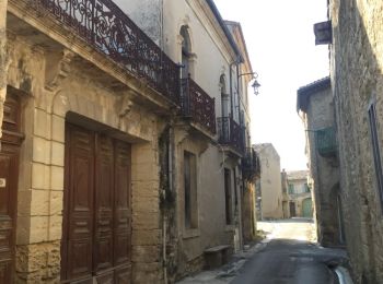
• SOMMIERES 30 - le Vidourle - la vieille ville - le chateau -chemin de Belleau - VILLEVIEILLE - les vieilles rues - le...
![Randonnée Marche Collorgues - Château de Castelnau - Collorgues - Photo](https://media.geolcdn.com/t/350/260/ext.jpg?maxdim=2&url=https%3A%2F%2Fservices.sitytrail.com%2FGeolivesWS%2FDownloadMedia.ashx%3FTrailID%3D317826%26Media%3D17177_4.jpg)
![Marche Marche](https://static1.geolcdn.com/sitytour/trail-icons/101.png)
Km
Marche
![](/images/other/stat-length.png)
![](https://static1.geolcdn.com/siteimages/upload/files/1508320355ic_sort_den_pos_24dp.png)
![](https://static1.geolcdn.com/siteimages/upload/files/1508320355ic_sort_den_neg_24dp.png)
![](https://static1.geolcdn.com/siteimages/upload/files/16400158638029165_repeat_loop_refresh_sync_direction_icon.png)
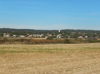
• Alternance de cultures et de bois. Belles vues au nord sur le mont Bouquet et au sud sur la plaine de St Chaptes. Une...
![Randonnée Marche Pouzilhac - Le sentier botanique - Pouzilhac - Photo](https://media.geolcdn.com/t/350/260/ext.jpg?maxdim=2&url=https%3A%2F%2Fservices.sitytrail.com%2FGeolivesWS%2FDownloadMedia.ashx%3FTrailID%3D317463%26Media%3D16695_6.jpg)
![Marche Marche](https://static1.geolcdn.com/sitytour/trail-icons/101.png)
Km
Marche
![](/images/other/stat-length.png)
![](https://static1.geolcdn.com/siteimages/upload/files/1508320355ic_sort_den_pos_24dp.png)
![](https://static1.geolcdn.com/siteimages/upload/files/1508320355ic_sort_den_neg_24dp.png)
![](https://static1.geolcdn.com/siteimages/upload/files/16400158638029165_repeat_loop_refresh_sync_direction_icon.png)
• Sentier botanique de Gaujac et la forêt de Pouzilhac au programme du circuit, avec la possibilité de faire le tour co...
![Randonnée Marche Saint-André-de-Roquepertuis - Montclus - St André de Roquepertuis - Photo](https://media.geolcdn.com/t/350/260/ext.jpg?maxdim=2&url=https%3A%2F%2Fservices.sitytrail.com%2FGeolivesWS%2FDownloadMedia.ashx%3FTrailID%3D317457%26Media%3D16689_6.jpg)
![Marche Marche](https://static1.geolcdn.com/sitytour/trail-icons/101.png)
Km
Marche
![](/images/other/stat-length.png)
![](https://static1.geolcdn.com/siteimages/upload/files/1508320355ic_sort_den_pos_24dp.png)
![](https://static1.geolcdn.com/siteimages/upload/files/1508320355ic_sort_den_neg_24dp.png)
![](https://static1.geolcdn.com/siteimages/upload/files/16400158638029165_repeat_loop_refresh_sync_direction_icon.png)
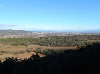
• Balade dans les gorges de la Céze puis sur les hauteurs à la frontière de l'Ardèche. Parking devant la mairie de St A...
![Randonnée Marche Jonquières-Saint-Vincent - Voie romaine - Jonquières St Vincent - Photo](https://media.geolcdn.com/t/350/260/ext.jpg?maxdim=2&url=https%3A%2F%2Fservices.sitytrail.com%2FGeolivesWS%2FDownloadMedia.ashx%3FTrailID%3D317239%26Media%3D16419_6.jpg)
![Marche Marche](https://static1.geolcdn.com/sitytour/trail-icons/101.png)
Km
Marche
![](/images/other/stat-length.png)
![](https://static1.geolcdn.com/siteimages/upload/files/1508320355ic_sort_den_pos_24dp.png)
![](https://static1.geolcdn.com/siteimages/upload/files/1508320355ic_sort_den_neg_24dp.png)
![](https://static1.geolcdn.com/siteimages/upload/files/16400158638029165_repeat_loop_refresh_sync_direction_icon.png)
• Du parking du marché, aller au centre du village, et sur la place (info rando) se diriger vers le Grand Valat et la V...
![Randonnée Marche Saint-Laurent-des-Arbres - Les Vignobles de Lirac - Saint Laurent des Arbres - Photo](https://media.geolcdn.com/t/350/260/ext.jpg?maxdim=2&url=https%3A%2F%2Fservices.sitytrail.com%2FGeolivesWS%2FDownloadMedia.ashx%3FTrailID%3D317237%26Media%3D16416_6.jpg)
![Marche Marche](https://static1.geolcdn.com/sitytour/trail-icons/101.png)
Km
Marche
![](/images/other/stat-length.png)
![](https://static1.geolcdn.com/siteimages/upload/files/1508320355ic_sort_den_pos_24dp.png)
![](https://static1.geolcdn.com/siteimages/upload/files/1508320355ic_sort_den_neg_24dp.png)
![](https://static1.geolcdn.com/siteimages/upload/files/16400158638029165_repeat_loop_refresh_sync_direction_icon.png)
• Parking à l'aire de jeux. Aller visiter le village et en sortir par la rue Marcel Pagnol puis le chemin de la Montagn...
![Randonnée Marche Quissac - Quissac - Photo](https://media.geolcdn.com/t/350/260/ext.jpg?maxdim=2&url=https%3A%2F%2Fservices.sitytrail.com%2FGeolivesWS%2FDownloadMedia.ashx%3FTrailID%3D233243%26Media%3Dfix__20131117121007.jpg)
![Marche Marche](https://static1.geolcdn.com/sitytour/trail-icons/101.png)
Km
Marche
![](/images/other/stat-length.png)
![](https://static1.geolcdn.com/siteimages/upload/files/1508320355ic_sort_den_pos_24dp.png)
![](https://static1.geolcdn.com/siteimages/upload/files/1508320355ic_sort_den_neg_24dp.png)
![](https://static1.geolcdn.com/siteimages/upload/files/16400158638029165_repeat_loop_refresh_sync_direction_icon.png)
• 17nov
![Randonnée Marche Rogues - Madières - La Sauvie - Photo](https://media.geolcdn.com/t/350/260/ext.jpg?maxdim=2&url=https%3A%2F%2Fservices.sitytrail.com%2FGeolivesWS%2FDownloadMedia.ashx%3FTrailID%3D214916%26Media%3D15483_6.jpg)
![Marche Marche](https://static1.geolcdn.com/sitytour/trail-icons/101.png)
Km
Marche
![](/images/other/stat-length.png)
![](https://static1.geolcdn.com/siteimages/upload/files/1508320355ic_sort_den_pos_24dp.png)
![](https://static1.geolcdn.com/siteimages/upload/files/1508320355ic_sort_den_neg_24dp.png)
![](https://static1.geolcdn.com/siteimages/upload/files/16400158638029165_repeat_loop_refresh_sync_direction_icon.png)
• Parking à Madières (rive gauche de la Vis). Belles vues sur les gorges de la Vis et le Pic d'Anjau. Traverser le pont...
![Randonnée Marche Argilliers - Les Darbounelles - Argilliers - Photo](https://media.geolcdn.com/t/350/260/ext.jpg?maxdim=2&url=https%3A%2F%2Fservices.sitytrail.com%2FGeolivesWS%2FDownloadMedia.ashx%3FTrailID%3D214850%26Media%3D15388_6.jpg)
![Marche Marche](https://static1.geolcdn.com/sitytour/trail-icons/101.png)
Km
Marche
![](/images/other/stat-length.png)
![](https://static1.geolcdn.com/siteimages/upload/files/1508320355ic_sort_den_pos_24dp.png)
![](https://static1.geolcdn.com/siteimages/upload/files/1508320355ic_sort_den_neg_24dp.png)
![](https://static1.geolcdn.com/siteimages/upload/files/16400158638029165_repeat_loop_refresh_sync_direction_icon.png)
• Remonter la grand rue d'Argilliers et suivre à gauche "Bornègre". Avant le pont romain (vestige de l'aqueduc du Pont ...
![Randonnée Marche Vauvert - Vauvert - Villetelle - Photo](https://media.geolcdn.com/t/350/260/ext.jpg?maxdim=2&url=https%3A%2F%2Fservices.sitytrail.com%2FGeolivesWS%2FDownloadMedia.ashx%3FTrailID%3D182328%26Media%3D20130331150712.jpeg)
![Marche Marche](https://static1.geolcdn.com/sitytour/trail-icons/101.png)
Km
Marche
![](/images/other/stat-length.png)
![](https://static1.geolcdn.com/siteimages/upload/files/1508320355ic_sort_den_pos_24dp.png)
![](https://static1.geolcdn.com/siteimages/upload/files/1508320355ic_sort_den_neg_24dp.png)
![](https://static1.geolcdn.com/siteimages/upload/files/16400158638029165_repeat_loop_refresh_sync_direction_icon.png)
• St Jacques
![Randonnée Marche Carnas - Carnas bois de Paris - Photo](https://media.geolcdn.com/t/350/260/ext.jpg?maxdim=2&url=https%3A%2F%2Fservices.sitytrail.com%2FGeolivesWS%2FDownloadMedia.ashx%3FTrailID%3D178653%26Media%3D20130304133341.jpeg)
![Marche Marche](https://static1.geolcdn.com/sitytour/trail-icons/101.png)
Km
Marche
![](/images/other/stat-length.png)
![](https://static1.geolcdn.com/siteimages/upload/files/1508320355ic_sort_den_pos_24dp.png)
![](https://static1.geolcdn.com/siteimages/upload/files/1508320355ic_sort_den_neg_24dp.png)
![](https://static1.geolcdn.com/siteimages/upload/files/16400158638029165_repeat_loop_refresh_sync_direction_icon.png)
• Promenade agréable, prévoir une lampe torche pour descendre avec prudence dans la grotte de Bois de Paris (escaliers ...
20 randonnées affichées sur 6474
Application GPS de randonnée GRATUITE
Activités
Régions proches
- Aigaliers
- Aigremont
- Aigues-Mortes
- Aigues-Vives
- Aiguèze
- Aimargues
- Alès
- Allègre-les-Fumades
- Alzon
- Anduze
- Aramon
- Argilliers
- Arpaillargues-et-Aureillac
- Arphy
- Arre
- Arrigas
- Aspères
- Aubais
- Aubord
- Aubussargues
- Aujac
- Aujargues
- Aulas
- Aumessas
- Avèze
- Bagard
- Bagnols-sur-Cèze
- Barjac
- Baron
- Beaucaire
- Beauvoisin
- Bellegarde
- Belvézet
- Bernis
- Bessèges
- Bez-et-Esparon
- Bezouce
- Blandas
- Blauzac
- Boisset-et-Gaujac
- Boissières
- Bonnevaux
- Bordezac
- Boucoiran-et-Nozières
- Bouillargues
- Bouquet
- Bourdic
- Bragassargues
- Branoux-les-Taillades
- Bréau-Mars
- Brignon
- Brouzet-lès-Alès
- Brouzet-lès-Quissac
- Cabrières
- Caissargues
- Calvisson
- Campestre-et-Luc
- Canaules-et-Argentières
- Cannes-et-Clairan
- Cardet
- Carnas
- Carsan
- Cassagnoles
- Castelnau-Valence
- Castillon-du-Gard
- Causse-Bégon
- Caveirac
- Cavillargues
- Cendras
- Chambon
- Chamborigaud
- Chusclan
- Clarensac
- Codognan
- Codolet
- Collias
- Collorgues
- Colognac
- Combas
- Comps
- Concoules
- Congénies
- Connaux
- Conqueyrac
- Corbès
- Corconne
- Cornillon
- Courry
- Crespian
- Cros
- Cruviers-Lascours
- Deaux
- Dions
- Domazan
- Domessargues
- Dourbies
- Durfort-et-Saint-Martin-de-Sossenac
- Estézargues
- Euzet
- Flaux
- Foissac
- Fons
- Fons-sur-Lussan
- Fontanès
- Fontarèches
- Fournès
- Fourques
- Fressac
- Gagnières
- Gailhan
- Gajan
- Gallargues-le-Montueux
- Garons
- Garrigues-Sainte-Eulalie
- Gaujac
- Générac
- Générargues
- Génolhac
- Goudargues
- Issirac
- Jonquières-Saint-Vincent
- Junas
- L'Estréchure
- La Bastide-d'Engras
- La Bruguière
- La Cadière-et-Cambo
- La Calmette
- La Capelle-et-Masmolène
- La Grand-Combe
- La Roque-sur-Cèze
- La Rouvière
- La Vernarède
- Lamelouze
- Langlade
- Lanuéjols
- Lasalle
- Laudun-l'Ardoise
- Laval-Pradel
- Laval-Saint-Roman
- Le Cailar
- Le Garn
- Le Grau-du-Roi
- Le Martinet
- Le Pin
- Le Vigan
- Lecques
- Lédenon
- Lédignan
- Les Angles
- Les Mages
- Les Plans
- Les Plantiers
- Les Salles-du-Gardon
- Lézan
- Liouc
- Lirac
- Logrian-Florian
- Lussan
- Malons-et-Elze
- Mandagout
- Manduel
- Marguerittes
- Martignargues
- Maruéjols-lès-Gardon
- Massanes
- Massillargues-Attuech
- Mauressargues
- Méjannes-le-Clap
- Méjannes-lès-Alès
- Meynes
- Meyrannes
- Mialet
- Milhaud
- Molières-Cavaillac
- Molières-sur-Cèze
- Monoblet
- Mons
- Montagnac
- Montaren-et-Saint-Médiers
- Montclus
- Montdardier
- Monteils
- Montfaucon
- Montfrin
- Montignargues
- Montmirat
- Montpezat
- Moulézan
- Moussac
- Mus
- Nages-et-Solorgues
- Navacelles
- Ners
- Nîmes
- Orsan
- Orthoux-Sérignac-Quilhan
- Parignargues
- Peyremale
- Peyrolles
- Pommiers
- Pompignan
- Pont-Saint-Esprit
- Ponteils-et-Brésis
- Portes
- Potelières
- Pougnadoresse
- Poulx
- Pouzilhac
- Puechredon
- Pujaut
- Quissac
- Redessan
- Remoulins
- Revens
- Ribaute-les-Tavernes
- Rivières
- Robiac-Rochessadoule
- Rochefort-du-Gard
- Rochegude
- Rodilhan
- Rogues
- Roquedur
- Roquemaure
- Rousson
- Sabran
- Saint-Alexandre
- Saint-Ambroix
- Saint-André-d'Olérargues
- Saint-André-de-Majencoules
- Saint-André-de-Roquepertuis
- Saint-André-de-Valborgne
- Saint-Bauzély
- Saint-Bénézet
- Saint-Bonnet-de-Salendrinque
- Saint-Bonnet-du-Gard
- Saint-Brès
- Saint-Bresson
- Saint-Césaire-de-Gauzignan
- Saint-Chaptes
- Saint-Christol-de-Rodières
- Saint-Christol-lez-Alès
- Saint-Clément
- Saint-Côme-et-Maruéjols
- Saint-Denis
- Saint-Dézéry
- Saint-Dionisy
- Saint-Étienne-de-l'Olm
- Saint-Étienne-des-Sorts
- Saint-Félix-de-Pallières
- Saint-Florent-sur-Auzonnet
- Saint-Geniès-de-Comolas
- Saint-Geniès-de-Malgoirès
- Saint-Gervais
- Saint-Gervasy
- Saint-Gilles
- Saint-Hilaire-d'Ozilhan
- Saint-Hilaire-de-Brethmas
- Saint-Hippolyte-de-Caton
- Saint-Hippolyte-de-Montaigu
- Saint-Hippolyte-du-Fort
- Saint-Jean-de-Ceyrargues
- Saint-Jean-de-Crieulon
- Saint-Jean-de-Maruéjols-et-Avéjan
- Saint-Jean-de-Serres
- Saint-Jean-de-Valériscle
- Saint-Jean-du-Gard
- Saint-Jean-du-Pin
- Saint-Julien-de-Cassagnas
- Saint-Julien-de-Peyrolas
- Saint-Julien-de-la-Nef
- Saint-Julien-les-Rosiers
- Saint-Just-et-Vacquières
- Saint-Laurent-d'Aigouze
- Saint-Laurent-de-Carnols
- Saint-Laurent-des-Arbres
- Saint-Laurent-la-Vernède
- Saint-Laurent-le-Minier
- Saint-Mamert-du-Gard
- Saint-Marcel-de-Careiret
- Saint-Martial
- Saint-Martin-de-Valgalgues
- Saint-Maurice-de-Cazevieille
- Saint-Maximin
- Saint-Michel-d'Euzet
- Saint-Nazaire
- Saint-Nazaire-des-Gardies
- Saint-Paul-la-Coste
- Saint-Paul-les-Fonts
- Saint-Paulet-de-Caisson
- Saint-Pons-la-Calm
- Saint-Privat-de-Champclos
- Saint-Privat-des-Vieux
- Saint-Quentin-la-Poterie
- Saint-Roman-de-Codières
- Saint-Sauveur-Camprieu
- Saint-Sébastien-d'Aigrefeuille
- Saint-Siffret
- Saint-Théodorit
- Saint-Victor-de-Malcap
- Saint-Victor-des-Oules
- Saint-Victor-la-Coste
- Sainte-Anastasie
- Sainte-Cécile-d'Andorge
- Sainte-Croix-de-Caderle
- Salazac
- Salindres
- Salinelles
- Sanilhac-Sagriès
- Sardan
- Saumane
- Sauve
- Sauveterre
- Sauzet
- Savignargues
- Saze
- Sénéchas
- Sernhac
- Servas
- Serviers-et-Labaume
- Seynes
- Sommières
- Soudorgues
- Soustelle
- Souvignargues
- Sumène
- Tavel
- Tharaux
- Théziers
- Thoiras
- Tornac
- Tresques
- Trèves
- Uchaud
- Uzès
- Vabres
- Val-d'Aigoual
- Vallabrègues
- Vallabrix
- Vallérargues
- Valliguières
- Vauvert
- Vénéjan
- Verfeuil
- Vergèze
- Vers-Pont-du-Gard
- Vestric-et-Candiac
- Vézénobres
- Vic-le-Fesq
- Villeneuve-lès-Avignon
- Villevieille
- Vissec