Le Fel, Aveyron : Les meilleures randonnées, itinéraires, parcours, balades et promenades

Le Fel : découvrez les meilleures randonnées : 8 pédestres et 2 à vélo ou VTT. Tous ces circuits, parcours, itinéraires et activités en plein air sont disponibles dans nos applications SityTrail pour smartphones et tablettes.


Les meilleurs parcours (15)
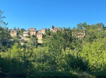
Randonnée sport Le Fel - Le fel saint cyprien  - Photo
sport 103.862
Km

sport

Très facile
Le Fel, Occitanie, Aveyron, France
104 km | 130 km-effort
Inconnu
1864 m
2125 m
Non
Glurps

Randonnée Marche Le Fel - Le Fel - Photo
Marche 18.032
Km

Marche

Très difficile
Le Fel, Occitanie, Aveyron, France
18 km | 27 km-effort
4h 42min
699 m
698 m
Oui
gcournac

• belle rando,beau paysages.

Randonnée Course à pied Le Fel - entre bel air et le viala - Photo
Course à pied 37.57
Km

Course à pied

Difficile
Le Fel, Occitanie, Aveyron, France
38 km | 52 km-effort
3h 3min
1102 m
1035 m
Non
kayakiste15

• inventaire de chemin

Randonnée Marche Le Fel - 12_le fel_espeyrac - Photo
Marche 26.029
Km

Marche

Très difficile
Le Fel, Occitanie, Aveyron, France
26 km | 39 km-effort
8h 46min
916 m
1029 m
Non
jab31

Randonnée Vélo électrique Le Fel - Jour 2 - Le Fel - St Cyprien - Photo
Vélo électrique 105.813
Km

Vélo électrique

Difficile
Le Fel, Occitanie, Aveyron, France
106 km | 133 km-effort
8h 22min
1956 m
2174 m
Non
Glurps

Randonnée Course à pied Le Fel - trail d'aqui du fel 16.7 621d+ - Photo
Course à pied 16.474
Km

Course à pied

Moyen
Le Fel, Occitanie, Aveyron, France
16,5 km | 25 km-effort
1h 33min
610 m
610 m
Oui
kayakiste15

Randonnée Marche Le Fel - Le gel - Photo
Marche 5.89
Km

Marche

Moyen
Le Fel, Occitanie, Aveyron, France
5,9 km | 8,9 km-effort
1h 57min
226 m
230 m
Oui
alainlissac

Randonnée Marche Le Fel - LE FEL Réel - Photo
Marche 13.657
Km

Marche

Moyen
Le Fel, Occitanie, Aveyron, France
13,7 km | 20 km-effort
4h 13min
507 m
494 m
Oui
moilier

Randonnée Marche Le Fel - camïn d'olt le Fel  le Port 21.3.21  - Photo
Marche 19.473
Km

Marche

Moyen
Le Fel, Occitanie, Aveyron, France
19,5 km | 30 km-effort
7h 33min
795 m
795 m
Oui
chantal12

Randonnée V.T.T. Le Fel - le Fel - Photo
V.T.T. 15.726
Km

V.T.T.

Difficile
Le Fel, Occitanie, Aveyron, France
15,7 km | 22 km-effort
1h 35min
489 m
512 m
Oui
micheljullien

Randonnée Autre activité Le Fel - le Fel Creste - Photo
Autre activité 8.988
Km

Autre activité

Facile
Le Fel, Occitanie, Aveyron, France
9 km | 13 km-effort
2h 51min
302 m
305 m
Oui
alainlissac

Randonnée Autre activité Le Fel - Creste La Vigne Le Blat - Photo
Autre activité 7.565
Km

Autre activité

Moyen
Le Fel, Occitanie, Aveyron, France
7,6 km | 12,2 km-effort
2h 33min
345 m
350 m
Oui
alainlissac

Randonnée Autre activité Le Fel - Creste La Vigne Le Blat - Photo
Autre activité 7.565
Km

Autre activité

Moyen
Le Fel, Occitanie, Aveyron, France
7,6 km | 12,2 km-effort
2h 33min
345 m
350 m
Oui
alainlissac

Randonnée Autre activité Le Fel - le Fel Creste - Photo
Autre activité 8.988
Km

Autre activité

Facile
Le Fel, Occitanie, Aveyron, France
9 km | 13 km-effort
2h 51min
302 m
305 m
Oui
alainlissac

Randonnée Marche Le Fel - Le Fel - Photo
Marche 10.218
Km

Marche

Facile
Le Fel, Occitanie, Aveyron, France
10,2 km | 14,6 km-effort
2h 58min
333 m
325 m
Non
alainlissac

15 randonnées affichées sur 15

Application GPS de randonnée GRATUITE

Logo SityTrail SityTrail

IGN / Instituts géographiques

Télécharger SityTrail sur l'App Store Télécharger SityTrail sur Google Play

Logo SityTrail SityTrail World

Le monde est à vous

Télécharger SityTrail sur l'App Store Télécharger SityTrail sur Google Play Télécharger SityTrail sur Huawei AppGallery

Activités

Fermer
Mes abonnements