Belforêt-en-Perche, Orne : Les meilleures randonnées, itinéraires, parcours, balades et promenades

3 commentaires

Belforêt-en-Perche : découvrez les meilleures randonnées : 50 pédestres. Tous ces circuits, parcours, itinéraires et activités en plein air sont disponibles dans nos applications SityTrail pour smartphones et tablettes.
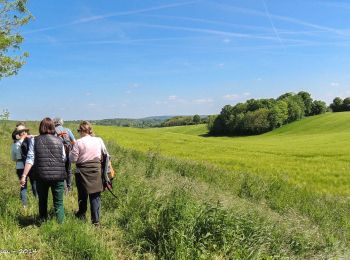
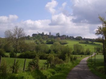
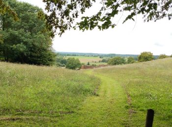

Les meilleurs parcours (54)

Randonnée Marche Belforêt-en-Perche - Chêne séculaire - Bellême - Photo
Marche 9.306
Km

Marche

Moyen
(2)
Belforêt-en-Perche, Normandie, Orne, France
9,3 km | 11,8 km-effort
3h 30min
183 m
196 m
Oui
tracegps

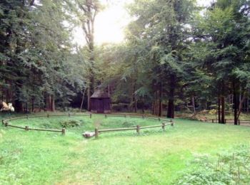
• Chêne séculaire – Bellême Découvrez un pittoresque parcours forestier, agrémenté par l'étang de la Herse et sa fontai...

Randonnée Marche Belforêt-en-Perche - La Perrière, forêt et village - Photo
Marche 11.066
Km

Marche

Difficile
Belforêt-en-Perche, Normandie, Orne, France
11,1 km | 13,8 km-effort
3h 8min
206 m
206 m
Oui
jeannine grandjean

• très belle randonnée en forêt, sans oublier d'arpenter les rues et ruelles de ce magnifique village au label de petit...

Randonnée Marche Belforêt-en-Perche - le chêne de l'école - Photo
Marche 15.67
Km

Marche

Très facile
Belforêt-en-Perche, Normandie, Orne, France
15,7 km | 19,7 km-effort
6h 47min
302 m
302 m
Oui
fournieralain

• 15.5 kms

Randonnée Marche Belforêt-en-Perche -  La Perrière - Saint-Germain-de-la-Coudre via Bellême (TCP) 28 km - Photo
Marche 28.374
Km

Marche

Moyen
Belforêt-en-Perche, Normandie, Orne, France
28 km | 35 km-effort
7h 16min
491 m
569 m
Non
Traversées Percheronnes

• LES TRAVERSÉES PERCHERONNES.. Vous offrent la description de près de 1700 kilomètres de chemins de randonnée perche...

Randonnée Marche Belforêt-en-Perche - La Perrière - Saint-Germain-de-la-Coudre via Igé (TCP) 27 km - Photo
Marche 27.384
Km

Marche

Facile
Belforêt-en-Perche, Normandie, Orne, France
27 km | 33 km-effort
7h 2min
428 m
506 m
Non
Traversées Percheronnes

• LES TRAVERSÉES PERCHERONNES.. Vous offrent la description de près de 1700 kilomètres de chemins de randonnée perche...

Randonnée Marche Belforêt-en-Perche - La Perrière - Mortagne-au-Perche (TCP) 29 km - Photo
Marche 28.879
Km

Marche

Difficile
Belforêt-en-Perche, Normandie, Orne, France
29 km | 34 km-effort
7h 18min
416 m
352 m
Non
Traversées Percheronnes

• LES TRAVERSÉES PERCHERONNES.. Vous offrent la description de près de 1700 kilomètres de chemins de randonnée perche...

Randonnée Marche Belforêt-en-Perche - La Perrière : village millénaire - Photo
Marche 11.087
Km

Marche

Moyen
Belforêt-en-Perche, Normandie, Orne, France
11,1 km | 14 km-effort
3h 0min
222 m
222 m
Oui
tracegps

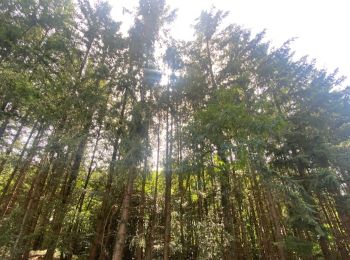
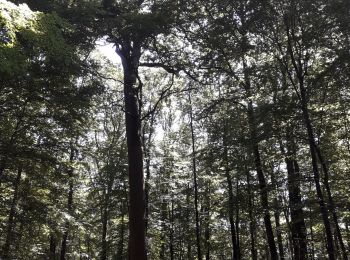
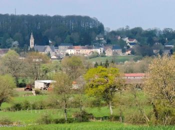
• La Perrière : village millénaire. La forêt de Bellême s'étend sur les douces collines du Perche. Couverte de chênes m...

Randonnée Marche Belforêt-en-Perche - la perrière par la forêt  - Photo
Marche 5.58
Km

Marche

Moyen
Belforêt-en-Perche, Normandie, Orne, France
5,6 km | 7,6 km-effort
1h 45min
153 m
141 m
Oui
Krissray

Randonnée Marche Belforêt-en-Perche - fourneaux gr jusqu'au ruisseau - Photo
Marche 5.046
Km

Marche

Moyen
Belforêt-en-Perche, Normandie, Orne, France
5 km | 6,7 km-effort
1h 15min
126 m
124 m
Oui
Krissray

Randonnée Voiture Belforêt-en-Perche - 2023-12-6 Bellême VduP - Photo
Voiture 47.002
Km

Voiture

Belforêt-en-Perche, Normandie, Orne, France
47 km | 56 km-effort
2h 48min
658 m
769 m
Non
patrick2m

• retraite prise 2 h Carrefour Mortomer Apre Lonné route de Bellou laT

Randonnée Marche Belforêt-en-Perche - La Perrière - Le Chêne de l'école 11 km - Photo
Marche 11.041
Km

Marche

Difficile
Belforêt-en-Perche, Normandie, Orne, France
11 km | 13,9 km-effort
3h 9min
213 m
213 m
Oui
ODDAD78

• Départ : La Perrière Arrivée : La Perrière Balisage : GR® PR Communes : 1. La Perrière 2. Origny-le-Butin 3. Le Gué-d...

Randonnée Marche Belforêt-en-Perche - La Perrière - La fontaine de Montperthuis 5,1 km - Photo
Marche 5.11
Km

Marche

Moyen
Belforêt-en-Perche, Normandie, Orne, France
5,1 km | 6,5 km-effort
1h 29min
108 m
108 m
Oui
ODDAD78

• Départ : La Perrière Arrivée : La Perrière Balisage : PR Communes : 1. La Perrière Au départ de l'église Notre-Dame d...

Randonnée Marche Belforêt-en-Perche - chemin chêne école fourneaux  - Photo
Marche 3.442
Km

Marche

Facile
(1)
Belforêt-en-Perche, Normandie, Orne, France
3,4 km | 4,7 km-effort
57min
96 m
93 m
Oui
Krissray

• chêne école diago droite descente fourneaux droite chemin à gauche coteau retou

Randonnée Marche Belforêt-en-Perche - la perrière par la route - Photo
Marche 6.319
Km

Marche

Très facile
Belforêt-en-Perche, Normandie, Orne, France
6,3 km | 8 km-effort
1h 28min
129 m
128 m
Oui
Krissray

Randonnée Marche Belforêt-en-Perche - 2-La Perrièe_Saint Germain-de-la-Coudre - Photo
Marche 28.029
Km

Marche

Très facile
Belforêt-en-Perche, Normandie, Orne, France
28 km | 34 km-effort
Inconnu
453 m
530 m
Non
jeanad

• Cette randonnée, septième étape d’un circuit de huit jours et de 220km, le Tour des Collines du Perche, proposé par I...

Randonnée Voiture Belforêt-en-Perche - 2020-01-18 V du P Belleme - Photo
Voiture 61.549
Km

Voiture

Belforêt-en-Perche, Normandie, Orne, France
62 km | 70 km-effort
3h 53min
624 m
719 m
Non
patrick2m

• r p

Randonnée Voiture Belforêt-en-Perche - 2019-12 VduP Les Chaises - Photo
Voiture 138.41
Km

Voiture

Belforêt-en-Perche, Normandie, Orne, France
138 km | 162 km-effort
3h 3min
1744 m
1739 m
Non
patrick2m

• R M

Randonnée Trail Belforêt-en-Perche - 2019-10-12 V du P - Photo
Trail 40.365
Km

Trail

Belforêt-en-Perche, Normandie, Orne, France
40 km | 49 km-effort
Inconnu
671 m
688 m
Non
patrick2m

• chasse RM

Randonnée Marche Belforêt-en-Perche - Le Gué de la Chaîne 11.3 Km - Photo
Marche 11.287
Km

Marche

Moyen
Belforêt-en-Perche, Normandie, Orne, France
11,3 km | 14,2 km-effort
3h 4min
222 m
222 m
Oui
ODDAD78

• A partir du circuit N°9

Randonnée Marche Belforêt-en-Perche - TCP Etape 7-1/8 t Germain de la Coudre - La Perrière S Via Bellême 28 km - Photo
Marche 28.506
Km

Marche

Facile
Belforêt-en-Perche, Normandie, Orne, France
29 km | 35 km-effort
7h 16min
484 m
568 m
Non
ODDAD78

• Le Perche, un rêve de campagne Une semaine d’évasion en famille ou entre amis à la porte de la maison aux confins de...

20 randonnées affichées sur 54

Application GPS de randonnée GRATUITE

Logo SityTrail SityTrail

IGN / Instituts géographiques

Télécharger SityTrail sur l'App Store Télécharger SityTrail sur Google Play

Logo SityTrail SityTrail World

Le monde est à vous

Télécharger SityTrail sur l'App Store Télécharger SityTrail sur Google Play Télécharger SityTrail sur Huawei AppGallery

Activités

Régions proches

Fermer
Mes abonnements