Randonnée Marche Belforêt-en-Perche - La Perrière : village millénaire - Photo

La Perrière : village millénaire

 tracegps
tracegps

Utilisateur

© OpenStreetMap contributors
Longueur
Longueur
11,1 km
Altitude max
Altitude max
246 m
Dénivelé positif
Dénivelé positif
222 m
Km-Effort
Km-Effort  
14 km
Altitude min
Altitude min
127 m
Dénivelé négatif
Dénivelé négatif
222 m
Boucle
Boucle
Oui
Date de création :
2014-12-10 00:00:00.0
Dernière modification :
2014-12-10 00:00:00.0

(0 Avis)

Marche
Marche
3h00
Difficulté : Moyen

Scannez ce code QR pour ouvrir la randonnée dans l'application SityTrail

Application GPS de randonnée GRATUITE

Logo SityTrail SityTrail

IGN / Instituts géographiques

Télécharger SityTrail sur l'App Store Télécharger SityTrail sur Google Play

Logo SityTrail SityTrail World

Le monde est à vous

Télécharger SityTrail sur l'App Store Télécharger SityTrail sur Google Play Télécharger SityTrail sur Huawei AppGallery

À propos

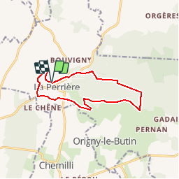
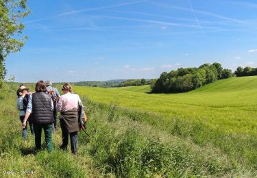
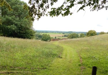
Randonnée Marche de 11,1 km à découvrir à Normandie, Orne, Belforêt-en-Perche. Cette randonnée est proposée par tracegps.

Description

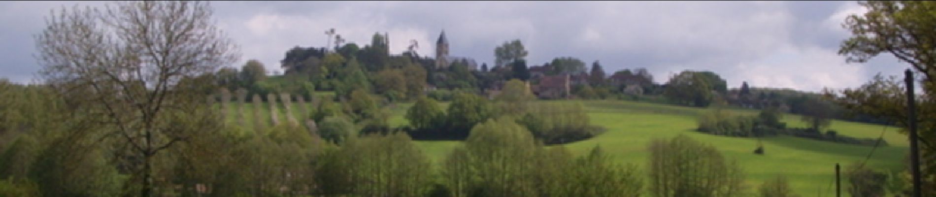
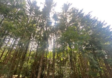
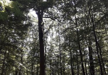
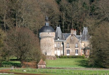
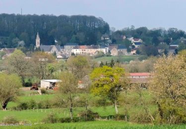
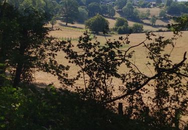
La Perrière : village millénaire. La forêt de Bellême s'étend sur les douces collines du Perche. Couverte de chênes majestueux, c'est un peu de la Gaule antique qui vit encore ici. Retrouvez les Coup de Cœur Randonnée dans l’Orne en Normandie.

Profil altimétrique

Photos

Localisation

Pays :
France
Région :
Normandie
Département/Province :
Orne
Commune :
Belforêt-en-Perche
Localité :
Unknown
Départ:(Dec)
Départ:(UTM)
310618 ; 5362872 (31U) N.

Randonnées à proximité

Randonnée Marche Belforêt-en-Perche - La Perrière, forêt et village - Photo
Marche
jeannine grandjean

Marche

Difficile
Belforêt-en-Perche, Normandie, Orne, France
11,1 km | 13,8 km-effort
3h 8min
Oui
Randonnée Marche Belforêt-en-Perche - le chêne de l'école - Photo
Marche
fournieralain

Marche

Très facile
Belforêt-en-Perche, Normandie, Orne, France
15,7 km | 19,7 km-effort
6h 47min
Oui
Randonnée Marche Belforêt-en-Perche -  La Perrière - Saint-Germain-de-la-Coudre via Bellême (TCP) 28 km - Photo
Marche

Marche

Moyen
Belforêt-en-Perche, Normandie, Orne, France
28 km | 35 km-effort
7h 16min
Non
Randonnée Marche Belforêt-en-Perche - La Perrière - Saint-Germain-de-la-Coudre via Igé (TCP) 27 km - Photo
Marche

Marche

Facile
Belforêt-en-Perche, Normandie, Orne, France
27 km | 33 km-effort
7h 2min
Non
Randonnée Marche Belforêt-en-Perche - La Perrière - Mortagne-au-Perche (TCP) 29 km - Photo
Marche

Marche

Difficile
Belforêt-en-Perche, Normandie, Orne, France
29 km | 34 km-effort
7h 18min
Non
Randonnée Marche Belforêt-en-Perche - la perrière par la forêt  - Photo
Marche
Krissray

Marche

Moyen
Belforêt-en-Perche, Normandie, Orne, France
5,6 km | 7,6 km-effort
1h 45min
Oui
Randonnée Marche Belforêt-en-Perche - fourneaux gr jusqu'au ruisseau - Photo
Marche
Krissray

Marche

Moyen
Belforêt-en-Perche, Normandie, Orne, France
5 km | 6,7 km-effort
1h 15min
Oui
Randonnée Voiture Belforêt-en-Perche - 2023-12-6 Bellême VduP - Photo
Voiture
patrick2m

Voiture

Belforêt-en-Perche, Normandie, Orne, France
47 km | 56 km-effort
2h 48min
Non
Randonnée Marche Belforêt-en-Perche - La Perrière - Le Chêne de l'école 11 km - Photo
Marche
ODDAD78

Marche

Difficile
Belforêt-en-Perche, Normandie, Orne, France
11 km | 13,9 km-effort
3h 9min
Oui


Fermer
Mes abonnements