![](/images/other/stat-length.png)
- Randonnées
- Outdoor
- France
- Nouvelle-Aquitaine
- Charente
Charente, Nouvelle-Aquitaine : Les meilleures randonnées, itinéraires, parcours, balades et promenades
Charente : découvrez les meilleures randonnées : 947 pédestres, 141 à vélo ou VTT et 14 parcours équestres. Tous ces circuits, parcours, itinéraires et activités en plein air sont disponibles dans nos applications SityTrail pour smartphones et tablettes.
Les meilleurs parcours (1168)
![Randonnée Marche Marillac-le-Franc - Randonnée n° 2 de Marillac le Franc - Photo](https://media.geolcdn.com/t/350/260/ext.jpg?maxdim=2&url=https%3A%2F%2Fservices.sitytrail.com%2FGeolivesWS%2FDownloadMedia.ashx%3FTrailID%3D1095204%26Media%3Dfix__20190110142040.jpg)
![Marche Marche](https://static1.geolcdn.com/sitytour/trail-icons/101.png)
Km
Marche
![](/images/other/stat-length.png)
![](https://static1.geolcdn.com/siteimages/upload/files/1508320355ic_sort_den_pos_24dp.png)
![](https://static1.geolcdn.com/siteimages/upload/files/1508320355ic_sort_den_neg_24dp.png)
![](https://static1.geolcdn.com/siteimages/upload/files/16400158638029165_repeat_loop_refresh_sync_direction_icon.png)
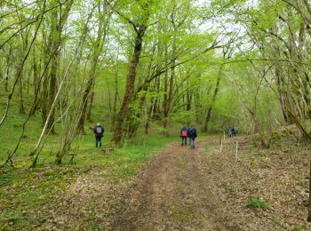
• Une randonnée agréable, très belle et facile
![Randonnée Marche Sers - Sers - Photo](https://media.geolcdn.com/t/350/260/ext.jpg?maxdim=2&url=https%3A%2F%2Fservices.sitytrail.com%2FGeolivesWS%2FDownloadMedia.ashx%3FTrailID%3D571764%26Media%3D20160519144402.jpg)
![Marche Marche](https://static1.geolcdn.com/sitytour/trail-icons/101.png)
Km
Marche
![](/images/other/stat-length.png)
![](https://static1.geolcdn.com/siteimages/upload/files/1508320355ic_sort_den_pos_24dp.png)
![](https://static1.geolcdn.com/siteimages/upload/files/1508320355ic_sort_den_neg_24dp.png)
![](https://static1.geolcdn.com/siteimages/upload/files/16400158638029165_repeat_loop_refresh_sync_direction_icon.png)
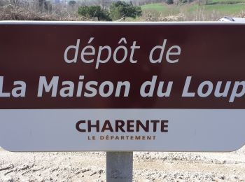
• ce circuit facile fait le tour des sites remarquables de la commune de Sers. Sité mérovingien e Belleveau avec son er...
![Randonnée Marche Châtignac - La randonnée des fours à pain de Chalignac - Photo](https://media.geolcdn.com/t/350/260/ext.jpg?maxdim=2&url=https%3A%2F%2Fservices.sitytrail.com%2FGeolivesWS%2FDownloadMedia.ashx%3FTrailID%3D312896%26Media%3Dfix__20140615110733.jpg)
![Marche Marche](https://static1.geolcdn.com/sitytour/trail-icons/101.png)
Km
Marche
![](/images/other/stat-length.png)
![](https://static1.geolcdn.com/siteimages/upload/files/1508320355ic_sort_den_pos_24dp.png)
![](https://static1.geolcdn.com/siteimages/upload/files/1508320355ic_sort_den_neg_24dp.png)
![](https://static1.geolcdn.com/siteimages/upload/files/16400158638029165_repeat_loop_refresh_sync_direction_icon.png)
• Randonnée très vallonnée, ou l'on peut découvrir les fours à pain rénovés.
![Randonnée Moteur Saint-Preuil - Découvrez la Grande Champagne hors des sentiers battus - Photo](https://media.geolcdn.com/t/350/260/ext.jpg?maxdim=2&url=https%3A%2F%2Fservices.sitytrail.com%2FGeolivesWS%2FDownloadMedia.ashx%3FTrailID%3D208592%26Media%3D2fdcdb5e-bdc8-496d-ba59-fceb5918b661.JPG)
![Moteur Moteur](https://static1.geolcdn.com/sitytour/trail-icons/400.png)
Km
Moteur
![](/images/other/stat-length.png)
![](https://static1.geolcdn.com/siteimages/upload/files/1508320355ic_sort_den_pos_24dp.png)
![](https://static1.geolcdn.com/siteimages/upload/files/1508320355ic_sort_den_neg_24dp.png)
![](https://static1.geolcdn.com/siteimages/upload/files/16400158638029165_repeat_loop_refresh_sync_direction_icon.png)
• Cet itinéraire au départ du Relais est une invitation à visiter le vignoble de Grande Champagne hors des sentiers bat...
![Randonnée V.T.T. Chasseneuil-sur-Bonnieure - Dans la forêt de Chasseneuil - Photo](https://media.geolcdn.com/t/350/260/ext.jpg?maxdim=2&url=https%3A%2F%2Fservices.sitytrail.com%2FGeolivesWS%2FDownloadMedia.ashx%3FTrailID%3D173132%26Media%3D14687_3.jpg)
![V.T.T. V.T.T.](https://static1.geolcdn.com/sitytour/trail-icons/202.png)
Km
V.T.T.
![](/images/other/stat-length.png)
![](https://static1.geolcdn.com/siteimages/upload/files/1508320355ic_sort_den_pos_24dp.png)
![](https://static1.geolcdn.com/siteimages/upload/files/1508320355ic_sort_den_neg_24dp.png)
![](https://static1.geolcdn.com/siteimages/upload/files/16400158638029165_repeat_loop_refresh_sync_direction_icon.png)
• Circuit au départ de la piscine de Chasseneuil, rue Ste Barbe. Vous passerez pour la moitié du parcours à travers la ...
![Randonnée Marche Montmoreau - Gurat - la maison du loup Gurat - Photo](https://media.geolcdn.com/t/350/260/ext.jpg?maxdim=2&url=https%3A%2F%2Fmedia.geolcdn.com%2Ff%2F840b8009-76c6-414e-b280-cb95135d258b.jpg)
![Marche Marche](https://static1.geolcdn.com/sitytour/trail-icons/101.png)
Km
Marche
![](/images/other/stat-length.png)
![](https://static1.geolcdn.com/siteimages/upload/files/1508320355ic_sort_den_pos_24dp.png)
![](https://static1.geolcdn.com/siteimages/upload/files/1508320355ic_sort_den_neg_24dp.png)
![](https://static1.geolcdn.com/siteimages/upload/files/16400158638029165_repeat_loop_refresh_sync_direction_icon.png)
• le parking se trouve sur la D19 près de la D450 (lat 45,42337 - long 0,20960)
![Randonnée A pied Bellevigne - Chemin Boisné - Photo](https://media.geolcdn.com/t/350/260/ext.jpg?maxdim=2&url=https%3A%2F%2Fmedia.geolcdn.com%2Ff%2F4591f9b2-aa70-4c6e-b273-f78c9a53919a.jpeg)
![A pied A pied](https://static1.geolcdn.com/sitytour/trail-icons/100.png)
Km
A pied
![](/images/other/stat-length.png)
![](https://static1.geolcdn.com/siteimages/upload/files/1508320355ic_sort_den_pos_24dp.png)
![](https://static1.geolcdn.com/siteimages/upload/files/1508320355ic_sort_den_neg_24dp.png)
![](https://static1.geolcdn.com/siteimages/upload/files/16400158638029165_repeat_loop_refresh_sync_direction_icon.png)
• Périgueux > Saintes Site web: http://itineraires-romains-en-france.pagesperso-orange.fr/templates/vr28.htm
![Randonnée Marche Confolens - Confolens - Photo](https://media.geolcdn.com/t/350/260/ext.jpg?maxdim=2&url=https%3A%2F%2Fstatic1.geolcdn.com%2Fsiteimages%2Fupload%2Ffiles%2F1553511878bg_sport_marche.png)
![Marche Marche](https://static1.geolcdn.com/sitytour/trail-icons/101.png)
Km
Marche
![](/images/other/stat-length.png)
![](https://static1.geolcdn.com/siteimages/upload/files/1508320355ic_sort_den_pos_24dp.png)
![](https://static1.geolcdn.com/siteimages/upload/files/1508320355ic_sort_den_neg_24dp.png)
![](https://static1.geolcdn.com/siteimages/upload/files/16400158638029165_repeat_loop_refresh_sync_direction_icon.png)
• Sentier Franck Rivaud On peut débuter par la table d'orientation au dessus du parking de l'office de tourisme. Ce ci...
![Randonnée Moteur Montrollet - sortie quad - Photo](https://media.geolcdn.com/t/350/260/ext.jpg?maxdim=2&url=https%3A%2F%2Fstatic1.geolcdn.com%2Fsiteimages%2Fupload%2Ffiles%2F15247431544x4.jpg)
![Moteur Moteur](https://static1.geolcdn.com/sitytour/trail-icons/400.png)
Km
Moteur
![](/images/other/stat-length.png)
![](https://static1.geolcdn.com/siteimages/upload/files/1508320355ic_sort_den_pos_24dp.png)
![](https://static1.geolcdn.com/siteimages/upload/files/1508320355ic_sort_den_neg_24dp.png)
![](https://static1.geolcdn.com/siteimages/upload/files/16400158638029165_repeat_loop_refresh_sync_direction_icon.png)
• Belle Balade
![Randonnée Marche Saint-Fort-sur-le-Né - verrières 1 - Photo](https://media.geolcdn.com/t/350/260/ext.jpg?maxdim=2&url=https%3A%2F%2Fstatic1.geolcdn.com%2Fsiteimages%2Fupload%2Ffiles%2F1553511878bg_sport_marche.png)
![Marche Marche](https://static1.geolcdn.com/sitytour/trail-icons/101.png)
Km
Marche
![](/images/other/stat-length.png)
![](https://static1.geolcdn.com/siteimages/upload/files/1508320355ic_sort_den_pos_24dp.png)
![](https://static1.geolcdn.com/siteimages/upload/files/1508320355ic_sort_den_neg_24dp.png)
![](https://static1.geolcdn.com/siteimages/upload/files/16400158638029165_repeat_loop_refresh_sync_direction_icon.png)
•
![Randonnée Marche Angoulême - La Coulée Verte à Angoulème - Photo](https://media.geolcdn.com/t/350/260/ext.jpg?maxdim=2&url=https%3A%2F%2Fstatic1.geolcdn.com%2Fsiteimages%2Fupload%2Ffiles%2F1553511878bg_sport_marche.png)
![Marche Marche](https://static1.geolcdn.com/sitytour/trail-icons/101.png)
Km
Marche
![](/images/other/stat-length.png)
![](https://static1.geolcdn.com/siteimages/upload/files/1508320355ic_sort_den_pos_24dp.png)
![](https://static1.geolcdn.com/siteimages/upload/files/1508320355ic_sort_den_neg_24dp.png)
![](https://static1.geolcdn.com/siteimages/upload/files/16400158638029165_repeat_loop_refresh_sync_direction_icon.png)
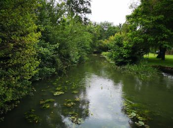
• La coulée verte est un ancien chemin de halage. Elle longe le fleuve Charente à travers Angoulème sur près de 20 km. ...
![Randonnée Marche Pranzac - Pranzac et ses petits villages. - Photo](https://media.geolcdn.com/t/350/260/ext.jpg?maxdim=2&url=https%3A%2F%2Fmedia.geolcdn.com%2Ff%2F3a77c9e3-0523-4318-8510-a2c1a4b859f3.jpg)
![Marche Marche](https://static1.geolcdn.com/sitytour/trail-icons/101.png)
Km
Marche
![](/images/other/stat-length.png)
![](https://static1.geolcdn.com/siteimages/upload/files/1508320355ic_sort_den_pos_24dp.png)
![](https://static1.geolcdn.com/siteimages/upload/files/1508320355ic_sort_den_neg_24dp.png)
![](https://static1.geolcdn.com/siteimages/upload/files/16400158638029165_repeat_loop_refresh_sync_direction_icon.png)
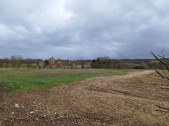
• Au départ de la lanterne des morts à Pranzac , visitez le bourg de Pranzac , direction le parc du château et tourner ...
![Randonnée Marche Val-de-Bonnieure - La randonnée des Palombes à Sainte Colombe 16 - Photo](https://media.geolcdn.com/t/350/260/ext.jpg?maxdim=2&url=https%3A%2F%2Fmedia.geolcdn.com%2Ff%2Fde16b4eb-55e6-4356-9bfb-9b9f33fdc9eb.jpg)
![Marche Marche](https://static1.geolcdn.com/sitytour/trail-icons/101.png)
Km
Marche
![](/images/other/stat-length.png)
![](https://static1.geolcdn.com/siteimages/upload/files/1508320355ic_sort_den_pos_24dp.png)
![](https://static1.geolcdn.com/siteimages/upload/files/1508320355ic_sort_den_neg_24dp.png)
![](https://static1.geolcdn.com/siteimages/upload/files/16400158638029165_repeat_loop_refresh_sync_direction_icon.png)
• Une balade sympathique facile avec retour au bord de la Bonnieure. Balisage bleu
![Randonnée Marche Fléac - Rando-ballade le long de la Charente au départ de Fléac - Photo](https://media.geolcdn.com/t/350/260/ext.jpg?maxdim=2&url=https%3A%2F%2Fmedia.geolcdn.com%2Ff%2F4c5e8a21-a383-4e32-b8cd-d665e2b7cb10.jpg)
![Marche Marche](https://static1.geolcdn.com/sitytour/trail-icons/101.png)
Km
Marche
![](/images/other/stat-length.png)
![](https://static1.geolcdn.com/siteimages/upload/files/1508320355ic_sort_den_pos_24dp.png)
![](https://static1.geolcdn.com/siteimages/upload/files/1508320355ic_sort_den_neg_24dp.png)
![](https://static1.geolcdn.com/siteimages/upload/files/16400158638029165_repeat_loop_refresh_sync_direction_icon.png)
• Belle ballade le long de la Charente. Dommage que du côté gauche ( sens rivière) que l'on doit marcher le long de la ...
![Randonnée Marche Tusson - La randonnée de Tusson - Photo](https://media.geolcdn.com/t/350/260/ext.jpg?maxdim=2&url=https%3A%2F%2Fmedia.geolcdn.com%2Ff%2F419afb6b-39dd-4873-ab4c-784edb417db0.jpg)
![Marche Marche](https://static1.geolcdn.com/sitytour/trail-icons/101.png)
Km
Marche
![](/images/other/stat-length.png)
![](https://static1.geolcdn.com/siteimages/upload/files/1508320355ic_sort_den_pos_24dp.png)
![](https://static1.geolcdn.com/siteimages/upload/files/1508320355ic_sort_den_neg_24dp.png)
![](https://static1.geolcdn.com/siteimages/upload/files/16400158638029165_repeat_loop_refresh_sync_direction_icon.png)
• Une belle balade avec la visite du magnifique village de Tusson
![Randonnée Marche Magnac-sur-Touvre - La balade d'Antornac - Photo](https://media.geolcdn.com/t/350/260/ext.jpg?maxdim=2&url=https%3A%2F%2Fmedia.geolcdn.com%2Ff%2F1c8a9bfb-e4c7-4321-8064-c91316bb9236.jpg)
![Marche Marche](https://static1.geolcdn.com/sitytour/trail-icons/101.png)
Km
Marche
![](/images/other/stat-length.png)
![](https://static1.geolcdn.com/siteimages/upload/files/1508320355ic_sort_den_pos_24dp.png)
![](https://static1.geolcdn.com/siteimages/upload/files/1508320355ic_sort_den_neg_24dp.png)
![](https://static1.geolcdn.com/siteimages/upload/files/16400158638029165_repeat_loop_refresh_sync_direction_icon.png)
• une superbe randonnée au départ de Du haut de Magnac sur Touvre
![Randonnée Marche Ronsenac - La boucle de Ronsenac - Photo](https://media.geolcdn.com/t/350/260/ext.jpg?maxdim=2&url=https%3A%2F%2Fmedia.geolcdn.com%2Ff%2F77c5c751-67ff-49bd-b1bf-674cc5039611.jpg)
![Marche Marche](https://static1.geolcdn.com/sitytour/trail-icons/101.png)
Km
Marche
![](/images/other/stat-length.png)
![](https://static1.geolcdn.com/siteimages/upload/files/1508320355ic_sort_den_pos_24dp.png)
![](https://static1.geolcdn.com/siteimages/upload/files/1508320355ic_sort_den_neg_24dp.png)
![](https://static1.geolcdn.com/siteimages/upload/files/16400158638029165_repeat_loop_refresh_sync_direction_icon.png)
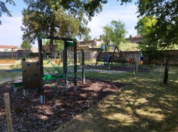
• Au départ de l'aire de jeux et des tennis 🎾 vers la maison d'accueil familiale ,puis les Boubas - la Michelie et re...
![Randonnée Marche Bunzac - La randonnée de l'ail des ours de Bunzac. - Photo](https://media.geolcdn.com/t/350/260/ext.jpg?maxdim=2&url=https%3A%2F%2Fmedia.geolcdn.com%2Ff%2F3caec311-6335-451e-8b98-07699b2429c2.jpg)
![Marche Marche](https://static1.geolcdn.com/sitytour/trail-icons/101.png)
Km
Marche
![](/images/other/stat-length.png)
![](https://static1.geolcdn.com/siteimages/upload/files/1508320355ic_sort_den_pos_24dp.png)
![](https://static1.geolcdn.com/siteimages/upload/files/1508320355ic_sort_den_neg_24dp.png)
![](https://static1.geolcdn.com/siteimages/upload/files/16400158638029165_repeat_loop_refresh_sync_direction_icon.png)
• Une super 👍 randonnée à découvrir absolument. Vous pouvez voir le gouffre de chez Roby,les jonquilles sauvage au pri...
![Randonnée Marche Combiers - La randonnée de Marchapack - Photo](https://media.geolcdn.com/t/350/260/ext.jpg?maxdim=2&url=https%3A%2F%2Fmedia.geolcdn.com%2Ff%2Fea8563e2-4ba2-481a-9ee5-82f48b60f3c1.jpg)
![Marche Marche](https://static1.geolcdn.com/sitytour/trail-icons/101.png)
Km
Marche
![](/images/other/stat-length.png)
![](https://static1.geolcdn.com/siteimages/upload/files/1508320355ic_sort_den_pos_24dp.png)
![](https://static1.geolcdn.com/siteimages/upload/files/1508320355ic_sort_den_neg_24dp.png)
![](https://static1.geolcdn.com/siteimages/upload/files/16400158638029165_repeat_loop_refresh_sync_direction_icon.png)
• Au départ du parking de la salle des fêtes de COMBIERS , vous allez découvrir le sentier d'interprétation de la Nizon...
![Randonnée Marche Villejoubert - Villejoubert et le château de la Barre - Photo](https://media.geolcdn.com/t/350/260/ext.jpg?maxdim=2&url=https%3A%2F%2Fmedia.geolcdn.com%2Ff%2F907ad314-aab5-49d2-9367-f56fc4587c7a.jpg)
![Marche Marche](https://static1.geolcdn.com/sitytour/trail-icons/101.png)
Km
Marche
![](/images/other/stat-length.png)
![](https://static1.geolcdn.com/siteimages/upload/files/1508320355ic_sort_den_pos_24dp.png)
![](https://static1.geolcdn.com/siteimages/upload/files/1508320355ic_sort_den_neg_24dp.png)
![](https://static1.geolcdn.com/siteimages/upload/files/16400158638029165_repeat_loop_refresh_sync_direction_icon.png)
• une randonnée cool où l'on découvre le château de la Barre du 16 ieme siècle.
20 randonnées affichées sur 1168
Application GPS de randonnée GRATUITE
Activités
Régions proches
- Abzac
- Agris
- Aigre
- Alloue
- Ambérac
- Ambleville
- Angeac-Charente
- Angeduc
- Angoulême
- Ars
- Asnières-sur-Nouère
- Aubeterre-sur-Dronne
- Aunac-sur-Charente
- Aussac-Vadalle
- Baignes-Sainte-Radegonde
- Balzac
- Barbezieux-Saint-Hilaire
- Bardenac
- Barret
- Barro
- Bassac
- Bazac
- Bécheresse
- Bellevigne
- Bellon
- Benest
- Bernac
- Berneuil
- Bessac
- Bioussac
- Birac
- Blanzaguet-Saint-Cybard
- Boisbreteau
- Boisné-la-Tude
- Bonnes
- Bonneuil
- Bors-de-Baignes
- Bors-de-Montmoreau
- Bouëx
- Bourg-Charente
- Bouteville
- Boutiers-Saint-Trojan
- Brie
- Brie-sous-Barbezieux
- Brie-sous-Chalais
- Brigueuil
- Brillac
- Brossac
- Bunzac
- Cellefrouin
- Cellettes
- Chabanais
- Chabrac
- Chadurie
- Chalais
- Challignac
- Champagne-Mouton
- Champagne-Vigny
- Champmillon
- Champniers
- Chantillac
- Charmé
- Charras
- Chasseneuil-sur-Bonnieure
- Chassenon
- Chassors
- Châteaubernard
- Châteauneuf-sur-Charente
- Châtignac
- Chazelles
- Cherves-Châtelars
- Cherves-Richemont
- Chillac
- Chirac
- Claix
- Cognac
- Combiers
- Condac
- Condéon
- Confolens
- Coteaux-du-Blanzacais
- Coulgens
- Courbillac
- Courcôme
- Courgeac
- Courlac
- Criteuil-la-Magdeleine
- Curac
- Deviat
- Dignac
- Dirac
- Douzat
- Ébréon
- Échallat
- Écuras
- Édon
- Empuré
- Esse
- Étagnac
- Étriac
- Exideuil-sur-Vienne
- Eymouthiers
- Feuillade
- Fléac
- Fontclaireau
- Fontenille
- Fouquebrune
- Garat
- Gardes-le-Pontaroux
- Genac-Bignac
- Gensac-la-Pallue
- Gimeux
- Gond-Pontouvre
- Grassac
- Graves-Saint-Amant
- Guimps
- Guizengeard
- Gurat
- Hiersac
- Houlette
- Jarnac
- Jauldes
- Juignac
- Juillac-le-Coq
- Julienne
- L'Isle-d'Espagnac
- La Chapelle
- La Couronne
- La Faye
- La Forêt-de-Tessé
- La Rochefoucauld-en-Angoumois
- La Rochette
- Lachaise
- Ladiville
- Lagarde-sur-le-Né
- Laprade
- Le Bouchage
- Le Lindois
- Le Tâtre
- Les Adjots
- Les Essards
- Les Pins
- Lésignac-Durand
- Lessac
- Lesterps
- Lichères
- Lignières-Sonneville
- Linars
- Londigny
- Louzac-Saint-André
- Luxé
- Magnac-Lavalette-Villars
- Magnac-sur-Touvre
- Maine-de-Boixe
- Mainxe-Gondeville
- Manot
- Mansle
- Marcillac-Lanville
- Mareuil
- Marillac-le-Franc
- Marsac
- Marthon
- Massignac
- Mazerolles
- Médillac
- Mérignac
- Merpins
- Mesnac
- Montboyer
- Montbron
- Montembœuf
- Montignac-Charente
- Montignac-le-Coq
- Montmérac
- Montmoreau
- Montrollet
- Mornac
- Mosnac-Saint-Simeux
- Moulidars
- Moulins-sur-Tardoire
- Mouthiers-sur-Boëme
- Mouton
- Moutonneau
- Mouzon
- Nabinaud
- Nanclars
- Nanteuil-en-Vallée
- Nercillac
- Nersac
- Nieuil
- Nonac
- Orgedeuil
- Paizay-Naudouin-Embourie
- Palluaud
- Parzac
- Passirac
- Pérignac
- Pillac
- Plassac-Rouffiac
- Pleuville
- Poullignac
- Poursac
- Pranzac
- Pressignac
- Puymoyen
- Puyréaux
- Reignac
- Réparsac
- Rioux-Martin
- Rivières
- Ronsenac
- Rouffiac
- Rougnac
- Rouillac
- Roullet-Saint-Estèphe
- Roussines
- Rouzède
- Ruelle-sur-Touvre
- Ruffec
- Saint-Adjutory
- Saint-Amant-de-Boixe
- Saint-Aulais-la-Chapelle
- Saint-Avit
- Saint-Brice
- Saint-Christophe
- Saint-Ciers-sur-Bonnieure
- Saint-Claud
- Saint-Coutant
- Saint-Cybardeaux
- Saint-Félix
- Saint-Fort-sur-le-Né
- Saint-Fraigne
- Saint-Front
- Saint-Genis-d'Hiersac
- Saint-Georges
- Saint-Germain-de-Montbron
- Saint-Laurent-de-Céris
- Saint-Laurent-de-Cognac
- Saint-Laurent-des-Combes
- Saint-Martial
- Saint-Mary
- Saint-Maurice-des-Lions
- Saint-Même-les-Carrières
- Saint-Michel
- Saint-Palais-du-Né
- Saint-Preuil
- Saint-Quentin-de-Chalais
- Saint-Quentin-sur-Charente
- Saint-Romain
- Saint-Saturnin
- Saint-Séverin
- Saint-Simon
- Saint-Sornin
- Saint-Sulpice-de-Cognac
- Saint-Yrieix-sur-Charente
- Sainte-Souline
- Salles-Lavalette
- Salles-d'Angles
- Salles-de-Villefagnan
- Saulgond
- Sauvignac
- Segonzac
- Sers
- Sigogne
- Sireuil
- Souffrignac
- Soyaux
- Suaux
- Taizé-Aizie
- Taponnat-Fleurignac
- Terres-de-Haute-Charente
- Torsac
- Touvérac
- Touvre
- Trois-Palis
- Tusson
- Val-d'Auge
- Val-de-Bonnieure
- Val-des-Vignes
- Vars
- Vaux-Lavalette
- Vaux-Rouillac
- Ventouse
- Verdille
- Verneuil
- Verteuil-sur-Charente
- Vervant
- Vibrac
- Vignolles
- Villebois-Lavalette
- Villejoubert
- Villognon
- Vindelle
- Vitrac-Saint-Vincent
- Vouharte
- Voulgézac
- Vouthon
- Vouzan
- Vœuil-et-Giget
- Yviers
- Yvrac-et-Malleyrand