Accueil
World
NEW
Premium
Shop
Randonnées
Articles
Aide - support
Français
English
Nederlands
Español
Italiano
Deutsch
Connexion
Accueil
World
Premium
Shop
Randonnées
Articles
Aide - support
SityTrail
>
Points d'intérêt
>
End point
SityTrail
>
Points d'intérêt
>
End point
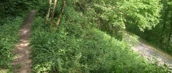
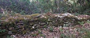
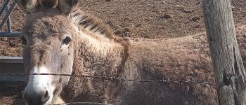
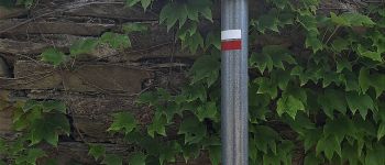
End point
Description
End point
Photos
End point est à découvir dans les randonnées suivantes...
tracegps
Les méandres du Tarn
Marche
Difficile
Villefranche-d'Albigeois, Occitanie, Tarn, France
13,4 km | 18,8 km-effort
4h 30min
Oui
tracegps
Utilisateur
©
OpenStreetMap
contributors
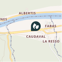
Localisation
Pays :
France
Région :
Occitanie
Département/Province :
Tarn
Commune :
Villefranche-d'Albigeois
Localité :
Unknown
Localisation
43.9317483 / 2.3090816
Date de création :
2018-04-09 11:58:43.423
Dernière modification
2018-04-09 11:58:43.423
(0 Avis)
Commentaires
Veuillez vous connecter pour laisser un commentaire ou une note
Points d'intérêt à proximité
tracegps
Start point
VILLEFRANCHE-D'ALBIGEOIS
canardDenis
Intersection
VILLEFRANCHE-D'ALBIGEOIS
canardDenis
GR 36
AMBIALET
canardDenis
Séparation avec GR
BELLEGARDE-MARSAL
canardDenis
Intersection sentier-piste
BELLEGARDE-MARSAL
canardDenis
Intersection tracé PR jaune
BELLEGARDE-MARSAL
canardDenis
Puech de l'Er
AMBIALET
canardDenis
Croisement GR
BELLEGARDE-MARSAL
Fermer
Mes abonnements