


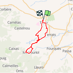

15 km | 18,2 km-effort


Utilisateur


Application GPS de randonnée GRATUITE
 SityTrail
IGN / Instituts géographiques
SityTrail World
Le monde est à vous
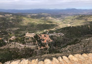
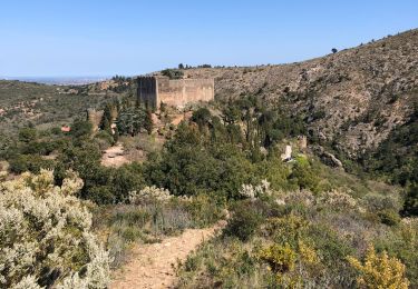
Randonnée V.T.T. de 22 km à découvrir à Occitanie, Pyrénées-Orientales, Thuir. Cette randonnée est proposée par tracegps.
Circuit en 8 au départ de Thuir. Prévoir suffisamment par temps chaud.

Marche

Marche
Marche
Marche
Marche

Marche
Marche
Marche
Marche