Randonnée Vélo Eslohe - Hochsauerringrad - Photo
 karawatsj
karawatsj

Utilisateur

© OpenStreetMap contributors
Longueur
Longueur
74 km
Altitude max
Altitude max
471 m
Dénivelé positif
Dénivelé positif
1156 m
Km-Effort
Km-Effort  
89 km
Altitude min
Altitude min
239 m
Dénivelé négatif
Dénivelé négatif
1156 m
Boucle
Boucle
Oui
Date de création :
2019-01-15 16:10:29.048
Dernière modification :
2019-01-15 16:10:29.048

(0 Avis)

Vélo
Vélo
4h47
Difficulté : Facile

Scannez ce code QR pour ouvrir la randonnée dans l'application SityTrail

Application GPS de randonnée GRATUITE

Logo SityTrail SityTrail

IGN / Instituts géographiques

Télécharger SityTrail sur l'App Store Télécharger SityTrail sur Google Play

Logo SityTrail SityTrail World

Le monde est à vous

Télécharger SityTrail sur l'App Store Télécharger SityTrail sur Google Play Télécharger SityTrail sur Huawei AppGallery

À propos

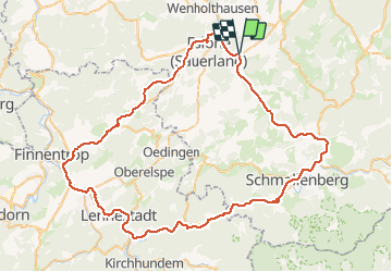
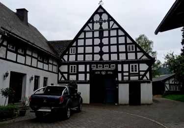
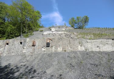
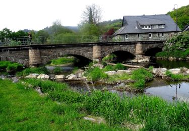
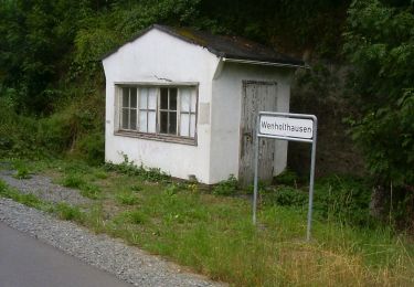
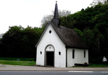
Randonnée Vélo de 74 km à découvrir à Rhénanie-du-Nord-Westphalie, Hochsauerlandkreis, Eslohe. Cette randonnée est proposée par karawatsj.

Profil altimétrique

Photos

Points d'intérêt

Point d'intérêt Finnentrop - vleermuistunnel - Photo
karawatsj
FINNENTROP 

Localisation

Pays :
Allemagne
Région :
Rhénanie-du-Nord-Westphalie
Département/Province :
Hochsauerlandkreis
Commune :
Eslohe
Localité :
Unknown
Départ:(Dec)
Départ:(UTM)
444869 ; 5678127 (32U) N.

Randonnées à proximité

Randonnée A pied Schmallenberg - Dorlar Rundweg D12 - Photo
A pied
PRO

A pied

Facile
Schmallenberg, Rhénanie-du-Nord-Westphalie, Hochsauerlandkreis, Allemagne
6,4 km | 8,6 km-effort
1h 57min
Non
Randonnée A pied Eslohe - Reiste Rundwanderweg Re3 - Photo
A pied
PRO

A pied

Facile
Eslohe, Rhénanie-du-Nord-Westphalie, Hochsauerlandkreis, Allemagne
10,7 km | 14,6 km-effort
3h 19min
Oui
Randonnée A pied Eslohe - Wenholthausen Wanderweg W7 - Photo
A pied
PRO

A pied

Facile
Eslohe, Rhénanie-du-Nord-Westphalie, Hochsauerlandkreis, Allemagne
7,6 km | 10,3 km-effort
2h 20min
Oui
Randonnée A pied Eslohe - Wenholthausen Rundweg W1 - Photo
A pied
PRO

A pied

Facile
Eslohe, Rhénanie-du-Nord-Westphalie, Hochsauerlandkreis, Allemagne
10,8 km | 15,3 km-effort
3h 28min
Non
Randonnée A pied Eslohe - Wenholthausen Rundweg W5 - Photo
A pied
PRO

A pied

Facile
Eslohe, Rhénanie-du-Nord-Westphalie, Hochsauerlandkreis, Allemagne
9 km | 13,3 km-effort
3h 1min
Non
Randonnée A pied Eslohe - Wenholthausen Rundweg W2 - Photo
A pied
PRO

A pied

Facile
Eslohe, Rhénanie-du-Nord-Westphalie, Hochsauerlandkreis, Allemagne
9,3 km | 12,4 km-effort
2h 49min
Non
Randonnée A pied Eslohe - Beerenberg Rundweg A2 - Photo
A pied
PRO

A pied

Facile
Eslohe, Rhénanie-du-Nord-Westphalie, Hochsauerlandkreis, Allemagne
4,1 km | 5,6 km-effort
1h 16min
Oui
Randonnée A pied Eslohe - Golddorf-Route Wenholthausen - Photo
A pied
PRO

A pied

Facile
Eslohe, Rhénanie-du-Nord-Westphalie, Hochsauerlandkreis, Allemagne
4,6 km | 7 km-effort
1h 35min
Non
Randonnée A pied Eslohe - Dorlar Rundweg D15 - Photo
A pied
PRO

A pied

Facile
Eslohe, Rhénanie-du-Nord-Westphalie, Hochsauerlandkreis, Allemagne
4,9 km | 6,8 km-effort
1h 32min
Non


Fermer
Mes abonnements