Randonnée Marche Mireval-Lauragais - 11_Mireval Lauragais - Photo
 jab31
jab31

Utilisateur

© OpenStreetMap contributors
Longueur
Longueur
15,8 km
Altitude max
Altitude max
394 m
Dénivelé positif
Dénivelé positif
357 m
Km-Effort
Km-Effort  
21 km
Altitude min
Altitude min
182 m
Dénivelé négatif
Dénivelé négatif
356 m
Boucle
Boucle
Oui
Date de création :
2019-01-06 17:09:52.526
Dernière modification :
2019-01-06 17:09:52.526

(0 Avis)

Marche
Marche
4h20
Difficulté : Moyen

Scannez ce code QR pour ouvrir la randonnée dans l'application SityTrail

Application GPS de randonnée GRATUITE

Logo SityTrail SityTrail

IGN / Instituts géographiques

Télécharger SityTrail sur l'App Store Télécharger SityTrail sur Google Play

Logo SityTrail SityTrail World

Le monde est à vous

Télécharger SityTrail sur l'App Store Télécharger SityTrail sur Google Play Télécharger SityTrail sur Huawei AppGallery

À propos

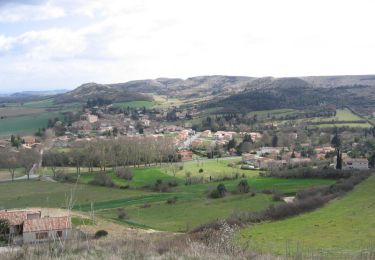
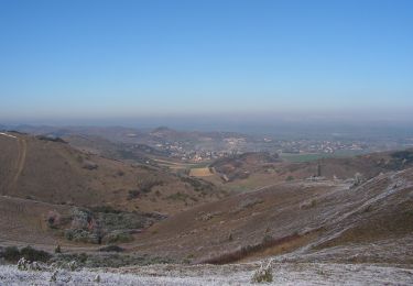
Randonnée Marche de 15,8 km à découvrir à Occitanie, Aude, Mireval-Lauragais. Cette randonnée est proposée par jab31.

Description

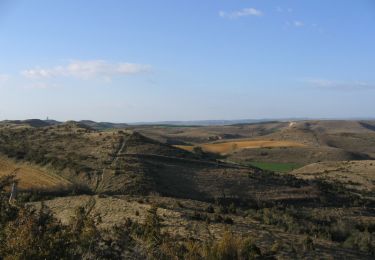
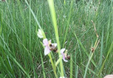
chemins de crêtes, champs et garrigues
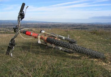
Profil altimétrique

Localisation

Pays :
France
Région :
Occitanie
Département/Province :
Aude
Commune :
Mireval-Lauragais
Localité :
Unknown
Départ:(Dec)
Départ:(UTM)
415523 ; 4789645 (31T) N.

Randonnées à proximité

Randonnée V.T.T. Villeneuve-la-Comptal - Les collines du pastel - Photo
V.T.T.
tracegps

V.T.T.

Difficile
(1)
Villeneuve-la-Comptal, Occitanie, Aude, France
26 km | 33 km-effort
2h 30min
Oui
Randonnée Marche Laurac - Laurac Fanjeaux - Photo
Marche
tracegps

Marche

Très difficile
(1)
Laurac, Occitanie, Aude, France
27 km | 37 km-effort
6h 30min
Oui
Randonnée Marche Villeneuve-la-Comptal - Villeneuve la Comptal 04 - Photo
Marche
tracegps

Marche

Moyen
(1)
Villeneuve-la-Comptal, Occitanie, Aude, France
11,2 km | 15 km-effort
2h 30min
Oui
Randonnée Marche Fonters-du-Razès - Boucle Saint Christol  - Photo
Marche
Mamilaure

Marche

Facile
Fonters-du-Razès, Occitanie, Aude, France
12,6 km | 16,3 km-effort
2h 48min
Oui
Randonnée V.T.T. Laurabuc - boucle bb - Photo
V.T.T.
leroj73

V.T.T.

Facile
(1)
Laurabuc, Occitanie, Aude, France
15,2 km | 19,2 km-effort
1h 15min
Oui
Randonnée Marche Villeneuve-la-Comptal - Villeneuve la Comptal 03 - Photo
Marche
tracegps

Marche

Moyen
Villeneuve-la-Comptal, Occitanie, Aude, France
14,1 km | 18,9 km-effort
3h 0min
Oui
Randonnée Marche Villeneuve-la-Comptal - Villeneuve la Comptal 01 - Photo
Marche
tracegps

Marche

Moyen
Villeneuve-la-Comptal, Occitanie, Aude, France
4,4 km | 6,1 km-effort
1h 0min
Oui
Randonnée Marche Laurabuc - boucle laurabuc bespllas - Photo
Marche
leroj73

Marche

Moyen
Laurabuc, Occitanie, Aude, France
17,9 km | 24 km-effort
5h 23min
Oui
Randonnée V.T.T. Villeneuve-la-Comptal - Col de Samson - Photo
V.T.T.
tracegps

V.T.T.

Difficile
Villeneuve-la-Comptal, Occitanie, Aude, France
14,3 km | 18,8 km-effort
1h 45min
Oui


Fermer
Mes abonnements