Randonnée Marche Navour-sur-Grosne - Boucle N°3 autour de Clermain - Photo
 tracegps
tracegps

Utilisateur

© OpenStreetMap contributors
Longueur
Longueur
18,7 km
Altitude max
Altitude max
527 m
Dénivelé positif
Dénivelé positif
676 m
Km-Effort
Km-Effort  
28 km
Altitude min
Altitude min
268 m
Dénivelé négatif
Dénivelé négatif
677 m
Boucle
Boucle
Oui
Date de création :
2014-12-10 00:00:00.0
Dernière modification :
2014-12-10 00:00:00.0

(0 Avis)

Marche
Marche
5h00
Difficulté : Moyen

Scannez ce code QR pour ouvrir la randonnée dans l'application SityTrail

Application GPS de randonnée GRATUITE

Logo SityTrail SityTrail

IGN / Instituts géographiques

Télécharger SityTrail sur l'App Store Télécharger SityTrail sur Google Play

Logo SityTrail SityTrail World

Le monde est à vous

Télécharger SityTrail sur l'App Store Télécharger SityTrail sur Google Play Télécharger SityTrail sur Huawei AppGallery

À propos

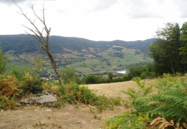
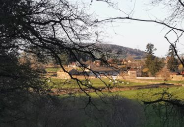
Randonnée Marche de 18,7 km à découvrir à Bourgogne-Franche-Comté, Saône-et-Loire, Navour-sur-Grosne. Cette randonnée est proposée par tracegps.

Description

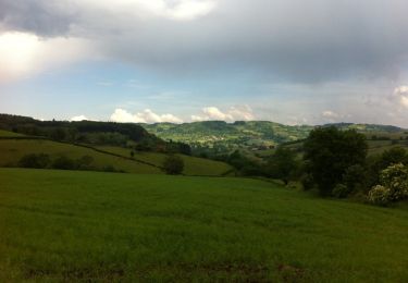
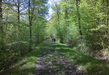
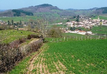
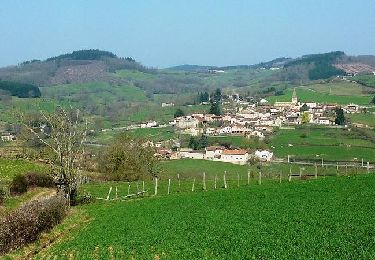
Rando sympathique qui vous fera découvrir les paysages du Haut Clunysois. Passage au Col des Enceins. Possibilité de restauration à Bourgvilain : "Chez la Zette". Accueil pique-nique.

Profil altimétrique

Localisation

Pays :
France
Région :
Bourgogne-Franche-Comté
Département/Province :
Saône-et-Loire
Commune :
Navour-sur-Grosne
Localité :
Unknown
Départ:(Dec)
Départ:(UTM)
621812 ; 5135871 (31T) N.

Randonnées à proximité

Randonnée Marche Bergesserin - bergesserin  - Photo
Marche
darrisa

Marche

Moyen
Bergesserin, Bourgogne-Franche-Comté, Saône-et-Loire, France
5,6 km | 7,7 km-effort
2h 11min
Oui
Randonnée Marche Sainte-Cécile - Le haut clunisois  - Photo
Marche
darrisa

Marche

Moyen
Sainte-Cécile, Bourgogne-Franche-Comté, Saône-et-Loire, France
14,9 km | 19,6 km-effort
4h 0min
Oui
Randonnée Marche Sainte-Cécile - bourgvilain - Photo
Marche
darrisa

Marche

Difficile
Sainte-Cécile, Bourgogne-Franche-Comté, Saône-et-Loire, France
6,4 km | 9,4 km-effort
2h 15min
Non
Randonnée Marche Trambly - Trambly - Saint Leger sous la Bussière - Photo
Marche
dominiq

Marche

Très facile
Trambly, Bourgogne-Franche-Comté, Saône-et-Loire, France
12,8 km | 18,5 km-effort
3h 54min
Oui
Randonnée Marche Curtil-sous-Buffières - Rando du 1er Mai - Curtil sous Buffières - Photo
Marche
tracegps

Marche

Difficile
Curtil-sous-Buffières, Bourgogne-Franche-Comté, Saône-et-Loire, France
25 km | 33 km-effort
5h 30min
Oui
Randonnée V.T.T. Trambly - Les Serpentines (2012-VTT-25km) - Trambly - Photo
V.T.T.
tracegps

V.T.T.

Difficile
Trambly, Bourgogne-Franche-Comté, Saône-et-Loire, France
25 km | 36 km-effort
2h 30min
Oui
Randonnée V.T.T. Trambly - Les Serpentines (2012-VTT-35km) - Trambly - Photo
V.T.T.
tracegps

V.T.T.

Très difficile
Trambly, Bourgogne-Franche-Comté, Saône-et-Loire, France
36 km | 52 km-effort
3h 0min
Oui
Randonnée Marche Navour-sur-Grosne - Les Echeliers - Brandon - Photo
Marche
tracegps

Marche

Moyen
Navour-sur-Grosne, Bourgogne-Franche-Comté, Saône-et-Loire, France
9,6 km | 14,2 km-effort
2h 45min
Oui
Randonnée Marche Mazille - Neronde - Photo
Marche
darrisa

Marche

Très difficile
Mazille, Bourgogne-Franche-Comté, Saône-et-Loire, France
21 km | 27 km-effort
4h 33min
Non


Fermer
Mes abonnements