Randonnée Marche Anzin-Saint-Aubin - Anzin Saint Aubin - Photo
 tracegps
tracegps

Utilisateur

© OpenStreetMap contributors
Longueur
Longueur
6,2 km
Altitude max
Altitude max
91 m
Dénivelé positif
Dénivelé positif
41 m
Km-Effort
Km-Effort  
6,8 km
Altitude min
Altitude min
58 m
Dénivelé négatif
Dénivelé négatif
48 m
Boucle
Boucle
Non
Date de création :
2014-12-10 00:00:00.0
Dernière modification :
2014-12-10 00:00:00.0

(0 Avis)

Marche
Marche
1h30
Difficulté : Moyen

Scannez ce code QR pour ouvrir la randonnée dans l'application SityTrail

Application GPS de randonnée GRATUITE

Logo SityTrail SityTrail

IGN / Instituts géographiques

Télécharger SityTrail sur l'App Store Télécharger SityTrail sur Google Play

Logo SityTrail SityTrail World

Le monde est à vous

Télécharger SityTrail sur l'App Store Télécharger SityTrail sur Google Play Télécharger SityTrail sur Huawei AppGallery

À propos

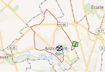
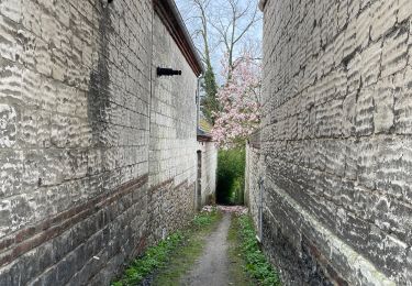
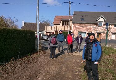
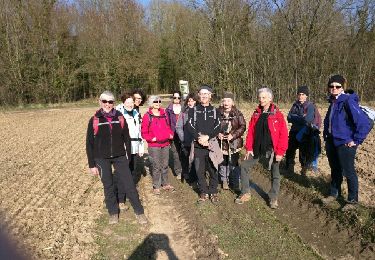
Randonnée Marche de 6,2 km à découvrir à Hauts-de-France, Pas-de-Calais, Anzin-Saint-Aubin. Cette randonnée est proposée par tracegps.

Description

Un petit tour autour d'Anzin St Aubin en passant par les champs et en revenant par le golf.

Profil altimétrique

Photos

Localisation

Pays :
France
Région :
Hauts-de-France
Département/Province :
Pas-de-Calais
Commune :
Anzin-Saint-Aubin
Localité :
Unknown
Départ:(Dec)
Départ:(UTM)
482572 ; 5573526 (31U) N.

Randonnées à proximité

Randonnée Marche Mont-Saint-Éloi - Autour du Mont-Saint-Éloi - Photo
Marche
tracegps

Marche

Difficile
(3)
Mont-Saint-Éloi, Hauts-de-France, Pas-de-Calais, France
14,3 km | 16,7 km-effort
3h 34min
Oui
Randonnée Marche Sainte-Catherine - Jardins et monuments - Arras - Photo
Marche
tracegps

Marche

Moyen
(3)
Sainte-Catherine, Hauts-de-France, Pas-de-Calais, France
9,6 km | 10,6 km-effort
2h 40min
Oui
Randonnée Marche Arras - Arras Citadelles Grands Prés 16,5 km - Photo
Marche
GUIDE
rvapeldo

Marche

Difficile
Arras, Hauts-de-France, Pas-de-Calais, France
16,4 km | 18,2 km-effort
4h 8min
Oui
Randonnée Marche nordique Mont-Saint-Éloi - Les trois abbayes  - Photo
Marche nordique
Castor65

Marche nordique

Facile
Mont-Saint-Éloi, Hauts-de-France, Pas-de-Calais, France
16,2 km | 18,9 km-effort
3h 24min
Oui
Randonnée A pied Achicourt - la vallée du crinchon  - Photo
A pied
Templeuveenmarche

A pied

Facile
(1)
Achicourt, Hauts-de-France, Pas-de-Calais, France
10,7 km | 11,8 km-effort
2h 10min
Oui
Randonnée Marche Arras - Beffroi à citadelle d'Arras - Photo
Marche
crijack

Marche

Très facile
Arras, Hauts-de-France, Pas-de-Calais, France
7,6 km | 8,5 km-effort
1h 31min
Oui
Randonnée Marche Dainville - le Crinchon - Photo
Marche
reneperrin

Marche

Facile
Dainville, Hauts-de-France, Pas-de-Calais, France
24 km | 26 km-effort
5h 18min
Oui
Randonnée Marche Dainville - le Crinchon - Photo
Marche
reneperrin

Marche

Facile
Dainville, Hauts-de-France, Pas-de-Calais, France
24 km | 26 km-effort
5h 18min
Oui
Randonnée Marche Arras - La Route du Louvre «La Canadienne» - Arras - Photo
Marche
tracegps

Marche

Moyen
Arras, Hauts-de-France, Pas-de-Calais, France
24 km | 27 km-effort
5h 30min
Non


Fermer
Mes abonnements