Trail Walking Anzin-Saint-Aubin - Anzin Saint Aubin - Photo
 tracegps
tracegps

User

© OpenStreetMap contributors
Length
Length
6.2 km
Max alt
Max alt
91 m
Uphill gradient
Uphill gradient
41 m
Km-Effort
Km-Effort  
6.8 km
Min alt
Min alt
58 m
Downhill gradient
Downhill gradient
48 m
Boucle
Boucle
No
Creation date :
2014-12-10 00:00:00.0
Updated on :
2014-12-10 00:00:00.0

(0 Reviews)

Walking
Walking
1h30
Difficulty : Medium

Scan this QR Code to open this trail in the SityTrail application

FREE GPS app for hiking

Logo SityTrail SityTrail

IGN / Geographical institutes

Download SityTrail from the App Store Download SityTrail from Google Play

Logo SityTrail SityTrail World

The world is yours!

Download SityTrail from the App Store Download SityTrail from Google Play Download SityTrail on Huawei AppGallery

About

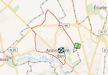
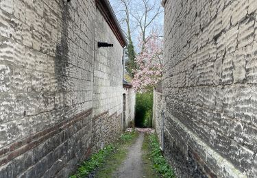
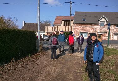
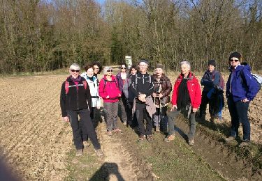
Trail Walking of 6.2 km to be discovered at Hauts-de-France, Pas-de-Calais, Anzin-Saint-Aubin. This trail is proposed by tracegps.

Description

Un petit tour autour d'Anzin St Aubin en passant par les champs et en revenant par le golf.

Elevation profile

Photos

Positioning

Country:
France
Region :
Hauts-de-France
Department/Province :
Pas-de-Calais
Municipality :
Anzin-Saint-Aubin
Location:
Unknown
Start:(UTM)
482572 ; 5573526 (31U) N.

Trails nearby

Trail Walking Mont-Saint-Éloi - Autour du Mont-Saint-Éloi - Photo
Walking
tracegps

Walking

Difficult
(3)
Mont-Saint-Éloi, Hauts-de-France, Pas-de-Calais, France
14.3 km | 16.7 km-effort
3h 34min
Yes
Trail Walking Sainte-Catherine - Jardins et monuments - Arras - Photo
Walking
tracegps

Walking

Medium
(3)
Sainte-Catherine, Hauts-de-France, Pas-de-Calais, France
9.6 km | 10.6 km-effort
2h 40min
Yes
Trail Walking Arras - Arras Citadelles Grands Prés 16,5 km - Photo
Walking
GUIDE
rvapeldo

Walking

Difficult
Arras, Hauts-de-France, Pas-de-Calais, France
16.4 km | 18.2 km-effort
4h 8min
Yes
Trail Nordic walking Mont-Saint-Éloi - Les trois abbayes  - Photo
Nordic walking
Castor65

Nordic walking

Easy
Mont-Saint-Éloi, Hauts-de-France, Pas-de-Calais, France
16.2 km | 18.9 km-effort
3h 24min
Yes
Trail On foot Achicourt - la vallée du crinchon  - Photo
On foot
Templeuveenmarche

On foot

Easy
(1)
Achicourt, Hauts-de-France, Pas-de-Calais, France
10.7 km | 11.8 km-effort
2h 10min
Yes
Trail Walking Arras - Beffroi à citadelle d'Arras - Photo
Walking
crijack

Walking

Very easy
Arras, Hauts-de-France, Pas-de-Calais, France
7.6 km | 8.5 km-effort
1h 31min
Yes
Trail Walking Dainville - le Crinchon - Photo
Walking
reneperrin

Walking

Easy
Dainville, Hauts-de-France, Pas-de-Calais, France
24 km | 26 km-effort
5h 18min
Yes
Trail Walking Dainville - le Crinchon - Photo
Walking
reneperrin

Walking

Easy
Dainville, Hauts-de-France, Pas-de-Calais, France
24 km | 26 km-effort
5h 18min
Yes
Trail Walking Arras - La Route du Louvre «La Canadienne» - Arras - Photo
Walking
tracegps

Walking

Medium
Arras, Hauts-de-France, Pas-de-Calais, France
24 km | 27 km-effort
5h 30min
No


Close
My subscriptions