Randonnée V.T.T. Onet-le-Château - VTT de Onet à Espalion - Photo

VTT de Onet à Espalion

 tracegps
tracegps

Utilisateur

© OpenStreetMap contributors
Longueur
Longueur
59 km
Altitude max
Altitude max
680 m
Dénivelé positif
Dénivelé positif
815 m
Km-Effort
Km-Effort  
71 km
Altitude min
Altitude min
333 m
Dénivelé négatif
Dénivelé négatif
1037 m
Boucle
Boucle
Non
Date de création :
2014-12-10 00:00:00.0
Dernière modification :
2014-12-10 00:00:00.0

(0 Avis)

V.T.T.
V.T.T.
7h15
Difficulté : Difficile

Scannez ce code QR pour ouvrir la randonnée dans l'application SityTrail

Application GPS de randonnée GRATUITE

Logo SityTrail SityTrail

IGN / Instituts géographiques

Télécharger SityTrail sur l'App Store Télécharger SityTrail sur Google Play

Logo SityTrail SityTrail World

Le monde est à vous

Télécharger SityTrail sur l'App Store Télécharger SityTrail sur Google Play Télécharger SityTrail sur Huawei AppGallery

À propos

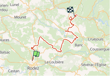
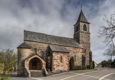
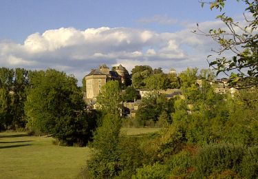
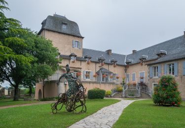
Randonnée V.T.T. de 59 km à découvrir à Occitanie, Aveyron, Onet-le-Château. Cette randonnée est proposée par tracegps.

Description

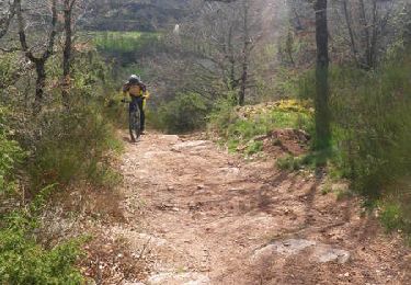
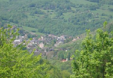
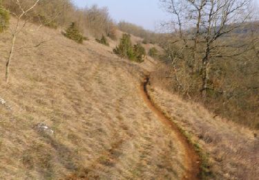
La première partie, c’est du Causse rien de très difficile. Prévoir une étape à Bouzouls pour manger et boire. Si vous suivez l’ancienne voie ferrée, prévoir une lampe torche pour le premier tunnel "800 mètres de longs en courbe" si vous suivez la trace vous évitez le tunnel. Bonne balade !!

Profil altimétrique

Photos

Localisation

Pays :
France
Région :
Occitanie
Département/Province :
Aveyron
Commune :
Onet-le-Château
Localité :
Unknown
Départ:(Dec)
Départ:(UTM)
465772 ; 4913727 (31T) N.

Randonnées à proximité

Randonnée V.T.T. Druelle Balsac - Autour de l'Aveyron de Agnac à Ampiac - Photo
V.T.T.
tracegps

V.T.T.

Très difficile
(1)
Druelle Balsac, Occitanie, Aveyron, France
15,7 km | 24 km-effort
3h 45min
Oui
Randonnée V.T.T. Onet-le-Château - Randonnée VTT boucle d'Onet le Château à Macillac - Photo
V.T.T.
tracegps

V.T.T.

Difficile
(1)
Onet-le-Château, Occitanie, Aveyron, France
39 km | 51 km-effort
5h 40min
Oui
Randonnée V.T.T. Onet-le-Château - Onet - Mondalazac - Onet - Photo
V.T.T.
tracegps

V.T.T.

Difficile
(2)
Onet-le-Château, Occitanie, Aveyron, France
45 km | 52 km-effort
4h 0min
Non
Randonnée A pied Rodez - Randonnée de Rodez Agglomération Circuit n°2 - Layoule - Photo
A pied
PRO

A pied

Facile
Rodez, Occitanie, Aveyron, France
5,6 km | 6,6 km-effort
1h 29min
Oui
Randonnée A pied Onet-le-Château - Circuit 20 Vabres - Photo
A pied
PRO

A pied

Facile
Onet-le-Château, Occitanie, Aveyron, France
4,9 km | 5,8 km-effort
1h 18min
Oui
Randonnée A pied Onet-le-Château - Circuit 16 Moulin de cantarane - Photo
A pied
PRO

A pied

Facile
Onet-le-Château, Occitanie, Aveyron, France
6,3 km | 8 km-effort
1h 48min
Oui
Randonnée A pied Le Monastère - Circuit 11 Le Monsastère - Photo
A pied
PRO

A pied

Facile
Le Monastère, Occitanie, Aveyron, France
6,4 km | 7,9 km-effort
1h 47min
Non
Randonnée A pied Olemps - Circuit 8 Le Viel Olemps - Photo
A pied
PRO

A pied

Facile
Olemps, Occitanie, Aveyron, France
5,1 km | 6,5 km-effort
1h 29min
Oui
Randonnée A pied Sébazac-Concourès - Circuit 18 Nord de Sébazac - Photo
A pied
PRO

A pied

Facile
Sébazac-Concourès, Occitanie, Aveyron, France
3,2 km | 3,7 km-effort
50min
Non


Fermer
Mes abonnements