


10,3 km | 24 km-effort


Utilisateur


Application GPS de randonnée GRATUITE
 SityTrail
IGN / Instituts géographiques
SityTrail World
Le monde est à vous
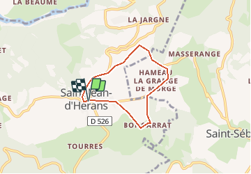
Randonnée Course à pied de 5,2 km à découvrir à Auvergne-Rhône-Alpes, Isère, Saint-Jean-d'Hérans. Cette randonnée est proposée par tracegps.
Circuit n°11 (vert) de la base VTT FFCT du Trièves. Empruntant des chemins herbeux ou gravillonnés, des routes peu fréquentées, ce parcours sur le plateau de St Jean d'Hérans est idéal pour faire ses premiers pas en VTT, ou pour une sortie facile en famille
Marche
Marche
Marche
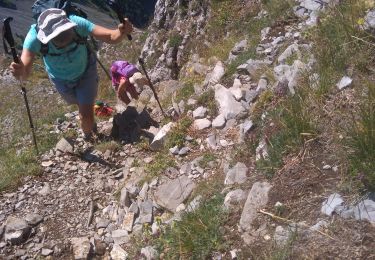
Marche
Trail
Marche
Marche

Marche
Marche