Randonnée Marche Tourtouse - Tourtouse, boucle de 20km - Photo

Tourtouse, boucle de 20km

 eric09
eric09

Utilisateur

© OpenStreetMap contributors
Longueur
Longueur
20 km
Altitude max
Altitude max
565 m
Dénivelé positif
Dénivelé positif
485 m
Km-Effort
Km-Effort  
27 km
Altitude min
Altitude min
359 m
Dénivelé négatif
Dénivelé négatif
485 m
Boucle
Boucle
Oui
Date de création :
2019-01-15 18:11:59.725
Dernière modification :
2019-05-31 20:10:32.224

(0 Avis)

Marche
Marche
5h44
Difficulté : Difficile
Trail
Trail
2h15
Difficulté : Difficile
V.T.T.
V.T.T.
1h45
Difficulté : Moyen

Scannez ce code QR pour ouvrir la randonnée dans l'application SityTrail

Application GPS de randonnée GRATUITE

Logo SityTrail SityTrail

IGN / Instituts géographiques

Télécharger SityTrail sur l'App Store Télécharger SityTrail sur Google Play

Logo SityTrail SityTrail World

Le monde est à vous

Télécharger SityTrail sur l'App Store Télécharger SityTrail sur Google Play Télécharger SityTrail sur Huawei AppGallery

À propos

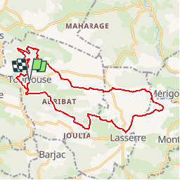
Randonnée Marche de 20 km à découvrir à Occitanie, Ariège, Tourtouse. Cette randonnée est proposée par eric09.

Description

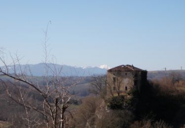
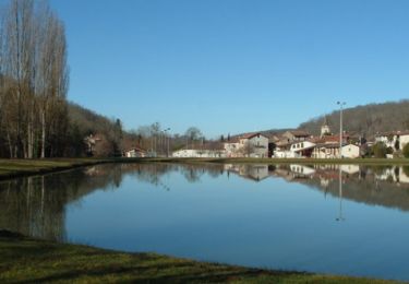
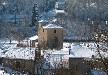
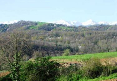
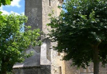
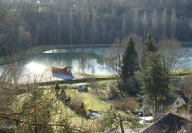
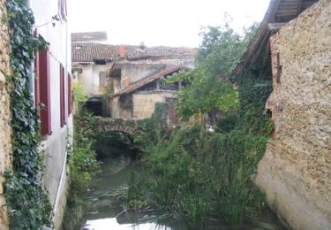
Jolie boucle pour découvrir Tourtouse et Lasserre avec des vues magnifique sur les montagnes ariègeoises.

Profil altimétrique

Localisation

Pays :
France
Région :
Occitanie
Département/Province :
Ariège
Commune :
Tourtouse
Localité :
Unknown
Départ:(Dec)
Départ:(UTM)
347357 ; 4772768 (31T) N.

Randonnées à proximité

Randonnée V.T.T. Tourtouse - Volvestre Tout Terrain  - Photo
V.T.T.
tracegps

V.T.T.

Difficile
(2)
Tourtouse, Occitanie, Ariège, France
30 km | 43 km-effort
3h 0min
Oui
Randonnée V.T.T. Sainte-Croix-Volvestre - Espace VTT FFC Couserans-Volvestre en Pyrénées - Sentier de Paouêt n°01 - Photo
V.T.T.
tracegps

V.T.T.

Moyen
(2)
Sainte-Croix-Volvestre, Occitanie, Ariège, France
5,1 km | 7 km-effort
30min
Oui
Randonnée Marche Sainte-Croix-Volvestre - Sainte Croix Volvestre, boucle de 13km - Photo
Marche
eric09

Marche

Moyen
Sainte-Croix-Volvestre, Occitanie, Ariège, France
13,3 km | 18,2 km-effort
3h 51min
Oui
Randonnée V.T.T. Bagert - Espace VTT FFC Couserans-Volvestre en Pyrénées - Sentier de Bergès n°10 - Photo
V.T.T.
tracegps

V.T.T.

Difficile
Bagert, Occitanie, Ariège, France
6,5 km | 10 km-effort
40min
Oui
Randonnée V.T.T. Tourtouse - Espace VTT FFC Couserans-Volvestre en Pyrénées - Sentier de Naudot et Guillou n°06 - Photo
V.T.T.
tracegps

V.T.T.

Moyen
(1)
Tourtouse, Occitanie, Ariège, France
17 km | 22 km-effort
1h 19min
Oui
Randonnée V.T.T. Sainte-Croix-Volvestre - Espace VTT FFC Couserans-Volvestre en Pyrénées - Sentier de Maharage n°02  - Photo
V.T.T.
tracegps

V.T.T.

Moyen
(1)
Sainte-Croix-Volvestre, Occitanie, Ariège, France
13,3 km | 16,7 km-effort
1h 10min
Oui
Randonnée V.T.T. Sainte-Croix-Volvestre - Les pré Pyrénées à Ste Croix Volvestre - Photo
V.T.T.
tracegps

V.T.T.

Moyen
Sainte-Croix-Volvestre, Occitanie, Ariège, France
21 km | 28 km-effort
2h 0min
Oui
Randonnée Marche Sainte-Croix-Volvestre - Les pré Pyrénées à Ste Croix Volvestre - Photo
Marche
tracegps

Marche

Difficile
(1)
Sainte-Croix-Volvestre, Occitanie, Ariège, France
21 km | 28 km-effort
4h 0min
Oui
Randonnée A pied Sainte-Croix-Volvestre - Sentier de Peyre - Photo
A pied
PRO

A pied

Facile
Sainte-Croix-Volvestre, Occitanie, Ariège, France
4,9 km | 7,2 km-effort
1h 37min
Non


Fermer
Mes abonnements