![](/images/other/stat-length.png)
![Randonnée Marche Brive-la-Gaillarde - De la vallée de Planchetorte à Noailles - Photo](https://media.geolcdn.com/t/1900/400/ext.pjpeg?maxdim=2&url=https%3A%2F%2Fservices.sitytrail.com%2FGeolivesWS%2FDownloadMedia.ashx%3FTrailID%3D106786%26Media%3D11478_6.jpg)
De la vallée de Planchetorte à Noailles
tracegps
Utilisateur
![Longueur](/images/other/stat-length.png)
Longueur
4,4 km
![Altitude max](https://static1.geolcdn.com/siteimages/upload/files/1508320355ic_sort_altitude_max_24dp.png)
Altitude max
279 m
![Dénivelé positif](https://static1.geolcdn.com/siteimages/upload/files/1508320355ic_sort_den_pos_24dp.png)
Dénivelé positif
165 m
![Km-Effort](/images/other/stat-length.png)
Km-Effort
6,2 km
![Altitude min](https://static1.geolcdn.com/siteimages/upload/files/1508320355ic_sort_altitude_min_24dp.png)
Altitude min
148 m
![Dénivelé négatif](https://static1.geolcdn.com/siteimages/upload/files/1508320355ic_sort_den_neg_24dp.png)
Dénivelé négatif
38 m
![Boucle](https://static1.geolcdn.com/siteimages/upload/files/16400158638029165_repeat_loop_refresh_sync_direction_icon.png)
Boucle
Non
Date de création :
2014-12-10 00:00:00.0
Dernière modification :
2014-12-10 00:00:00.0
![Marche](https://static1.geolcdn.com/sitytour/trail-icons/101.png)
1h00
Difficulté : Moyen
![Scannez ce code QR pour ouvrir la randonnée dans l'application SityTrail](https://capi.geolives.com/qq0zvz2zws4bq2lad0pu/sitytour/trails/106786/qr.png?size=200)
Application GPS de randonnée GRATUITE
À propos
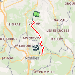
Randonnée Marche de 4,4 km à découvrir à Nouvelle-Aquitaine, Corrèze, Brive-la-Gaillarde. Cette randonnée est proposée par tracegps.
Description
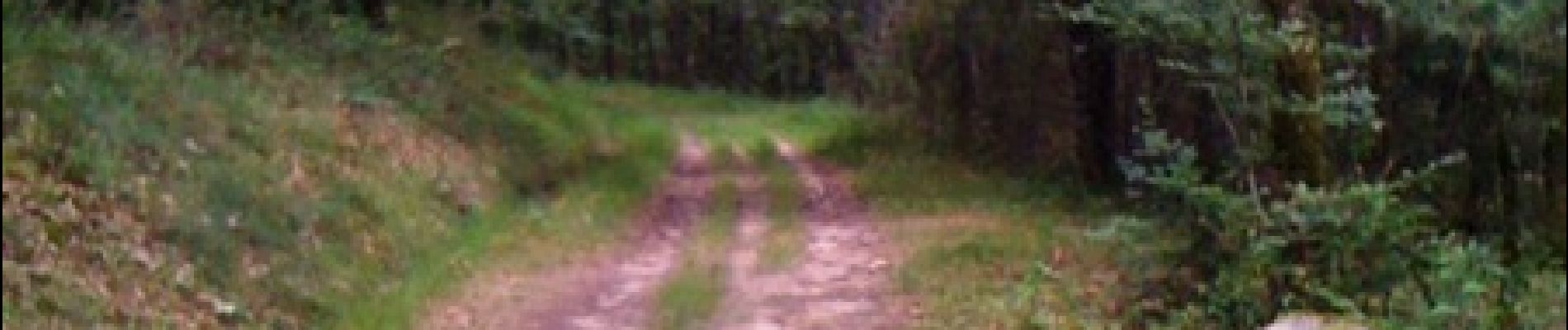
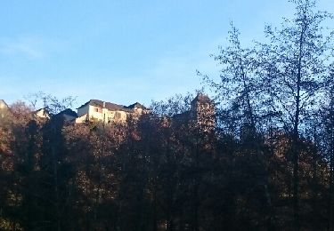
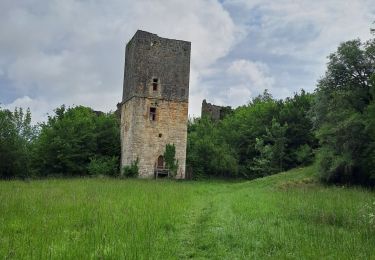
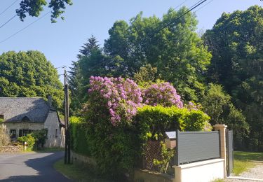
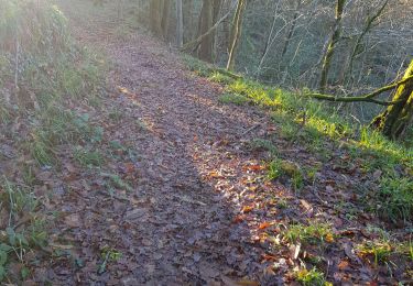
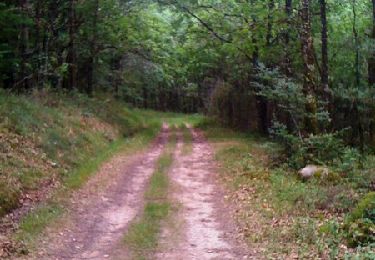
Balade sympathique aux portes de Brive où vous aurez de magnifiques vues sur le Bassin de Brive et sur le Causse Corrézien. Vous traverserez des paysages où se mêlent figuiers, pruniers, cerisiers, pommiers et même de la vigne!
Localisation
Pays :
France
Région :
Nouvelle-Aquitaine
Département/Province :
Corrèze
Commune :
Brive-la-Gaillarde
Localité :
Unknown
Départ:(Dec)
Départ:(UTM)
383967 ; 4998726 (31T) N.
Commentaires
Randonnées à proximité
![Randonnée Marche Lissac-sur-Couze - lissac son lac - Photo](https://media.geolcdn.com/t/375/260/ext.jpg?maxdim=2&url=https%3A%2F%2Fservices.sitytrail.com%2FGeolivesWS%2FDownloadMedia.ashx%3FTrailID%3D665039%26Media%3Dfix__20161127155955.jpg)
![Marche Marche](https://static1.geolcdn.com/sitytour/trail-icons/101.png)
lissac son lac
Marche
Facile
(1)
Lissac-sur-Couze,
Nouvelle-Aquitaine,
Corrèze,
France
![](/images/other/stat-length.png)
7,6 km | 8,5 km-effort
2h 7min
![](https://static1.geolcdn.com/siteimages/upload/files/16400158638029165_repeat_loop_refresh_sync_direction_icon.png)
Oui
![Randonnée V.T.T. Lissac-sur-Couze - BOUCLE DU LAC DU CAUSSE A NADAILLAC via Chartrier - Photo](https://media.geolcdn.com/t/375/260/ext.jpg?maxdim=2&url=https%3A%2F%2Fstatic1.geolcdn.com%2Fsiteimages%2Fupload%2Ffiles%2F1524743154velo.jpg)
![V.T.T. V.T.T.](https://static1.geolcdn.com/sitytour/trail-icons/202.png)
BOUCLE DU LAC DU CAUSSE A NADAILLAC via Chartrier
V.T.T.
Très difficile
(1)
Lissac-sur-Couze,
Nouvelle-Aquitaine,
Corrèze,
France
![](/images/other/stat-length.png)
36 km | 45 km-effort
2h 53min
![](https://static1.geolcdn.com/siteimages/upload/files/16400158638029165_repeat_loop_refresh_sync_direction_icon.png)
Oui
![Randonnée Marche Malemort - les Escures dampniat les escures - Photo](https://media.geolcdn.com/t/375/260/ext.jpg?maxdim=2&url=https%3A%2F%2Fstatic1.geolcdn.com%2Fsiteimages%2Fupload%2Ffiles%2F1553511878bg_sport_marche.png)
![Marche Marche](https://static1.geolcdn.com/sitytour/trail-icons/101.png)
les Escures dampniat les escures
Marche
Facile
(3)
Malemort,
Nouvelle-Aquitaine,
Corrèze,
France
![](/images/other/stat-length.png)
10 km | 12,9 km-effort
2h 50min
![](https://static1.geolcdn.com/siteimages/upload/files/16400158638029165_repeat_loop_refresh_sync_direction_icon.png)
Oui
![Randonnée Marche Lissac-sur-Couze - boucle lac de causse - Photo](https://media.geolcdn.com/t/375/260/ext.jpg?maxdim=2&url=https%3A%2F%2Fmedia.geolcdn.com%2Ff%2F28b2c68b-2e4a-4536-9882-f709897b55b0.jpg)
![Marche Marche](https://static1.geolcdn.com/sitytour/trail-icons/101.png)
boucle lac de causse
Marche
Moyen
Lissac-sur-Couze,
Nouvelle-Aquitaine,
Corrèze,
France
![](/images/other/stat-length.png)
14,5 km | 21 km-effort
4h 57min
![](https://static1.geolcdn.com/siteimages/upload/files/16400158638029165_repeat_loop_refresh_sync_direction_icon.png)
Oui
![Randonnée Marche Lissac-sur-Couze - Boucle la vierge de Fournet la forêt de Couzage - Photo](https://media.geolcdn.com/t/375/260/ext.jpg?maxdim=2&url=https%3A%2F%2Fmedia.geolcdn.com%2Ff%2F0590ca93-0a6e-44ae-8863-f90f1b8d97b7.jpg)
![Marche Marche](https://static1.geolcdn.com/sitytour/trail-icons/101.png)
Boucle la vierge de Fournet la forêt de Couzage
Marche
Très difficile
Lissac-sur-Couze,
Nouvelle-Aquitaine,
Corrèze,
France
![](/images/other/stat-length.png)
15,6 km | 22 km-effort
5h 2min
![](https://static1.geolcdn.com/siteimages/upload/files/16400158638029165_repeat_loop_refresh_sync_direction_icon.png)
Oui
![Randonnée Vélo de route Brive-la-Gaillarde - balade 50 km Beynat Chastang Aubazine Brive - Photo](https://media.geolcdn.com/t/375/260/ext.jpg?maxdim=2&url=https%3A%2F%2Fmedia.geolcdn.com%2Ff%2Fcd93208f-9861-4bd4-94d5-46075229805f.jpg)
![Vélo de route Vélo de route](https://static1.geolcdn.com/sitytour/trail-icons/201.png)
balade 50 km Beynat Chastang Aubazine Brive
Vélo de route
Difficile
Brive-la-Gaillarde,
Nouvelle-Aquitaine,
Corrèze,
France
![](/images/other/stat-length.png)
50 km | 61 km-effort
2h 25min
![](https://static1.geolcdn.com/siteimages/upload/files/16400158638029165_repeat_loop_refresh_sync_direction_icon.png)
Oui
![Randonnée Trail Malemort - 20191231 voie verte 17,5 K dev 548m - Photo](https://media.geolcdn.com/t/375/260/ext.jpg?maxdim=2&url=https%3A%2F%2Fmedia.geolcdn.com%2Ff%2F5c154ecf-423e-476c-a8e5-ac251e5a6f18.jpg)
![Trail Trail](https://static1.geolcdn.com/sitytour/trail-icons/104.png)
20191231 voie verte 17,5 K dev 548m
Trail
Moyen
Malemort,
Nouvelle-Aquitaine,
Corrèze,
France
![](/images/other/stat-length.png)
17,2 km | 24 km-effort
2h 14min
![](https://static1.geolcdn.com/siteimages/upload/files/16400158638029165_repeat_loop_refresh_sync_direction_icon.png)
Oui
![Randonnée Marche Brive-la-Gaillarde - chevrecujols_2 - Photo](https://media.geolcdn.com/t/375/260/ext.jpg?maxdim=2&url=https%3A%2F%2Fstatic1.geolcdn.com%2Fsiteimages%2Fupload%2Ffiles%2F1553511878bg_sport_marche.png)
![Marche Marche](https://static1.geolcdn.com/sitytour/trail-icons/101.png)
chevrecujols_2
Marche
Moyen
(1)
Brive-la-Gaillarde,
Nouvelle-Aquitaine,
Corrèze,
France
![](/images/other/stat-length.png)
6,2 km | 8,8 km-effort
1h 51min
![](https://static1.geolcdn.com/siteimages/upload/files/16400158638029165_repeat_loop_refresh_sync_direction_icon.png)
Oui
![Randonnée V.T.T. Brive-la-Gaillarde - De la vallée de Planchetorte à Noailles - Photo](https://media.geolcdn.com/t/375/260/ext.jpg?maxdim=2&url=https%3A%2F%2Fservices.sitytrail.com%2FGeolivesWS%2FDownloadMedia.ashx%3FTrailID%3D106787%26Media%3D11478_6.jpg)
![V.T.T. V.T.T.](https://static1.geolcdn.com/sitytour/trail-icons/202.png)
De la vallée de Planchetorte à Noailles
V.T.T.
Moyen
Brive-la-Gaillarde,
Nouvelle-Aquitaine,
Corrèze,
France
![](/images/other/stat-length.png)
4,4 km | 6,2 km-effort
49min
![](https://static1.geolcdn.com/siteimages/upload/files/16400158638029165_repeat_loop_refresh_sync_direction_icon.png)
Non