Randonnée Marche Le Hézo - Tour du Golfe du Morbihan - 05 - Noyalo, Theix - Photo

Tour du Golfe du Morbihan - 05 - Noyalo, Theix

 tracegps
tracegps

Utilisateur

© OpenStreetMap contributors
Longueur
Longueur
10,5 km
Altitude max
Altitude max
20 m
Dénivelé positif
Dénivelé positif
87 m
Km-Effort
Km-Effort  
11,7 km
Altitude min
Altitude min
0 m
Dénivelé négatif
Dénivelé négatif
83 m
Boucle
Boucle
Non
Date de création :
2014-12-10 00:00:00.0
Dernière modification :
2014-12-10 00:00:00.0

(0 Avis)

Marche
Marche
2h30
Difficulté : Moyen

Scannez ce code QR pour ouvrir la randonnée dans l'application SityTrail

Application GPS de randonnée GRATUITE

Logo SityTrail SityTrail

IGN / Instituts géographiques

Télécharger SityTrail sur l'App Store Télécharger SityTrail sur Google Play

Logo SityTrail SityTrail World

Le monde est à vous

Télécharger SityTrail sur l'App Store Télécharger SityTrail sur Google Play Télécharger SityTrail sur Huawei AppGallery

À propos

Randonnée Marche de 10,5 km à découvrir à Bretagne, Morbihan, Le Hézo. Cette randonnée est proposée par tracegps.

Description

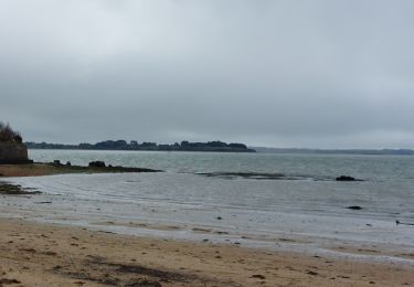
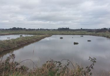
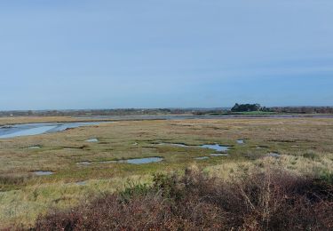
Tour du Golfe du Morbihan - 05 - Noyalo, Theix À LA FRONTIÈRE ENTRE TERRE ET MER Le chenal St Léonard Ici, le Golfe s’étire paresseusement entre les reliefs à peine marqués de Séné, à l’ouest, de Noyalo et Theix, à l’est. La plupart du temps, cette frange maritime apparaît sous la forme de marais verts où poussent des plantes halophiles. De temps en temps, un miroir d’eau salée vient refléter la campagne. Nous sommes à la frontière mouvante et floue entre monde rural et univers maritime. Pourtant, si l’on y regarde de près, la séparation est nette entre eau douce et eau salée. De part et d’autre du chemin, ce n’est pas du tout la même végétation. Cette frontière devient évidente lorsqu’on passe sur la digue de l’étang de Noyalo: d’un côté le golfe et son eau salée ; de l’autre, un vaste étang, réservoir d’eau douce de Vannes… La suite et beaucoup d’autres informations à propos du Tour du Golfe du Morbihan sur le site Bretagne – Rando.com. Crédit Photos : © T. Hair - Thomas & Thomas / Droits réservés CG 56

Profil altimétrique

Photos

Localisation

Pays :
France
Région :
Bretagne
Département/Province :
Morbihan
Commune :
Le Hézo
Localité :
Unknown
Départ:(Dec)
Départ:(UTM)
523325 ; 5270739 (30T) N.

Randonnées à proximité

Randonnée Marche Saint-Armel - Tour du Golfe du Morbihan - 04 - St Armel, Le Hézo - Photo
Marche
tracegps

Marche

Difficile
(1)
Saint-Armel, Bretagne, Morbihan, France
16,6 km | 17,6 km-effort
4h 0min
Non
Randonnée Marche Saint-Armel - Île TASCON- Le Passage 56  - Photo
Marche
med88

Marche

Facile
(1)
Saint-Armel, Bretagne, Morbihan, France
11,5 km | 12,1 km-effort
2h 31min
Oui
Randonnée Marche Saint-Armel - St Armel en passant par l'Ile de Tason (Boucle) - Photo
Marche
neitag61

Marche

Moyen
(3)
Saint-Armel, Bretagne, Morbihan, France
20 km | 22 km-effort
4h 49min
Oui
Randonnée Marche Séné - PR_56_Sene_IA_09_Circuit1b_Sentier-Des-Gabelous_20240311 - Photo
Marche
patrickdanilo

Marche

Très facile
Séné, Bretagne, Morbihan, France
10,1 km | 11 km-effort
1h 53min
Oui
Randonnée Marche Sarzeau - PR_56_Sarzeau_EA_05_Circuit1b_Au-Coeur-De-La-Foret_20240202 - Photo
Marche
patrickdanilo

Marche

Très facile
Sarzeau, Bretagne, Morbihan, France
12,3 km | 13,2 km-effort
3h 0min
Oui
Randonnée Marche Saint-Armel - PR_56_St-Armel_AA_01_Circuit1b_Le-Marais-Salant-De-Lasne_20231222 - Photo
Marche
patrickdanilo

Marche

Très facile
Saint-Armel, Bretagne, Morbihan, France
12,6 km | 13,4 km-effort
2h 39min
Oui
Randonnée Marche Séné - PR_56_Sene_HA_08_Circuit3a_Du-Passage_20231205 - Photo
Marche
patrickdanilo

Marche

Moyen
Séné, Bretagne, Morbihan, France
8,5 km | 9,7 km-effort
1h 47min
Oui
Randonnée Marche Séné - PR_56_Sene_GA_07_Circuit3b_Entre-Bocage-Et-Marais_20231115 - Photo
Marche
patrickdanilo

Marche

Moyen
Séné, Bretagne, Morbihan, France
7,8 km | 8,3 km-effort
1h 30min
Oui
Randonnée Marche Theix-Noyalo - PR_56_Theix-Noyalo_AA_01_Circuit3b_Vers-Corn-Er-Hoet_20230401 - Photo
Marche
patrickdanilo

Marche

Moyen
Theix-Noyalo, Bretagne, Morbihan, France
8,3 km | 9,9 km-effort
1h 40min
Oui


Fermer
Mes abonnements