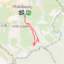

15,9 km | 21 km-effort


Utilisateur


Application GPS de randonnée GRATUITE
 SityTrail
IGN / Instituts géographiques
SityTrail World
Le monde est à vous
Randonnée Marche de 3,8 km à découvrir à Grand Est, Moselle, Phalsbourg. Cette randonnée est proposée par tracegps.
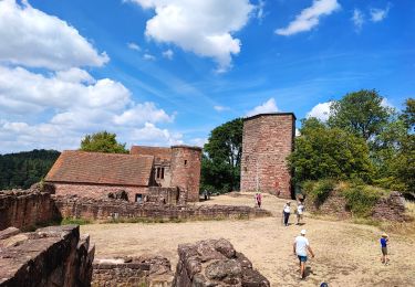
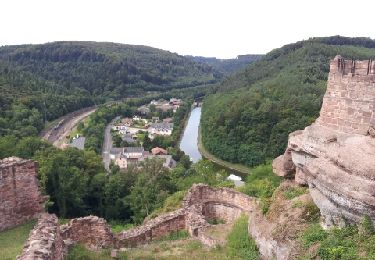
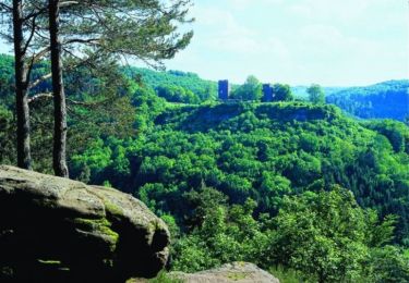
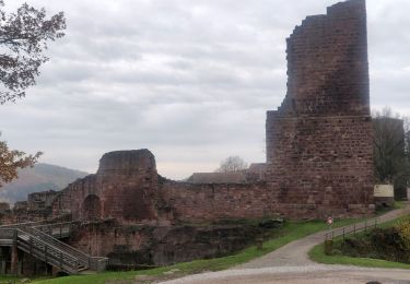
Le sentier botanique du Brunnenthal est une promenade circulaire en milieu forestier d'environ 4 km qui serpente dans une vallée riche en sources et en lavoirs et qui permet de découvrir au travers de panneaux richement illustrés faune, flore, botanique et géologie de la région. Départ du cimetière juif, Chemin du Brunnenthal ou du Centre Européen (Auberge de Jeunesse). Retrouvez d’autres informations sur Phalsbourg


Marche

V.T.T.
Marche

A pied
Marche

Marche
Marche

Cheval