Trail Walking Phalsbourg - Sentier botanique du Brunnenthal - Photo

Sentier botanique du Brunnenthal

 tracegps
tracegps

User

© OpenStreetMap contributors
Length
Length
3.8 km
Max alt
Max alt
334 m
Uphill gradient
Uphill gradient
79 m
Km-Effort
Km-Effort  
4.8 km
Min alt
Min alt
272 m
Downhill gradient
Downhill gradient
79 m
Boucle
Boucle
Yes
Creation date :
2014-12-10 00:00:00.0
Updated on :
2014-12-10 00:00:00.0

(0 Reviews)

Walking
Walking
2h00
Difficulty : Easy

Scan this QR Code to open this trail in the SityTrail application

FREE GPS app for hiking

Logo SityTrail SityTrail

IGN / Geographical institutes

Download SityTrail from the App Store Download SityTrail from Google Play

Logo SityTrail SityTrail World

The world is yours!

Download SityTrail from the App Store Download SityTrail from Google Play Download SityTrail on Huawei AppGallery

About

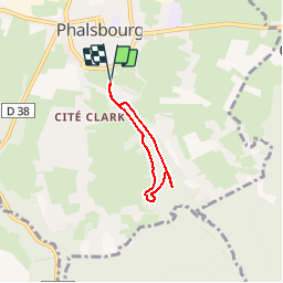
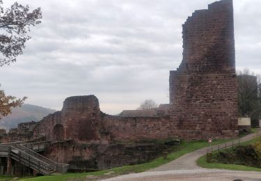
Trail Walking of 3.8 km to be discovered at Grand Est, Moselle, Phalsbourg. This trail is proposed by tracegps.

Description

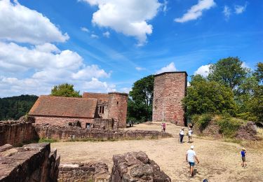
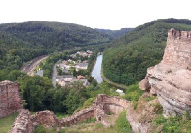
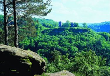
Le sentier botanique du Brunnenthal est une promenade circulaire en milieu forestier d'environ 4 km qui serpente dans une vallée riche en sources et en lavoirs et qui permet de découvrir au travers de panneaux richement illustrés faune, flore, botanique et géologie de la région. Départ du cimetière juif, Chemin du Brunnenthal ou du Centre Européen (Auberge de Jeunesse). Retrouvez d’autres informations sur Phalsbourg

Elevation profile

Photos

Positioning

Country:
France
Region :
Grand Est
Department/Province :
Moselle
Municipality :
Phalsbourg
Location:
Unknown
Start:(UTM)
372165 ; 5402425 (32U) N.

Trails nearby

Trail Walking Lutzelbourg - Lutzelbourg - Hultehouse - Wasserwald - Photo
Walking
VacheKiri67

Walking

Medium
(2)
Lutzelbourg, Grand Est, Moselle, France
15.9 km | 21 km-effort
4h 53min
Yes
Trail Mountain bike Phalsbourg - Circuit VTT de Bonne Fontaine - Phalsbourg - Photo
Mountain bike
tracegps

Mountain bike

Medium
(1)
Phalsbourg, Grand Est, Moselle, France
22 km | 29 km-effort
2h 30min
Yes
Trail Walking Phalsbourg - Circulaire de Phalsbourg - Lutzelbourg - Photo
Walking
tracegps

Walking

Difficult
(1)
Phalsbourg, Grand Est, Moselle, France
13.5 km | 18.6 km-effort
4h 30min
Yes
Trail On foot Eckartswiller - Chevalet bleu - Photo
On foot
PRO

On foot

Easy
Eckartswiller, Grand Est, Bas-Rhin, France
6.1 km | 9 km-effort
2h 3min
No
Trail Walking Lutzelbourg - 2019-11-11 Marche Lutzelbourg Sentier des bornes - Photo
Walking
GUIDE
holtzv

Walking

Very easy
Lutzelbourg, Grand Est, Moselle, France
16.9 km | 23 km-effort
4h 49min
Yes
Trail Walking Lutzelbourg - Lutzelbourg Gobain 2015 - Photo
Walking
mirkojmb

Walking

Easy
(3)
Lutzelbourg, Grand Est, Moselle, France
18.3 km | 25 km-effort
5h 22min
Yes
Trail Walking Eckartswiller - Oberhof - Photo
Walking
gilbraun67150

Walking

Medium
(1)
Eckartswiller, Grand Est, Bas-Rhin, France
18.4 km | 25 km-effort
5h 30min
Yes
Trail Equestrian Eckartswiller - eline - Photo
Equestrian
depoucquesElisabeth

Equestrian

Easy
(1)
Eckartswiller, Grand Est, Bas-Rhin, France
18.6 km | 25 km-effort
3h 50min
No
Trail Walking Henridorff - lutzbourg - Photo
Walking
didier cornelius

Walking

Medium
Henridorff, Grand Est, Moselle, France
16.1 km | 23 km-effort
6h 26min
Yes


Close
My subscriptions