Randonnée Marche Bréhal - Le Chemin du Bois - Bréhal - Photo

Le Chemin du Bois - Bréhal

 tracegps
tracegps

Utilisateur

© OpenStreetMap contributors
Longueur
Longueur
5,8 km
Altitude max
Altitude max
61 m
Dénivelé positif
Dénivelé positif
64 m
Km-Effort
Km-Effort  
6,6 km
Altitude min
Altitude min
14 m
Dénivelé négatif
Dénivelé négatif
62 m
Boucle
Boucle
Oui
Date de création :
2014-12-10 00:00:00.0
Dernière modification :
2014-12-10 00:00:00.0

(0 Avis)

Marche
Marche
1h45
Difficulté : Moyen

Scannez ce code QR pour ouvrir la randonnée dans l'application SityTrail

Application GPS de randonnée GRATUITE

Logo SityTrail SityTrail

IGN / Instituts géographiques

Télécharger SityTrail sur l'App Store Télécharger SityTrail sur Google Play

Logo SityTrail SityTrail World

Le monde est à vous

Télécharger SityTrail sur l'App Store Télécharger SityTrail sur Google Play Télécharger SityTrail sur Huawei AppGallery

À propos

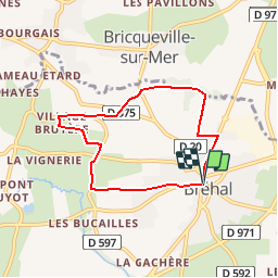
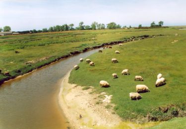
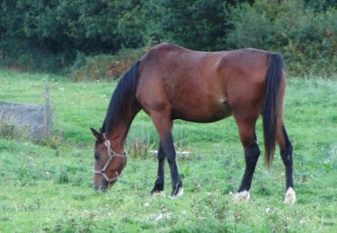
Randonnée Marche de 5,8 km à découvrir à Normandie, Manche, Bréhal. Cette randonnée est proposée par tracegps.

Description

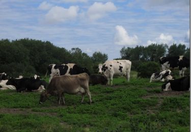
Jolie promenade, sans aucune difficulté, au travers du bocage normand départ de la halle centrale de Bréhal.

Profil altimétrique

Photos

Localisation

Pays :
France
Région :
Normandie
Département/Province :
Manche
Commune :
Bréhal
Localité :
Unknown
Départ:(Dec)
Départ:(UTM)
608996 ; 5417251 (30U) N.

Randonnées à proximité

Randonnée Marche Bréville-sur-Mer - Balade à Breville sur Mer - Photo
Marche
tracegps

Marche

Moyen
Bréville-sur-Mer, Normandie, Manche, France
14,2 km | 15,4 km-effort
3h 0min
Oui
Randonnée V.T.T. Bréhal - brehal 1  - Photo
V.T.T.
dumbell

V.T.T.

Très facile
Bréhal, Normandie, Manche, France
30 km | 35 km-effort
2h 45min
Oui
Randonnée Randonnée équestre Lingreville - Balade Sarah samedi - Photo
Randonnée équestre
phillipine

Randonnée équestre

Moyen
Lingreville, Normandie, Manche, France
19,7 km | 21 km-effort
45min
Oui
Randonnée Marche Chanteloup - Le chant des Loups - Chanteloup - Photo
Marche
tracegps

Marche

Moyen
Chanteloup, Normandie, Manche, France
9 km | 10,4 km-effort
2h 0min
Oui
Randonnée Marche Hudimesnil - Le Moulin du Pont - Hudimesnil - Photo
Marche
tracegps

Marche

Moyen
(1)
Hudimesnil, Normandie, Manche, France
14,8 km | 17,3 km-effort
3h 30min
Oui
Randonnée Marche Hudimesnil - La Chapelle Sainte Suzanne - Hudimesnil - Photo
Marche
tracegps

Marche

Moyen
Hudimesnil, Normandie, Manche, France
5,2 km | 6,2 km-effort
1h 4min
Oui
Randonnée Marche Muneville-sur-Mer - Les Vallées - Muneville sur Mer  - Photo
Marche
tracegps

Marche

Moyen
Muneville-sur-Mer, Normandie, Manche, France
8,6 km | 9,8 km-effort
1h 45min
Oui
Randonnée Marche Muneville-sur-Mer - Les Quatre Chemins - Muneville sur Mer  - Photo
Marche
tracegps

Marche

Facile
Muneville-sur-Mer, Normandie, Manche, France
5,5 km | 6,2 km-effort
1h 4min
Oui
Randonnée Marche Bricqueville-sur-Mer - Le Havre de la Vanlée - Bricqueville sur Mer  - Photo
Marche
tracegps

Marche

Moyen
Bricqueville-sur-Mer, Normandie, Manche, France
10 km | 10,6 km-effort
2h 0min
Oui


Fermer
Mes abonnements