Randonnée Marche Gressan - pila  - Photo
 titim
titim

Utilisateur

© OpenStreetMap contributors
Longueur
Longueur
10,8 km
Altitude max
Altitude max
2345 m
Dénivelé positif
Dénivelé positif
581 m
Km-Effort
Km-Effort  
18,5 km
Altitude min
Altitude min
1793 m
Dénivelé négatif
Dénivelé négatif
581 m
Boucle
Boucle
Oui
Date de création :
2014-12-10 00:00:00.0
Dernière modification :
2014-12-10 00:00:00.0

(1 Avis)

Marche
Marche
4h32
Difficulté : Inconnu

Scannez ce code QR pour ouvrir la randonnée dans l'application SityTrail

Application GPS de randonnée GRATUITE

Logo SityTrail SityTrail

IGN / Instituts géographiques

Télécharger SityTrail sur l'App Store Télécharger SityTrail sur Google Play

Logo SityTrail SityTrail World

Le monde est à vous

Télécharger SityTrail sur l'App Store Télécharger SityTrail sur Google Play Télécharger SityTrail sur Huawei AppGallery

À propos

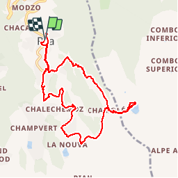
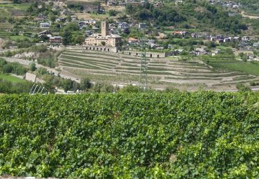
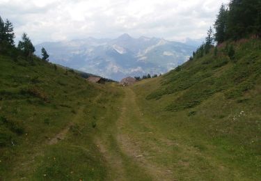
Randonnée Marche de 10,8 km à découvrir à Vallée d'Aoste, Inconnu, Gressan. Cette randonnée est proposée par titim.

Profil altimétrique

Photos

Localisation

Pays :
Italie
Région :
Vallée d'Aoste
Département/Province :
Inconnu
Commune :
Gressan
Localité :
Unknown
Départ:(Dec)
Départ:(UTM)
368479 ; 5060708 (32T) N.

Commentaires

Veuillez vous connecter pour laisser un commentaire ou une note


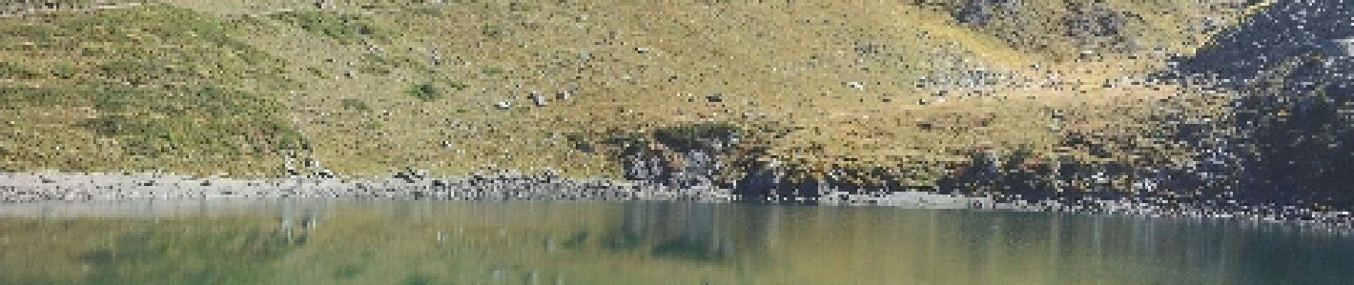
bon chemin, belle randonne.elle passe par le lac de chamole et si l'envie vous vient de continuer : vous pouvez depuis le lac pousser jusqu'au refuge à 200m de dénivelé plus haut (compter 1h15 de plus)


Randonnées à proximité

Randonnée Marche Aymavilles - vignes - Photo
Marche
Nathalie Frison

Marche

Moyen
Aymavilles, Vallée d'Aoste, Inconnu, Italie
3,1 km | 4,2 km-effort
1h 8min
Oui
Randonnée Marche Gressan - alpi.  lac chamolé  aller par piste retour par sentier - Photo
Marche
stef789

Marche

Très facile
Gressan, Vallée d'Aoste, Inconnu, Italie
12 km | 0 m-effort
4h 34min
Non
Randonnée Ski de randonnée Gressan - Pointe du Drink - Photo
Ski de randonnée
jcolonnadelega

Ski de randonnée

Très facile
Gressan, Vallée d'Aoste, Inconnu, Italie
11,6 km | 25 km-effort
5h 24min
Oui
Randonnée Marche Charvensod - lago di chamole - Photo
Marche
titim

Marche

Très facile
Charvensod, Vallée d'Aoste, Inconnu, Italie
7,8 km | 16,5 km-effort
Inconnu
Oui
Randonnée Marche Charvensod - 700 - Photo
Marche
titim

Marche

Très facile
Charvensod, Vallée d'Aoste, Inconnu, Italie
7,8 km | 16,5 km-effort
Inconnu
Oui
Randonnée Marche Gressan - Pila - Photo
Marche
tchatelain

Marche

Très facile
Gressan, Vallée d'Aoste, Inconnu, Italie
11 km | 31 km-effort
9h 12min
Oui
Randonnée Marche Gressan - refuge d'Arbolle 13-08-19 - Photo
Marche
legios84

Marche

Moyen
Gressan, Vallée d'Aoste, Inconnu, Italie
3,1 km | 7,3 km-effort
2h 11min
Non
Randonnée Marche Gressan - Pila - Photo
Marche
jhw

Marche

Facile
Gressan, Vallée d'Aoste, Inconnu, Italie
9,6 km | 18,5 km-effort
3h 42min
Oui
Randonnée Via ferrata Gressan - Monte Emilius - Photo
Via ferrata
mpignon

Via ferrata

Très difficile
Gressan, Vallée d'Aoste, Inconnu, Italie
26 km | 57 km-effort
12h 10min
Oui


Fermer
Mes abonnements