![](/images/other/stat-length.png)
![Randonnée Marche Bougival - Marche dans la superbe Forêt Domaniale de Marly - Photo](https://media.geolcdn.com/t/1900/400/ext.pjpeg?maxdim=2&url=https%3A%2F%2Fstatic1.geolcdn.com%2Fsiteimages%2Fupload%2Ffiles%2F1553511878bg_sport_marche.png)
Marche dans la superbe Forêt Domaniale de Marly
wallander76
Utilisateur
![Longueur](/images/other/stat-length.png)
Longueur
7,5 km
![Altitude max](https://static1.geolcdn.com/siteimages/upload/files/1508320355ic_sort_altitude_max_24dp.png)
Altitude max
179 m
![Dénivelé positif](https://static1.geolcdn.com/siteimages/upload/files/1508320355ic_sort_den_pos_24dp.png)
Dénivelé positif
137 m
![Km-Effort](/images/other/stat-length.png)
Km-Effort
9,3 km
![Altitude min](https://static1.geolcdn.com/siteimages/upload/files/1508320355ic_sort_altitude_min_24dp.png)
Altitude min
125 m
![Dénivelé négatif](https://static1.geolcdn.com/siteimages/upload/files/1508320355ic_sort_den_neg_24dp.png)
Dénivelé négatif
136 m
![Boucle](https://static1.geolcdn.com/siteimages/upload/files/16400158638029165_repeat_loop_refresh_sync_direction_icon.png)
Boucle
Oui
Date de création :
2014-12-10 00:00:00.0
Dernière modification :
2014-12-10 00:00:00.0
![Marche](https://static1.geolcdn.com/sitytour/trail-icons/101.png)
59m
Difficulté : Inconnu
![Scannez ce code QR pour ouvrir la randonnée dans l'application SityTrail](https://capi.geolives.com/qq0zvz2zws4bq2lad0pu/sitytour/trails/171496/qr.png?size=200)
Application GPS de randonnée GRATUITE
À propos
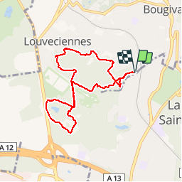
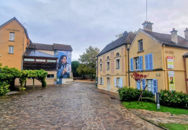
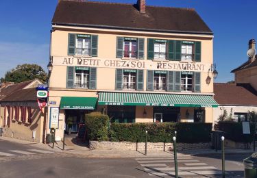
Randonnée Marche de 7,5 km à découvrir à Île-de-France, Yvelines, Bougival. Cette randonnée est proposée par wallander76.
Description
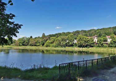
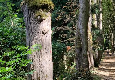
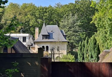
Au départ de la Gare de Bougival, marche typique en forêt au grès de mes envies. Les possibilités d'itinéraires sont innombrables et il y a quelques beaux dénivelés pour les amateurs
Localisation
Pays :
France
Région :
Île-de-France
Département/Province :
Yvelines
Commune :
Bougival
Localité :
Unknown
Départ:(Dec)
Départ:(UTM)
436234 ; 5411602 (31U) N.
Commentaires
Randonnées à proximité
![Randonnée Marche Chaville - GRP CV-IDF 20R Chaville à Vaucresson - Photo](https://media.geolcdn.com/t/375/260/ext.jpg?maxdim=2&url=https%3A%2F%2Fmedia.geolcdn.com%2Ff%2Fee9d0d3a-696b-449f-af8b-f1928f5c8b40.jpg)
![Marche Marche](https://static1.geolcdn.com/sitytour/trail-icons/101.png)
GRP CV-IDF 20R Chaville à Vaucresson
Marche
Moyen
(1)
Chaville,
Île-de-France,
Hauts-de-Seine,
France
![](/images/other/stat-length.png)
8,2 km | 11,1 km-effort
2h 30min
![](https://static1.geolcdn.com/siteimages/upload/files/16400158638029165_repeat_loop_refresh_sync_direction_icon.png)
Non
![Randonnée Marche Bougival - Bougival-Saint-cucufa reel - Photo](https://media.geolcdn.com/t/375/260/ext.jpg?maxdim=2&url=https%3A%2F%2Fmedia.geolcdn.com%2Ff%2Ff8214235-f5e3-4ba5-8084-044ba7cbf132.jpeg)
![Marche Marche](https://static1.geolcdn.com/sitytour/trail-icons/101.png)
Bougival-Saint-cucufa reel
Marche
(1)
Bougival,
Île-de-France,
Yvelines,
France
![](/images/other/stat-length.png)
7,7 km | 10,3 km-effort
2h 29min
![](https://static1.geolcdn.com/siteimages/upload/files/16400158638029165_repeat_loop_refresh_sync_direction_icon.png)
Oui
![Randonnée Autre activité Versailles - Parc de Versailles - Photo](https://media.geolcdn.com/t/375/260/ext.jpg?maxdim=2&url=https%3A%2F%2Fstatic1.geolcdn.com%2Fsiteimages%2Fupload%2Ffiles%2F1545311037marcheuse_200dpi.jpg)
![Autre activité Autre activité](https://static1.geolcdn.com/sitytour/trail-icons/900.png)
Parc de Versailles
Autre activité
Très facile
(1)
Versailles,
Île-de-France,
Yvelines,
France
![](/images/other/stat-length.png)
8,9 km | 9,7 km-effort
1h 49min
![](https://static1.geolcdn.com/siteimages/upload/files/16400158638029165_repeat_loop_refresh_sync_direction_icon.png)
Oui
![Randonnée Vélo Chaville - chaville - maison lafitte - Photo](https://media.geolcdn.com/t/375/260/ext.jpg?maxdim=2&url=https%3A%2F%2Fstatic1.geolcdn.com%2Fsiteimages%2Fupload%2Ffiles%2F1524743154velo.jpg)
![Vélo Vélo](https://static1.geolcdn.com/sitytour/trail-icons/200.png)
chaville - maison lafitte
Vélo
Moyen
(1)
Chaville,
Île-de-France,
Hauts-de-Seine,
France
![](/images/other/stat-length.png)
44 km | 50 km-effort
3h 27min
![](https://static1.geolcdn.com/siteimages/upload/files/16400158638029165_repeat_loop_refresh_sync_direction_icon.png)
Non
![Randonnée V.T.T. Chaville - grand circuit VTT - Photo](https://media.geolcdn.com/t/375/260/ext.jpg?maxdim=2&url=https%3A%2F%2Fstatic1.geolcdn.com%2Fsiteimages%2Fupload%2Ffiles%2F1524743154velo.jpg)
![V.T.T. V.T.T.](https://static1.geolcdn.com/sitytour/trail-icons/202.png)
grand circuit VTT
V.T.T.
Très facile
(1)
Chaville,
Île-de-France,
Hauts-de-Seine,
France
![](/images/other/stat-length.png)
32 km | 40 km-effort
Inconnu
![](https://static1.geolcdn.com/siteimages/upload/files/16400158638029165_repeat_loop_refresh_sync_direction_icon.png)
Oui
![Randonnée Marche Ville-d'Avray - Etang Corot - Photo](https://media.geolcdn.com/t/375/260/ext.jpg?maxdim=2&url=https%3A%2F%2Fmedia.geolcdn.com%2Ff%2Fcc441ea5-4e83-477e-927f-c2fa161e4a45.jpg)
![Marche Marche](https://static1.geolcdn.com/sitytour/trail-icons/101.png)
Etang Corot
Marche
Facile
Ville-d'Avray,
Île-de-France,
Hauts-de-Seine,
France
![](/images/other/stat-length.png)
3,8 km | 5 km-effort
1h 12min
![](https://static1.geolcdn.com/siteimages/upload/files/16400158638029165_repeat_loop_refresh_sync_direction_icon.png)
Oui
![Randonnée A pied Rueil-Malmaison - La Seine impressioniste Etape 1 Rueil - Conflans Ste Honorine - Photo](https://media.geolcdn.com/t/375/260/ext.jpg?maxdim=2&url=https%3A%2F%2Fmedia.geolcdn.com%2Ff%2Fc514a42a-e126-47ef-85f0-d75f60d63c7a.jpg)
![A pied A pied](https://static1.geolcdn.com/sitytour/trail-icons/100.png)
La Seine impressioniste Etape 1 Rueil - Conflans Ste Honorine
A pied
Moyen
Rueil-Malmaison,
Île-de-France,
Hauts-de-Seine,
France
![](/images/other/stat-length.png)
32 km | 37 km-effort
8h 22min
![](https://static1.geolcdn.com/siteimages/upload/files/16400158638029165_repeat_loop_refresh_sync_direction_icon.png)
Non
![Randonnée Marche Vaucresson - GRP CV-IDF 01R Vaucresson à L'Étang-la-Ville - Photo](https://media.geolcdn.com/t/375/260/ext.jpg?maxdim=2&url=https%3A%2F%2Fmedia.geolcdn.com%2Ff%2F784469fa-7dc6-44b2-a81d-cfd8e4ef0614.jpg)
![Marche Marche](https://static1.geolcdn.com/sitytour/trail-icons/101.png)
GRP CV-IDF 01R Vaucresson à L'Étang-la-Ville
Marche
Facile
Vaucresson,
Île-de-France,
Hauts-de-Seine,
France
![](/images/other/stat-length.png)
11,9 km | 15,3 km-effort
3h 29min
![](https://static1.geolcdn.com/siteimages/upload/files/16400158638029165_repeat_loop_refresh_sync_direction_icon.png)
Non
![Randonnée Marche Saint-Germain-en-Laye - Audax St Germain en Laye - Paris Tour Eiffel - Photo](https://media.geolcdn.com/t/375/260/ext.jpg?maxdim=2&url=https%3A%2F%2Fmedia.geolcdn.com%2Ff%2F5e15adf7-e627-4ac0-b5fd-8bf0b40406ac.jpg)
![Marche Marche](https://static1.geolcdn.com/sitytour/trail-icons/101.png)
Audax St Germain en Laye - Paris Tour Eiffel
Marche
Facile
Saint-Germain-en-Laye,
Île-de-France,
Yvelines,
France
![](/images/other/stat-length.png)
29 km | 35 km-effort
4h 59min
![](https://static1.geolcdn.com/siteimages/upload/files/16400158638029165_repeat_loop_refresh_sync_direction_icon.png)
Non
début de parcour très bien, mais du coté de la RN186 c'est très bruillant et les sentiers souvent difficiles a suivre. Par temps humide attention au chemins devenant boueux.