Randonnée Marche Béthonsart - Bethonsart Caucourt Mingoval - Photo

Bethonsart Caucourt Mingoval

 tracegps
tracegps

Utilisateur

© OpenStreetMap contributors
Longueur
Longueur
11,7 km
Altitude max
Altitude max
156 m
Dénivelé positif
Dénivelé positif
105 m
Km-Effort
Km-Effort  
13,2 km
Altitude min
Altitude min
94 m
Dénivelé négatif
Dénivelé négatif
109 m
Boucle
Boucle
Oui
Date de création :
2014-12-10 00:00:00.0
Dernière modification :
2014-12-10 00:00:00.0

(0 Avis)

Marche
Marche
2h30
Difficulté : Moyen

Scannez ce code QR pour ouvrir la randonnée dans l'application SityTrail

Application GPS de randonnée GRATUITE

Logo SityTrail SityTrail

IGN / Instituts géographiques

Télécharger SityTrail sur l'App Store Télécharger SityTrail sur Google Play

Logo SityTrail SityTrail World

Le monde est à vous

Télécharger SityTrail sur l'App Store Télécharger SityTrail sur Google Play Télécharger SityTrail sur Huawei AppGallery

À propos

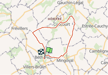
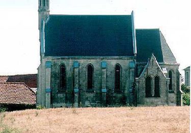
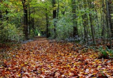
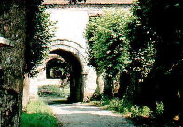
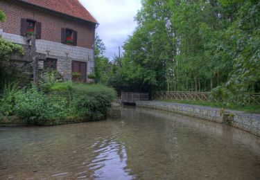
Randonnée Marche de 11,7 km à découvrir à Hauts-de-France, Pas-de-Calais, Béthonsart. Cette randonnée est proposée par tracegps.

Description

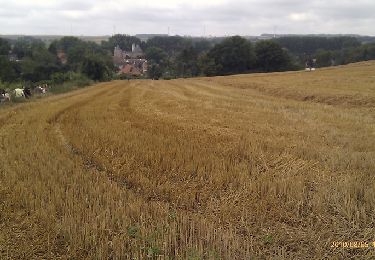
Beau parcours qui emprunte des chemins creux sur Caucourt (à faire par beau temps) et le gué de Caucourt.

Profil altimétrique

Photos

Localisation

Pays :
France
Région :
Hauts-de-France
Département/Province :
Pas-de-Calais
Commune :
Béthonsart
Localité :
Unknown
Départ:(Dec)
Départ:(UTM)
468135 ; 5580502 (31U) N.

Randonnées à proximité

Randonnée Marche Magnicourt-en-Comte - Chemin de la vallée des prêtres (Magnicourt-en-Comte) - Photo
Marche
tracegps

Marche

Facile
Magnicourt-en-Comte, Hauts-de-France, Pas-de-Calais, France
4,6 km | 5,6 km-effort
1h 15min
Oui
Randonnée Marche Villers-Châtel - Chemin de la charbonnière (Villers-Châtel)  - Photo
Marche
tracegps

Marche

Moyen
Villers-Châtel, Hauts-de-France, Pas-de-Calais, France
11,8 km | 13,4 km-effort
3h 0min
Oui
Randonnée Marche Gauchin-Légal - Vieux cailloux et patois - Photo
Marche
tracegps

Marche

Difficile
(2)
Gauchin-Légal, Hauts-de-France, Pas-de-Calais, France
26 km | 31 km-effort
5h 30min
Oui
Randonnée Marche Cambligneul - Cambigneul - Villers Chatel - Mingoval - Caucourt - Estée Cauchy - Photo
Marche
tracegps

Marche

Moyen
Cambligneul, Hauts-de-France, Pas-de-Calais, France
9,9 km | 11,1 km-effort
2h 0min
Oui
Randonnée Marche Gauchin-Légal - Autour du golf d'Olhain - Gauchin Légal - Photo
Marche
tracegps

Marche

Moyen
Gauchin-Légal, Hauts-de-France, Pas-de-Calais, France
8,1 km | 10,2 km-effort
2h 0min
Oui
Randonnée Marche Chelers - Chemin des Bosquets (Chelers) - Photo
Marche
tracegps

Marche

Difficile
Chelers, Hauts-de-France, Pas-de-Calais, France
14,7 km | 16,5 km-effort
3h 45min
Oui
Randonnée Marche Gauchin-Légal - En passant par le gué de Caucourt - Photo
Marche
tracegps

Marche

Moyen
(2)
Gauchin-Légal, Hauts-de-France, Pas-de-Calais, France
9,1 km | 10,3 km-effort
2h 0min
Oui
Randonnée Marche Gauchin-Légal - Gauchin le Gal - Tour du golf d'Olhain - Photo
Marche
tracegps

Marche

Moyen
Gauchin-Légal, Hauts-de-France, Pas-de-Calais, France
8 km | 10 km-effort
1h 40min
Oui
Randonnée V.T.T. Tincques - Rando_Tincques2012 - Photo
V.T.T.
tantan62

V.T.T.

Moyen
Tincques, Hauts-de-France, Pas-de-Calais, France
71 km | 81 km-effort
Inconnu
Oui


Fermer
Mes abonnements