Randonnée V.T.T. Sorbier - Sorbier, la ligne, la digue - Photo

Sorbier, la ligne, la digue

 coco03
coco03

Utilisateur

© OpenStreetMap contributors
Longueur
Longueur
9,8 km
Altitude max
Altitude max
379 m
Dénivelé positif
Dénivelé positif
129 m
Km-Effort
Km-Effort  
11,6 km
Altitude min
Altitude min
279 m
Dénivelé négatif
Dénivelé négatif
131 m
Boucle
Boucle
Oui
Date de création :
2014-12-10 00:00:00.0
Dernière modification :
2014-12-10 00:00:00.0

(0 Avis)

V.T.T.
V.T.T.
46m
Difficulté : Moyen

Scannez ce code QR pour ouvrir la randonnée dans l'application SityTrail

Application GPS de randonnée GRATUITE

Logo SityTrail SityTrail

IGN / Instituts géographiques

Télécharger SityTrail sur l'App Store Télécharger SityTrail sur Google Play

Logo SityTrail SityTrail World

Le monde est à vous

Télécharger SityTrail sur l'App Store Télécharger SityTrail sur Google Play Télécharger SityTrail sur Huawei AppGallery

À propos

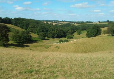
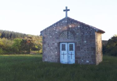
Randonnée V.T.T. de 9,8 km à découvrir à Auvergne-Rhône-Alpes, Allier, Sorbier. Cette randonnée est proposée par coco03.

Description

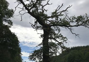
Passage sur l'ancienne ligne du tacot (Ancien train qui transporté la charbon.

Profil altimétrique

Localisation

Pays :
France
Région :
Auvergne-Rhône-Alpes
Département/Province :
Allier
Commune :
Sorbier
Localité :
Unknown
Départ:(Dec)
Départ:(UTM)
552691 ; 5134453 (31T) N.

Randonnées à proximité

Randonnée Marche Bert - Boucle du Roc - BERT - Photo
Marche
coco03

Marche

Moyen
(1)
Bert, Auvergne-Rhône-Alpes, Allier, France
12,5 km | 16,6 km-effort
3h 36min
Oui
Randonnée Marche Saint-Léon - St Leon à Barrais-Bussolles  - Photo
Marche
NANE51

Marche

Facile
Saint-Léon, Auvergne-Rhône-Alpes, Allier, France
20 km | 27 km-effort
5h 8min
Non
Randonnée Marche Bert - Bert, la Tour Pouçain - Photo
Marche
coco03

Marche

Moyen
(1)
Bert, Auvergne-Rhône-Alpes, Allier, France
11,4 km | 14,7 km-effort
3h 19min
Non
Randonnée Marche Sorbier - Montcombroux-Bert - Photo
Marche
coco03

Marche

Moyen
Sorbier, Auvergne-Rhône-Alpes, Allier, France
7,2 km | 9,3 km-effort
2h 5min
Oui
Randonnée Marche Sorbier - Sorbier Long - Photo
Marche
danou56

Marche

Facile
Sorbier, Auvergne-Rhône-Alpes, Allier, France
9,3 km | 11 km-effort
2h 24min
Oui
Randonnée Marche Sorbier - Sorbier Court - Photo
Marche
danou56

Marche

Facile
Sorbier, Auvergne-Rhône-Alpes, Allier, France
6,6 km | 8 km-effort
1h 44min
Oui
Randonnée Marche Le Donjon - Le Fetrez - Photo
Marche
coco03

Marche

Moyen
Le Donjon, Auvergne-Rhône-Alpes, Allier, France
10,2 km | 12,8 km-effort
2h 47min
Oui
Randonnée Vélo Bert - Bert-Nuits st Georges - Photo
Vélo
NOVICLIE

Vélo

Facile
Bert, Auvergne-Rhône-Alpes, Allier, France
163 km | 183 km-effort
Inconnu
Non
Randonnée Marche Le Donjon - Le Fetrez Bert - Photo
Marche
JFL03

Marche

Facile
Le Donjon, Auvergne-Rhône-Alpes, Allier, France
46 km | 57 km-effort
2h 39min
Non


Fermer
Mes abonnements