


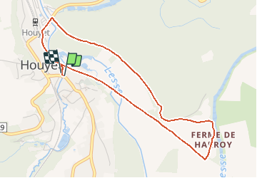


14,3 km | 19 km-effort

Randonnées de la Maison du Tourisme Famenne - Ardenne Ourthe & Lesse PRO


Application GPS de randonnée GRATUITE
 SityTrail
IGN / Instituts géographiques
SityTrail World
Le monde est à vous
Randonnée Marche de 4,3 km à découvrir à Wallonie, Namur, Houyet. Cette randonnée est proposée par Maison du Tourisme Famenne - Ardenne Ourthe & Lesse.
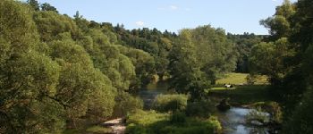
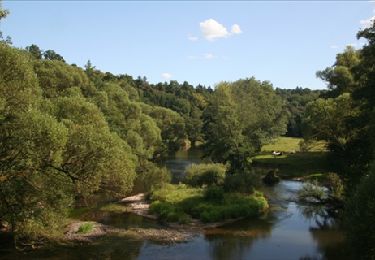
Promenade familiale par excellence, accessible aux personnes à mobilité réduite, aux poussettes, ...


Marche

Marche

Marche

Marche

Marche
Marche

Marche

Marche

Marche
perfecte locatie als je fietst op de Tabel.
Très bonne application pour découvrir la région. je vous la conseille vivement. il est également possible de prendre des promenades en voiture et de brancher votre téléphone sur les hauts parleurs de votre voiture, il se transformera en guide ;-)
Accessible aux poussettes. Simple
v
Route et RAVEL uniquement. Vu la courte distance je pense qu'il n'y avait pas moyen de faire un meilleur parcours. A recommander pour les familles avec enfants en bas ?ges ou les personnes ? mobilit? r?duite. Les autres choisiront un parcours diff?rent.