Randonnée V.T.T. Poule-les-Écharmeaux - Marche de Poule les Echarmeaux - Photo
 balli51
balli51

Utilisateur

© OpenStreetMap contributors
Longueur
Longueur
30 km
Altitude max
Altitude max
966 m
Dénivelé positif
Dénivelé positif
1092 m
Km-Effort
Km-Effort  
45 km
Altitude min
Altitude min
464 m
Dénivelé négatif
Dénivelé négatif
1093 m
Boucle
Boucle
Oui
Date de création :
2014-12-10 00:00:00.0
Dernière modification :
2014-12-10 00:00:00.0

(0 Avis)

V.T.T.
V.T.T.
2h49
Difficulté : Très difficile

Scannez ce code QR pour ouvrir la randonnée dans l'application SityTrail

Application GPS de randonnée GRATUITE

Logo SityTrail SityTrail

IGN / Instituts géographiques

Télécharger SityTrail sur l'App Store Télécharger SityTrail sur Google Play

Logo SityTrail SityTrail World

Le monde est à vous

Télécharger SityTrail sur l'App Store Télécharger SityTrail sur Google Play Télécharger SityTrail sur Huawei AppGallery

À propos

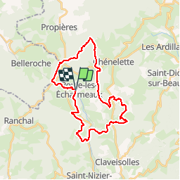
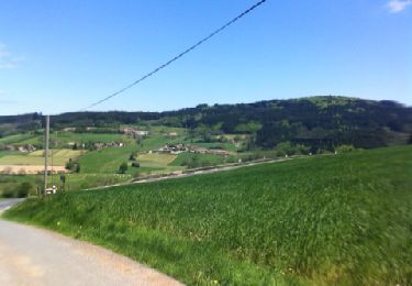
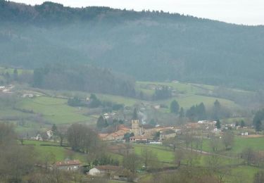
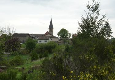
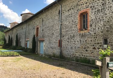
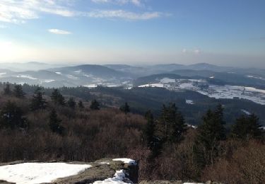
Randonnée V.T.T. de 30 km à découvrir à Auvergne-Rhône-Alpes, Rhône, Poule-les-Écharmeaux. Cette randonnée est proposée par balli51.

Description

Le 09/06/13

Profil altimétrique

Localisation

Pays :
France
Région :
Auvergne-Rhône-Alpes
Département/Province :
Rhône
Commune :
Poule-les-Écharmeaux
Localité :
Unknown
Départ:(Dec)
Départ:(UTM)
612306 ; 5111627 (31T) N.

Randonnées à proximité

Randonnée Marche Ranchal - Ranchal village vert  - Photo
Marche
tracegps

Marche

Moyen
(1)
Ranchal, Auvergne-Rhône-Alpes, Rhône, France
10,2 km | 14,2 km-effort
2h 0min
Oui
Randonnée Marche Ranchal - Col de favardy - Photo
Marche
redtek

Marche

Facile
Ranchal, Auvergne-Rhône-Alpes, Rhône, France
8,7 km | 12,6 km-effort
2h 39min
Oui
Randonnée Marche Propières - Circuit de Propières - Photo
Marche
tracegps

Marche

Difficile
Propières, Auvergne-Rhône-Alpes, Rhône, France
14,3 km | 21 km-effort
5h 0min
Oui
Randonnée V.T.T. Belleroche - Marche de Belleroche - Photo
V.T.T.
balli51

V.T.T.

Difficile
Belleroche, Auvergne-Rhône-Alpes, Loire, France
33 km | 48 km-effort
2h 59min
Oui
Randonnée Marche Belleroche - Belleroche - Circuit du Mont Joly - Photo
Marche
tracegps

Marche

Moyen
(1)
Belleroche, Auvergne-Rhône-Alpes, Loire, France
8,1 km | 11,9 km-effort
2h 30min
Oui
Randonnée V.T.T. Belleroche - VTT à Belleroche - Rando 2010 - Photo
V.T.T.
tracegps

V.T.T.

Très difficile
Belleroche, Auvergne-Rhône-Alpes, Loire, France
43 km | 63 km-effort
4h 15min
Oui
Randonnée Marche Poule-les-Écharmeaux - Poule-Les-Echarmeaux (16 km - D. 555) - Photo
Marche
Thomasdanielle

Marche

Difficile
Poule-les-Écharmeaux, Auvergne-Rhône-Alpes, Rhône, France
16,5 km | 24 km-effort
5h 37min
Oui
Randonnée Marche Ranchal - Ranchal  (18 km - D. 520 m) - Photo
Marche
Thomasdanielle

Marche

Difficile
Ranchal, Auvergne-Rhône-Alpes, Rhône, France
17,6 km | 25 km-effort
5h 59min
Oui
Randonnée Marche Poule-les-Écharmeaux - Echarmeaux-Roche d'Ajout - Photo
Marche
balli51

Marche

Moyen
Poule-les-Écharmeaux, Auvergne-Rhône-Alpes, Rhône, France
2,5 km | 4,6 km-effort
1h 2min
Non


Fermer
Mes abonnements