Randonnée Marche Bitschwiller-lès-Thann - Bitschwiller-Fourmi (29/11/2018) - Photo

Bitschwiller-Fourmi (29/11/2018)

 Richard68500
Richard68500

Utilisateur

© OpenStreetMap contributors
Longueur
Longueur
11,5 km
Altitude max
Altitude max
964 m
Dénivelé positif
Dénivelé positif
621 m
Km-Effort
Km-Effort  
19,8 km
Altitude min
Altitude min
368 m
Dénivelé négatif
Dénivelé négatif
621 m
Boucle
Boucle
Oui
Date de création :
2018-11-29 09:43:33.657
Dernière modification :
2018-11-29 18:16:26.237

(0 Avis)

Marche
Marche
3h01
Difficulté : Moyen

Scannez ce code QR pour ouvrir la randonnée dans l'application SityTrail

Application GPS de randonnée GRATUITE

Logo SityTrail SityTrail

IGN / Instituts géographiques

Télécharger SityTrail sur l'App Store Télécharger SityTrail sur Google Play

Logo SityTrail SityTrail World

Le monde est à vous

Télécharger SityTrail sur l'App Store Télécharger SityTrail sur Google Play Télécharger SityTrail sur Huawei AppGallery

À propos

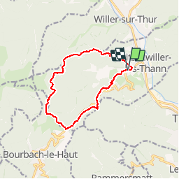
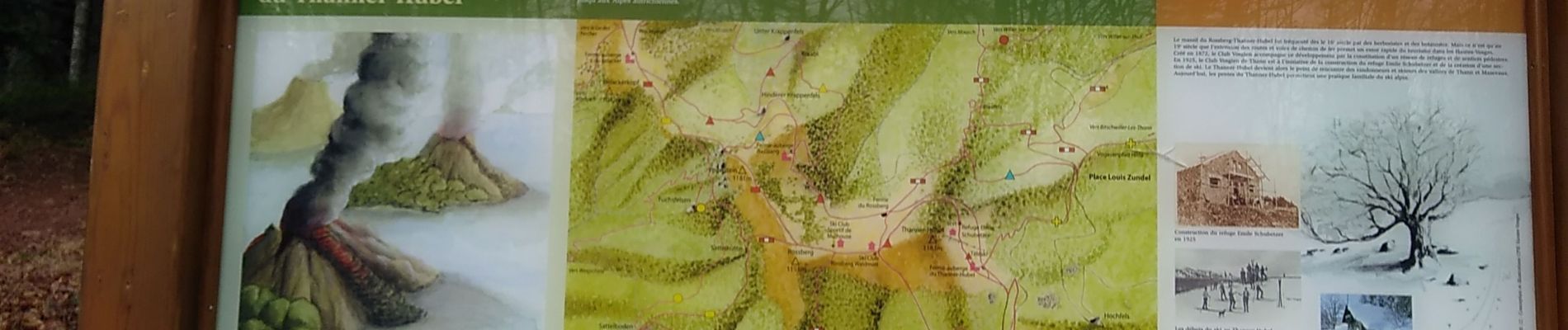
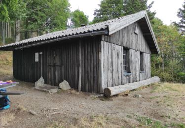
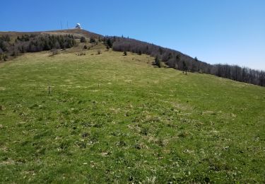
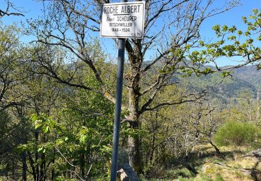
Randonnée Marche de 11,5 km à découvrir à Grand Est, Haut-Rhin, Bitschwiller-lès-Thann. Cette randonnée est proposée par Richard68500.

Description

plus tard

Profil altimétrique

Photos

Localisation

Pays :
France
Région :
Grand Est
Département/Province :
Haut-Rhin
Commune :
Bitschwiller-lès-Thann
Localité :
Unknown
Départ:(UTM)
355756 ; 5298780 (32T) N.

Randonnées à proximité

Randonnée Autre activité Steinbach - lac du ballon - Photo
Autre activité
rodabruna

Autre activité

Très facile
(1)
Steinbach, Grand Est, Haut-Rhin, France
33 km | 64 km-effort
5h 1min
Non
Randonnée Marche Bourbach-le-Haut - Tour du Rossberg - Gsang - Thannerhubel - Photo
Marche
GUIDE
mumu.larandonneuse

Marche

Difficile
Bourbach-le-Haut, Grand Est, Haut-Rhin, France
11,4 km | 18,5 km-effort
4h 12min
Oui
Randonnée Marche Thann - JD 14/20 Thann-roche--albert--grumbachkopf - Photo
Marche
argonneuweg

Marche

Moyen
(1)
Thann, Grand Est, Haut-Rhin, France
7,6 km | 12 km-effort
2h 28min
Oui
Randonnée A pied Bitschwiller-lès-Thann - Bitschwiller les Thann - Rehbrunnel - Abri du Becherkopf - Roche Albert - Photo
A pied
patrickbeyrath

A pied

Moyen
(1)
Bitschwiller-lès-Thann, Grand Est, Haut-Rhin, France
10,3 km | 16,4 km-effort
Inconnu
Oui
Randonnée Marche Bitschwiller-lès-Thann - 68 Col du Hundsrück  - FA Gsang - retour ThannerHubel - Photo
Marche

Marche

Moyen
(1)
Bitschwiller-lès-Thann, Grand Est, Haut-Rhin, France
11,2 km | 18,4 km-effort
3h 48min
Oui
Randonnée Marche Moosch - Moosch Haag - Photo
Marche
Estelle Handschin

Marche

Difficile
(1)
Moosch, Grand Est, Haut-Rhin, France
21 km | 0 m-effort
5h 27min
Oui
Randonnée Marche Moosch - Moos abri Faucon Crécerelle - Photo
Marche
ROPPJP

Marche

Très difficile
Moosch, Grand Est, Haut-Rhin, France
14,4 km | 24 km-effort
6h 32min
Oui
Randonnée Marche Willer-sur-Thur - Willer sur Thur col du Haag  - Photo
Marche
gamille67

Marche

Moyen
Willer-sur-Thur, Grand Est, Haut-Rhin, France
29 km | 46 km-effort
6h 45min
Oui
Randonnée Marche Bitschwiller-lès-Thann - JD 16/20 Willer sur Thur - Ferme Auberge d'Ostein 15km 4h - Photo
Marche
argonneuweg

Marche

Difficile
Bitschwiller-lès-Thann, Grand Est, Haut-Rhin, France
15,1 km | 22 km-effort
4h 7min
Oui


Fermer
Mes abonnements