Randonnée Marche Saché - Sache - Photo
 fustier
fustier

Utilisateur

© OpenStreetMap contributors
Longueur
Longueur
20 km
Altitude max
Altitude max
115 m
Dénivelé positif
Dénivelé positif
225 m
Km-Effort
Km-Effort  
23 km
Altitude min
Altitude min
43 m
Dénivelé négatif
Dénivelé négatif
224 m
Boucle
Boucle
Oui
Date de création :
2019-02-13 10:22:41.269
Dernière modification :
2019-02-16 10:57:54.197

(0 Avis)

Marche
Marche
5h16
Difficulté : Très facile

Scannez ce code QR pour ouvrir la randonnée dans l'application SityTrail

Application GPS de randonnée GRATUITE

Logo SityTrail SityTrail

IGN / Instituts géographiques

Télécharger SityTrail sur l'App Store Télécharger SityTrail sur Google Play

Logo SityTrail SityTrail World

Le monde est à vous

Télécharger SityTrail sur l'App Store Télécharger SityTrail sur Google Play Télécharger SityTrail sur Huawei AppGallery

À propos

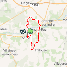
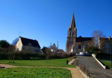
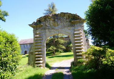
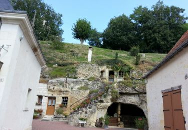
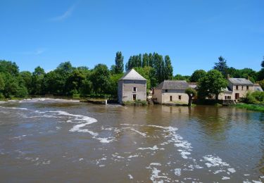
Randonnée Marche de 20 km à découvrir à Centre-Val de Loire, Indre-et-Loire, Saché. Cette randonnée est proposée par fustier.

Description

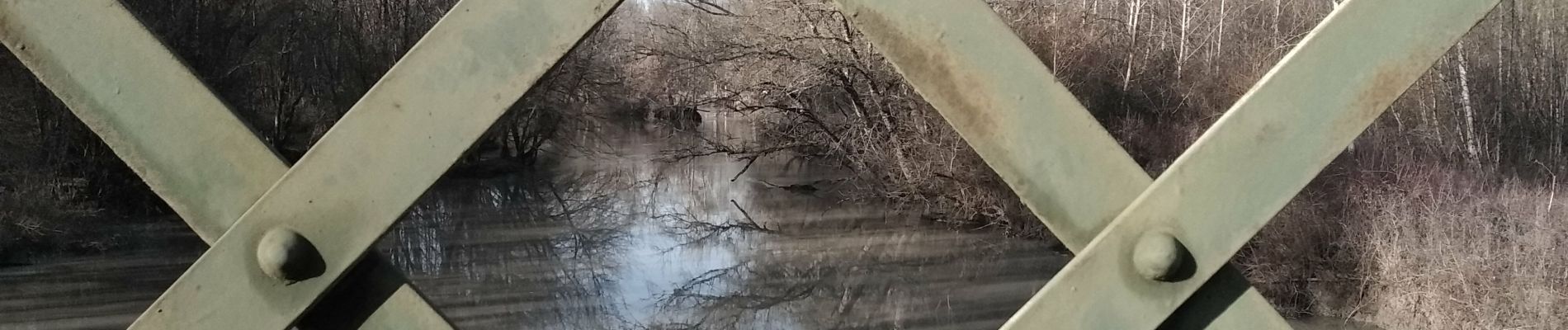
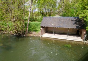
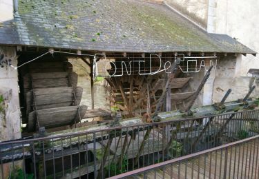
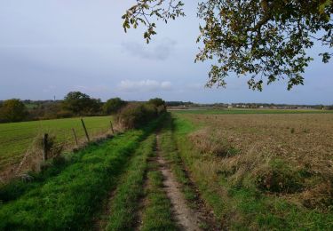
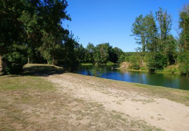
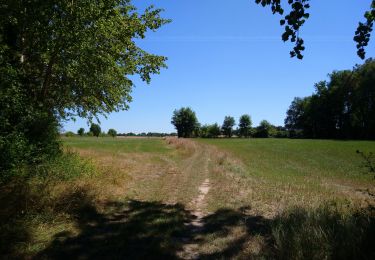
Randonnée à partir de Sache puis les abords d'Artannes, pic-nic à Pont de Ruan au bord de l'Indre. Retour à Saché par les bois en direction de Thilouze. On peut en arrivant à Saché visité la maison de Balzac. A signaler en sortant de Pont de Ruan on passe devant un circuit de voiture cross.

Profil altimétrique

Photos

Localisation

Pays :
France
Région :
Centre-Val de Loire
Département/Province :
Indre-et-Loire
Commune :
Saché
Localité :
Unknown
Départ:(UTM)
314075 ; 5235517 (31T) N.

Randonnées à proximité

Randonnée Marche Artannes-sur-Indre - Artannes-sur-Indre - Zig zag Pont-de-Ruan - 22.1km 280m 4h50 (40mn) - 2024 04 22 - Photo
Marche
Orcal37

Marche

Moyen
Artannes-sur-Indre, Centre-Val de Loire, Indre-et-Loire, France
22 km | 26 km-effort
4h 50min
Oui
Randonnée Marche Pont-de-Ruan - Pont-de-Ruan - PR Sentier Balzacien - 21.6km 195m 4h35 (40mn) - 2023 11 29 - Photo
Marche
Orcal37

Marche

Facile
Pont-de-Ruan, Centre-Val de Loire, Indre-et-Loire, France
22 km | 24 km-effort
4h 35min
Oui
Randonnée Marche Artannes-sur-Indre - Artannes-sur-Indre - PRs Lavandières et Vallée du Lys - 25.4km 310m 5h45 (25mn) - 2023 11 11 - Photo
Marche
Orcal37

Marche

Moyen
Artannes-sur-Indre, Centre-Val de Loire, Indre-et-Loire, France
26 km | 30 km-effort
5h 45min
Oui
Randonnée Marche Saché - Saché - Goupillières - 14.8km 185m 3h40 - 2022 07 10 - Photo
Marche
Orcal37

Marche

Facile
Saché, Centre-Val de Loire, Indre-et-Loire, France
14,8 km | 17,3 km-effort
3h 40min
Oui
Randonnée Marche Pont-de-Ruan - Pont-de-Ruan - Couteau - 14.1km 120m 3h15 - 2022 07 08 - Photo
Marche
Orcal37

Marche

Facile
Pont-de-Ruan, Centre-Val de Loire, Indre-et-Loire, France
14,1 km | 15,7 km-effort
3h 15min
Oui
Randonnée Marche Thilouze - Thilouze - PR Pont-de-Ruan GR46A PR Croix Maurice - 20.5km 200m 4h25 - 2022 02 12 - Photo
Marche
Orcal37

Marche

Facile
Thilouze, Centre-Val de Loire, Indre-et-Loire, France
20 km | 23 km-effort
4h 25min
Oui
Randonnée Marche Artannes-sur-Indre - Artannes-sur-Indre - les Mattés - 19.5km 260m 4h10 - 2020 05 18 - Photo
Marche
Orcal37

Marche

Facile
Artannes-sur-Indre, Centre-Val de Loire, Indre-et-Loire, France
19,5 km | 23 km-effort
4h 10min
Oui
Randonnée Marche Villaines-les-Rochers - Villaines-les-Rochers - circuit 1 - 16.4km 260m 4h05 (30mn) - 2018 07 22 - Photo
Marche
Orcal37

Marche

Facile
Villaines-les-Rochers, Centre-Val de Loire, Indre-et-Loire, France
16,4 km | 19,9 km-effort
4h 5min
Oui
Randonnée Marche Pont-de-Ruan - Pont-de-Ruan - circuit 1 - boucle Thilouze - 15.7km 130m 2h45 - 2017 04 16 - Photo
Marche
Orcal37

Marche

Facile
Pont-de-Ruan, Centre-Val de Loire, Indre-et-Loire, France
15,7 km | 17,4 km-effort
2h 45min
Oui


Fermer
Mes abonnements