Randonnée Marche Labarthe-Rivière - sentier des 4 chenes - Photo
© OpenStreetMap contributors
Longueur
Longueur
7,8 km
Altitude max
Altitude max
665 m
Dénivelé positif
Dénivelé positif
264 m
Km-Effort
Km-Effort  
11,4 km
Altitude min
Altitude min
396 m
Dénivelé négatif
Dénivelé négatif
302 m
Boucle
Boucle
Non
Date de création :
2019-03-27 13:05:13.419
Dernière modification :
2019-03-27 17:34:43.619

(0 Avis)

Marche
Marche
3h03
Difficulté : Facile

Scannez ce code QR pour ouvrir la randonnée dans l'application SityTrail

Application GPS de randonnée GRATUITE

Logo SityTrail SityTrail

IGN / Instituts géographiques

Télécharger SityTrail sur l'App Store Télécharger SityTrail sur Google Play

Logo SityTrail SityTrail World

Le monde est à vous

Télécharger SityTrail sur l'App Store Télécharger SityTrail sur Google Play Télécharger SityTrail sur Huawei AppGallery

À propos

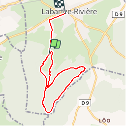
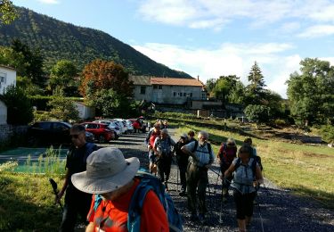
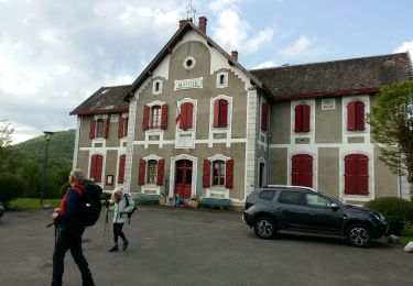
Randonnée Marche de 7,8 km à découvrir à Occitanie, Haute-Garonne, Labarthe-Rivière. Cette randonnée est proposée par Jacqueline Vandergheynst.

Description

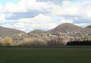
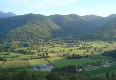
Belle rando en forêt printanière
Fleurs primevères, orckis, fritillaires des Pyrénées, scilles violettes.......

Profil altimétrique

Localisation

Pays :
France
Région :
Occitanie
Département/Province :
Haute-Garonne
Commune :
Labarthe-Rivière
Localité :
Unknown
Départ:(UTM)
309847 ; 4771208 (31T) N.

Randonnées à proximité

Randonnée Marche Ardiège - Promenade autour d'Ardiège et de Cier de Rivière - Photo
Marche
tracegps

Marche

Facile
(1)
Ardiège, Occitanie, Haute-Garonne, France
5 km | 6,4 km-effort
1h 15min
Oui
Randonnée Marche Barbazan - Tour de Barbazan - Photo
Marche
tracegps

Marche

Facile
(2)
Barbazan, Occitanie, Haute-Garonne, France
5,7 km | 7,3 km-effort
1h 30min
Oui
Randonnée V.T.T. Sauveterre-de-Comminges - sunday spin 8/6/14 - Photo
V.T.T.
ray23

V.T.T.

Difficile
(2)
Sauveterre-de-Comminges, Occitanie, Haute-Garonne, France
18,2 km | 26 km-effort
2h 10min
Oui
Randonnée Marche Saint-Gaudens - Via Garonna - Photo
Marche
jlmauriz

Marche

Moyen
Saint-Gaudens, Occitanie, Haute-Garonne, France
25 km | 30 km-effort
6h 23min
Non
Randonnée A pied Barbazan - BARBAZAN  le refuge saint-martin G3 Fait
A pied
GUIDE
marmotte65

A pied

Facile
Barbazan, Occitanie, Haute-Garonne, France
11,2 km | 18,1 km-effort
3h 34min
Oui
Randonnée Marche Cier-de-Rivière - CIER DE RIVIERE col de Couret et de l'Aouach  G4  - Photo
Marche
GUIDE
marmotte65

Marche

Difficile
Cier-de-Rivière, Occitanie, Haute-Garonne, France
10,9 km | 15,1 km-effort
3h 20min
Oui
Randonnée Marche Barbazan - de barbazan au refuge st Martin  - Photo
Marche
yoyo31

Marche

Moyen
Barbazan, Occitanie, Haute-Garonne, France
10,5 km | 16,5 km-effort
2h 25min
Oui
Randonnée V.T.T. Barbazan - Les collines du Comminges  n°16 - Barbazan - Photo
V.T.T.
tracegps

V.T.T.

Difficile
Barbazan, Occitanie, Haute-Garonne, France
30 km | 39 km-effort
3h 0min
Oui
Randonnée V.T.T. Sauveterre-de-Comminges - Le tour du Barry - Sauveterre de Comminges - Photo
V.T.T.
tracegps

V.T.T.

Moyen
Sauveterre-de-Comminges, Occitanie, Haute-Garonne, France
15,3 km | 19,1 km-effort
1h 30min
Oui


Fermer
Mes abonnements