Randonnée 4x4 Le Mayet-de-Montagne - le mayet la prune. - Photo
 terminatoy
terminatoy

Utilisateur

© OpenStreetMap contributors
Longueur
Longueur
21 km
Altitude max
Altitude max
958 m
Dénivelé positif
Dénivelé positif
849 m
Km-Effort
Km-Effort  
32 km
Altitude min
Altitude min
547 m
Dénivelé négatif
Dénivelé négatif
706 m
Boucle
Boucle
Non
Date de création :
2019-07-14 11:52:28.643
Dernière modification :
2019-07-17 14:07:06.704

(1 Avis)

4x4
4x4
3h27
Difficulté : Facile

Scannez ce code QR pour ouvrir la randonnée dans l'application SityTrail

Application GPS de randonnée GRATUITE

Logo SityTrail SityTrail

IGN / Instituts géographiques

Télécharger SityTrail sur l'App Store Télécharger SityTrail sur Google Play

Logo SityTrail SityTrail World

Le monde est à vous

Télécharger SityTrail sur l'App Store Télécharger SityTrail sur Google Play Télécharger SityTrail sur Huawei AppGallery

À propos

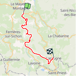
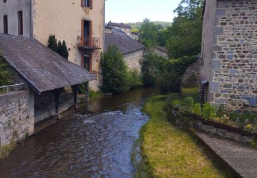
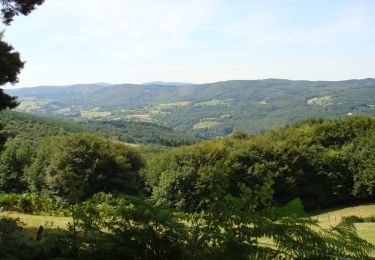
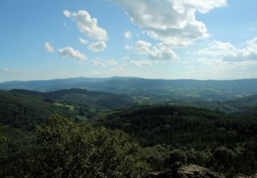
Randonnée 4x4 de 21 km à découvrir à Auvergne-Rhône-Alpes, Allier, Le Mayet-de-Montagne. Cette randonnée est proposée par terminatoy.

Profil altimétrique

Localisation

Pays :
France
Région :
Auvergne-Rhône-Alpes
Département/Province :
Allier
Commune :
Le Mayet-de-Montagne
Localité :
Unknown
Départ:(UTM)
552077 ; 5100899 (31T) N.

Commentaires

Veuillez vous connecter pour laisser un commentaire ou une note


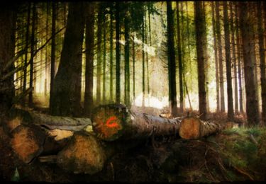
portion pas adapté pour un Toyota Land cruiser long plutôt adapté pour un 4x4 préparer avec full protection quel dommage


Randonnées à proximité

Randonnée Marche Ferrières-sur-Sichon - Balade autour de Ferrières sur Sichon - Photo
Marche
tracegps

Marche

Moyen
(1)
Ferrières-sur-Sichon, Auvergne-Rhône-Alpes, Allier, France
7,4 km | 10,8 km-effort
2h 15min
Oui
Randonnée Marche Ferrières-sur-Sichon - Arboretum  - Photo
Marche
nadd73

Marche

Très facile
Ferrières-sur-Sichon, Auvergne-Rhône-Alpes, Allier, France
3 km | 4,5 km-effort
1h 2min
Non
Randonnée Marche Ferrières-sur-Sichon - Grotte des fées y cascade  - Photo
Marche
nadd73

Marche

Très facile
Ferrières-sur-Sichon, Auvergne-Rhône-Alpes, Allier, France
5,1 km | 6,7 km-effort
1h 15min
Oui
Randonnée Trail Ferrières-sur-Sichon - circuit du moulin neuf  - Photo
Trail
nadd73

Trail

Facile
Ferrières-sur-Sichon, Auvergne-Rhône-Alpes, Allier, France
12,3 km | 17,8 km-effort
1h 15min
Oui
Randonnée Marche Châtel-Montagne - Charguéraud a La Croix Bruyère  - Photo
Marche
NANE51

Marche

Facile
Châtel-Montagne, Auvergne-Rhône-Alpes, Allier, France
12,2 km | 16,9 km-effort
3h 9min
Non
Randonnée Marche Le Mayet-de-Montagne - Saint Clément - Photo
Marche
tracegps

Marche

Difficile
Le Mayet-de-Montagne, Auvergne-Rhône-Alpes, Allier, France
15,9 km | 23 km-effort
3h 30min
Oui
Randonnée Marche Le Mayet-de-Montagne - Le Grand Roc - Le Mallot - Photo
Marche
tracegps

Marche

Moyen
Le Mayet-de-Montagne, Auvergne-Rhône-Alpes, Allier, France
10,4 km | 15,2 km-effort
2h 45min
Oui
Randonnée Marche Le Mayet-de-Montagne - Boucle autour du Cluzel - Arronnes - Photo
Marche
tracegps

Marche

Moyen
Le Mayet-de-Montagne, Auvergne-Rhône-Alpes, Allier, France
12 km | 15,8 km-effort
2h 45min
Oui
Randonnée Marche La Chabanne - Balade autour de Chaudagne - Photo
Marche
tracegps

Marche

Moyen
La Chabanne, Auvergne-Rhône-Alpes, Allier, France
8 km | 11,1 km-effort
2h 0min
Oui


Fermer
Mes abonnements