Randonnée Marche Saint-Estèphe - Etang de St Estèphe - Piegut - Photo

Etang de St Estèphe - Piegut

 Zygomat
Zygomat

Utilisateur

© OpenStreetMap contributors
Longueur
Longueur
16,9 km
Altitude max
Altitude max
293 m
Dénivelé positif
Dénivelé positif
253 m
Km-Effort
Km-Effort  
20 km
Altitude min
Altitude min
224 m
Dénivelé négatif
Dénivelé négatif
253 m
Boucle
Boucle
Oui
Date de création :
2019-08-01 10:11:39.509
Dernière modification :
2019-09-30 21:27:38.8

(0 Avis)

Marche
Marche
4h30
Difficulté : Moyen

Scannez ce code QR pour ouvrir la randonnée dans l'application SityTrail

Application GPS de randonnée GRATUITE

Logo SityTrail SityTrail

IGN / Instituts géographiques

Télécharger SityTrail sur l'App Store Télécharger SityTrail sur Google Play

Logo SityTrail SityTrail World

Le monde est à vous

Télécharger SityTrail sur l'App Store Télécharger SityTrail sur Google Play Télécharger SityTrail sur Huawei AppGallery

À propos

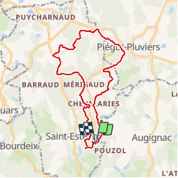
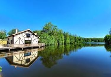
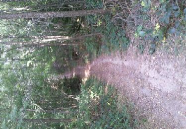
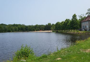
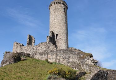
Randonnée Marche de 16,9 km à découvrir à Nouvelle-Aquitaine, Dordogne, Saint-Estèphe. Cette randonnée est proposée par Zygomat.

Description

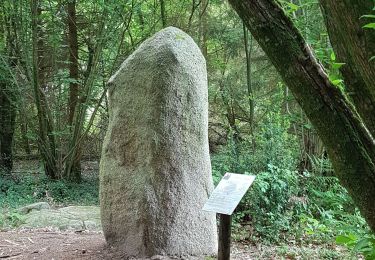
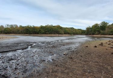
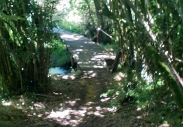
Autour de l'étang de St Estèphe en passant par le Roc branlant, le menhir de Fixard, Piegut, le donjon de Piegut et retour au tout de l'étang en passant par le bac.

Profil altimétrique

Localisation

Pays :
France
Région :
Nouvelle-Aquitaine
Département/Province :
Dordogne
Commune :
Saint-Estèphe
Localité :
Unknown
Départ:(Dec)
Départ:(UTM)
318585 ; 5051111 (31T) N.

Randonnées à proximité

Randonnée Marche Saint-Estèphe - Saint-Estephe par Piėgut - Photo
Marche
swp648

Marche

Très facile
Saint-Estèphe, Nouvelle-Aquitaine, Dordogne, France
15 km | 0 m-effort
4h 13min
Non
Randonnée Marche Saint-Estèphe - st estephe  piegut - Photo
Marche
thierry16

Marche

Très difficile
Saint-Estèphe, Nouvelle-Aquitaine, Dordogne, France
16,2 km | 20 km-effort
3h 15min
Non
Randonnée Marche Augignac - les chaufauds - Photo
Marche
temmichel

Marche

Moyen
Augignac, Nouvelle-Aquitaine, Dordogne, France
8,7 km | 10,4 km-effort
2h 14min
Oui
Randonnée Marche Saint-Estèphe - Boucle Saint-Estèphe - Piégut - Photo
Marche
CC.RIDER

Marche

Difficile
Saint-Estèphe, Nouvelle-Aquitaine, Dordogne, France
13,1 km | 16,1 km-effort
3h 39min
Oui
Randonnée V.T.T. Augignac - Circuit_StEstephe_Bourdeix - Photo
V.T.T.
JeremyBois

V.T.T.

Difficile
Augignac, Nouvelle-Aquitaine, Dordogne, France
27 km | 33 km-effort
2h 4min
Oui
Randonnée Marche Saint-Estèphe - St estephe - Photo
Marche
dededavid

Marche

Facile
Saint-Estèphe, Nouvelle-Aquitaine, Dordogne, France
3,1 km | 3,4 km-effort
1h 8min
Oui
Randonnée Marche Saint-Estèphe - De Saint-Estèphe à Piégut - Photo
Marche
neoroll44

Marche

Difficile
Saint-Estèphe, Nouvelle-Aquitaine, Dordogne, France
13,6 km | 16,6 km-effort
3h 46min
Oui
Randonnée Marche Piégut-Pluviers - Piegut-pluviers - Photo
Marche
viam19

Marche

Moyen
Piégut-Pluviers, Nouvelle-Aquitaine, Dordogne, France
10,3 km | 12,3 km-effort
3h 41min
Oui
Randonnée Autre activité Saint-Estèphe - De Saint-Estèphe à Piégut - Photo
Autre activité
swp648

Autre activité

Très facile
Saint-Estèphe, Nouvelle-Aquitaine, Dordogne, France
13,6 km | 16,7 km-effort
4h 0min
Oui


Fermer
Mes abonnements