Randonnée Marche Justine-Herbigny - (16/8/2019) Herbigny - les 2 tables d'orientation  - Photo

(16/8/2019) Herbigny - les 2 tables d'orientation

 ABICHE
ABICHE

Utilisateur

© OpenStreetMap contributors
Longueur
Longueur
17,4 km
Altitude max
Altitude max
174 m
Dénivelé positif
Dénivelé positif
226 m
Km-Effort
Km-Effort  
20 km
Altitude min
Altitude min
76 m
Dénivelé négatif
Dénivelé négatif
227 m
Boucle
Boucle
Oui
Date de création :
2019-08-16 08:29:48.619
Dernière modification :
2019-08-16 13:16:09.507

(0 Avis)

Marche
Marche
4h45
Difficulté : Facile

Scannez ce code QR pour ouvrir la randonnée dans l'application SityTrail

Application GPS de randonnée GRATUITE

Logo SityTrail SityTrail

IGN / Instituts géographiques

Télécharger SityTrail sur l'App Store Télécharger SityTrail sur Google Play

Logo SityTrail SityTrail World

Le monde est à vous

Télécharger SityTrail sur l'App Store Télécharger SityTrail sur Google Play Télécharger SityTrail sur Huawei AppGallery

À propos

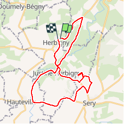
Randonnée Marche de 17,4 km à découvrir à Grand Est, Ardennes, Justine-Herbigny. Cette randonnée est proposée par ABICHE.

Description

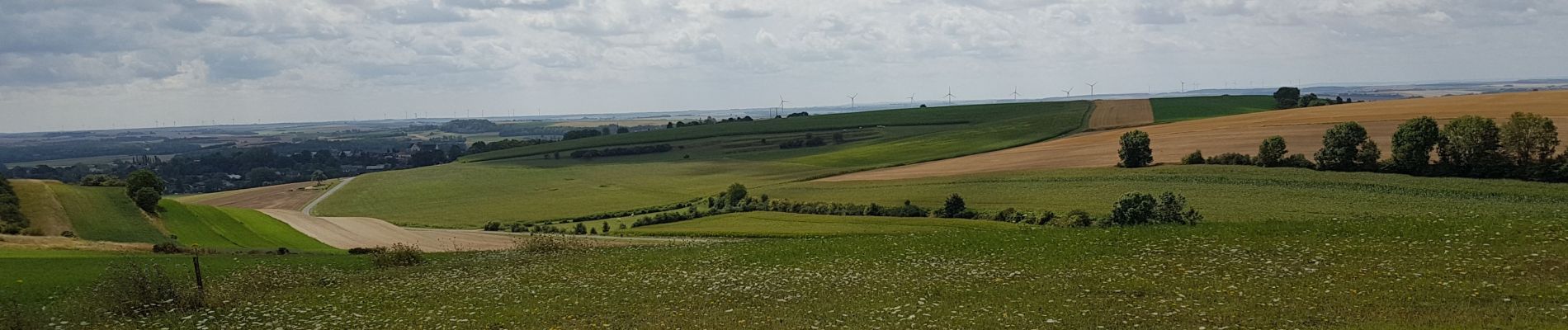
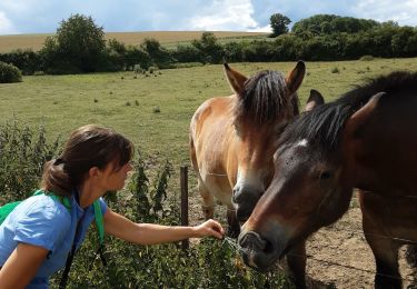
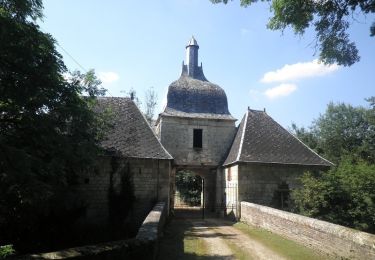
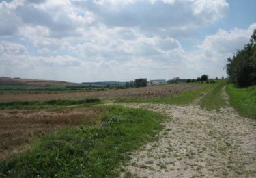
Randonnée dans la campagne des côtes pré-ardennaise.

Profil altimétrique

Photos

Localisation

Pays :
France
Région :
Grand Est
Département/Province :
Ardennes
Commune :
Justine-Herbigny
Localité :
Unknown
Départ:(UTM)
595872 ; 5496425 (31U) N.

Randonnées à proximité

Randonnée Marche Sery - sery - Photo
Marche
gilbertwarin08

Marche

Très facile
Sery, Grand Est, Ardennes, France
10,1 km | 12,8 km-effort
3h 24min
Oui
Randonnée Marche Sery - sery - Photo
Marche
gilbertwarin08

Marche

Très facile
Sery, Grand Est, Ardennes, France
10,1 km | 12,8 km-effort
3h 24min
Oui
Randonnée Marche Wasigny -  Wasigny un des plus beaux villages - Photo
Marche
tracegps

Marche

Moyen
(1)
Wasigny, Grand Est, Ardennes, France
12,5 km | 15 km-effort
3h 0min
Oui
Randonnée Marche Wasigny - Chemin de Compostelle, Voie de Vézelay GR654® De Wasigny à Château Porcien - Photo
Marche
tracegps

Marche

Difficile
Wasigny, Grand Est, Ardennes, France
21 km | 25 km-effort
4h 15min
Non
Randonnée Marche Sery - Les Monts de Sery - Photo
Marche
tracegps

Marche

Facile
Sery, Grand Est, Ardennes, France
5,1 km | 6,8 km-effort
1h 15min
Oui
Randonnée V.T.T. Sery - Porcien. Sery - Photo
V.T.T.
ThierryLECLERC

V.T.T.

Facile
Sery, Grand Est, Ardennes, France
36 km | 43 km-effort
2h 53min
Oui
Randonnée Marche Sery - sery - Photo
Marche
gilbertwarin08

Marche

Très facile
(1)
Sery, Grand Est, Ardennes, France
10,5 km | 13,2 km-effort
3h 22min
Oui
Randonnée Marche Chappes - Sentier autour de Chappes - Photo
Marche
tracegps

Marche

Moyen
Chappes, Grand Est, Ardennes, France
9,3 km | 11,6 km-effort
2h 30min
Oui


Fermer
Mes abonnements