Randonnée Canoë - kayak Préchac - Prechac/Bommes - Photo
 hubertcasm
hubertcasm

Utilisateur

© OpenStreetMap contributors
Longueur
Longueur
19,4 km
Altitude max
Altitude max
47 m
Dénivelé positif
Dénivelé positif
96 m
Km-Effort
Km-Effort  
21 km
Altitude min
Altitude min
16 m
Dénivelé négatif
Dénivelé négatif
117 m
Boucle
Boucle
Non
Date de création :
2019-08-28 08:00:00.0
Dernière modification :
2019-08-28 17:10:19.826

(0 Avis)

Canoë - kayak
Canoë - kayak
3h58
Difficulté : Moyen

Scannez ce code QR pour ouvrir la randonnée dans l'application SityTrail

Application GPS de randonnée GRATUITE

Logo SityTrail SityTrail

IGN / Instituts géographiques

Télécharger SityTrail sur l'App Store Télécharger SityTrail sur Google Play

Logo SityTrail SityTrail World

Le monde est à vous

Télécharger SityTrail sur l'App Store Télécharger SityTrail sur Google Play Télécharger SityTrail sur Huawei AppGallery

À propos

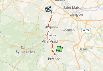
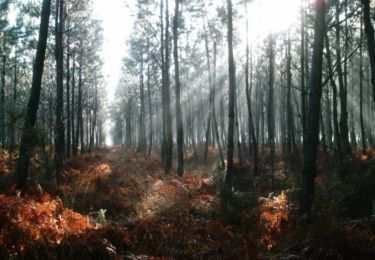
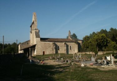
Randonnée Canoë - kayak de 19,4 km à découvrir à Nouvelle-Aquitaine, Gironde, Préchac. Cette randonnée est proposée par hubertcasm.
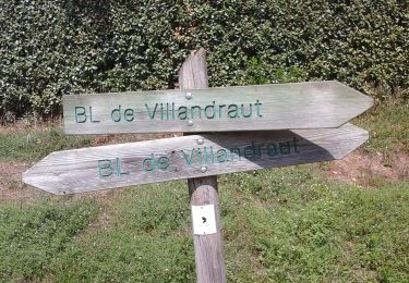
Description

Base de villandraut

Profil altimétrique

Photos

Localisation

Pays :
France
Région :
Nouvelle-Aquitaine
Département/Province :
Gironde
Commune :
Préchac
Localité :
Unknown
Départ:(Dec)
Départ:(UTM)
711473 ; 4920910 (30T) N.

Randonnées à proximité

Randonnée A pied Villandraut - Boucle locale de Villandraut - Photo
A pied
PRO

A pied

Facile
Villandraut, Nouvelle-Aquitaine, Gironde, France
6,2 km | 6,8 km-effort
1h 33min
Non
Randonnée Marche Préchac - Prechac 2 - Photo
Marche
leglisemichel

Marche

Moyen
Préchac, Nouvelle-Aquitaine, Gironde, France
10,2 km | 11,4 km-effort
2h 36min
Oui
Randonnée Canoë - kayak Villandraut - Descente du coton - Photo
Canoë - kayak
PVERTICAL

Canoë - kayak

Très facile
Villandraut, Nouvelle-Aquitaine, Gironde, France
19,4 km | 21 km-effort
4h 13min
Non
Randonnée V.T.T. Pompéjac - Autour de Pompéjac - Photo
V.T.T.
tracegps

V.T.T.

Moyen
Pompéjac, Nouvelle-Aquitaine, Gironde, France
28 km | 32 km-effort
3h 0min
Oui
Randonnée V.T.T. Lucmau - De Insos à Lucmau - Photo
V.T.T.
tracegps

V.T.T.

Moyen
Lucmau, Nouvelle-Aquitaine, Gironde, France
59 km | 66 km-effort
3h 0min
Non
Randonnée Marche Uzeste - Uzeste Villandrault Ar - Photo
Marche
plavengut

Marche

Difficile
Uzeste, Nouvelle-Aquitaine, Gironde, France
13,9 km | 15,7 km-effort
4h 0min
Oui
Randonnée Marche Uzeste - Uzeste Villandrault Uzeste - Photo
Marche
plavengut

Marche

Facile
Uzeste, Nouvelle-Aquitaine, Gironde, France
13,5 km | 15,2 km-effort
4h 0min
Oui
Randonnée Marche Villandraut - Villandrau PNL - Photo
Marche
20LTh

Marche

Villandraut, Nouvelle-Aquitaine, Gironde, France
9,5 km | 10,6 km-effort
2h 34min
Oui
Randonnée V.T.T. Préchac - Vallée du Ciron - Photo
V.T.T.
tracegps

V.T.T.

Difficile
Préchac, Nouvelle-Aquitaine, Gironde, France
34 km | 38 km-effort
3h 0min
Oui


Fermer
Mes abonnements