![](/images/other/stat-length.png)
![Randonnée V.T.T. Azay-sur-Cher - azay-cher-montrichard et retour - Photo](https://media.geolcdn.com/t/1900/400/ext.pjpeg?maxdim=2&url=https%3A%2F%2Fservices.sitytrail.com%2FGeolivesWS%2FDownloadMedia.ashx%3FTrailID%3D219014%26Media%3Dfix__20130904121107.jpg)
azay-cher-montrichard et retour
dporcher
Utilisateur
![Longueur](/images/other/stat-length.png)
Longueur
56 km
![Altitude max](https://static1.geolcdn.com/siteimages/upload/files/1508320355ic_sort_altitude_max_24dp.png)
Altitude max
77 m
![Dénivelé positif](https://static1.geolcdn.com/siteimages/upload/files/1508320355ic_sort_den_pos_24dp.png)
Dénivelé positif
393 m
![Km-Effort](/images/other/stat-length.png)
Km-Effort
61 km
![Altitude min](https://static1.geolcdn.com/siteimages/upload/files/1508320355ic_sort_altitude_min_24dp.png)
Altitude min
47 m
![Dénivelé négatif](https://static1.geolcdn.com/siteimages/upload/files/1508320355ic_sort_den_neg_24dp.png)
Dénivelé négatif
392 m
![Boucle](https://static1.geolcdn.com/siteimages/upload/files/16400158638029165_repeat_loop_refresh_sync_direction_icon.png)
Boucle
Oui
Date de création :
2014-12-10 00:00:00.0
Dernière modification :
2014-12-10 00:00:00.0
![V.T.T.](https://static1.geolcdn.com/sitytour/trail-icons/202.png)
3h23
Difficulté : Très facile
![Scannez ce code QR pour ouvrir la randonnée dans l'application SityTrail](https://capi.geolives.com/qq0zvz2zws4bq2lad0pu/sitytour/trails/219014/qr.png?size=200)
Application GPS de randonnée GRATUITE
À propos
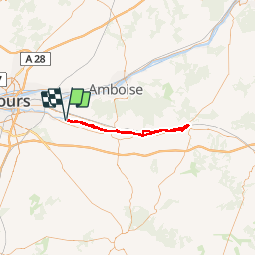
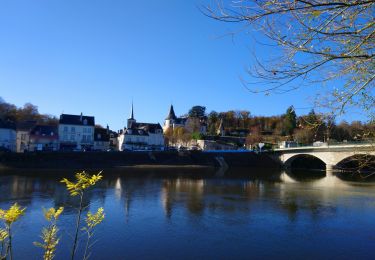
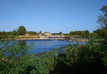
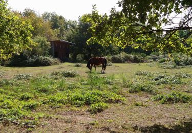
Randonnée V.T.T. de 56 km à découvrir à Centre-Val de Loire, Indre-et-Loire, Azay-sur-Cher. Cette randonnée est proposée par dporcher.
Description
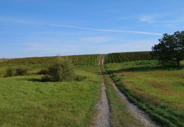
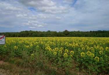
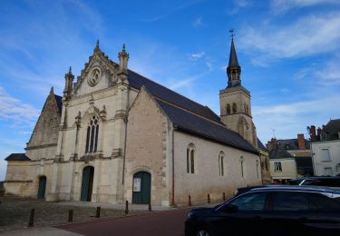
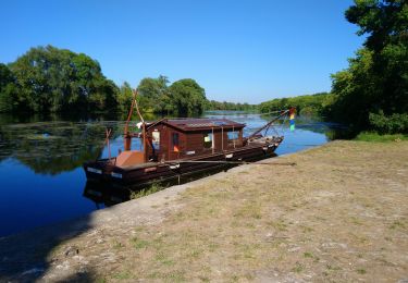
Plat sur chemins roulants. A faire de préférence hors période touristique pour qui vous voulez éviter la foule aux abords de Chenonceaux. Un passage sympathique de 2km peu après Bléré, un autre avant Chenonceaux.
Localisation
Pays :
France
Région :
Centre-Val de Loire
Département/Province :
Indre-et-Loire
Commune :
Azay-sur-Cher
Localité :
Unknown
Départ:(Dec)
Départ:(UTM)
337599 ; 5246462 (31T) N.
Commentaires
Randonnées à proximité
![Randonnée Marche Véretz - Véretz - PR Sentier de Bacchus - 14.9km 90m 3h00 - 2023 11 25 - Photo](https://media.geolcdn.com/t/375/260/ext.jpg?maxdim=2&url=https%3A%2F%2Fmedia.geolcdn.com%2Ff%2Fba6757e2-3664-4b27-83f8-18e13d10493f.jpg)
![Marche Marche](https://static1.geolcdn.com/sitytour/trail-icons/101.png)
Véretz - PR Sentier de Bacchus - 14.9km 90m 3h00 - 2023 11 25
Marche
Facile
Véretz,
Centre-Val de Loire,
Indre-et-Loire,
France
![](/images/other/stat-length.png)
14,9 km | 16,1 km-effort
3h 0min
![](https://static1.geolcdn.com/siteimages/upload/files/16400158638029165_repeat_loop_refresh_sync_direction_icon.png)
Oui
![Randonnée Marche Montlouis-sur-Loire - Montlouis-sur-Loire - gare GR41 Veretz Azay-sur-Cher - 13km 85m 2h45 - 2023 10 07 - Photo](https://media.geolcdn.com/t/375/260/ext.jpg?maxdim=2&url=https%3A%2F%2Fmedia.geolcdn.com%2Ff%2F0a795f12-7cb8-451f-a494-3acd28ec6c5f.jpg)
![Marche Marche](https://static1.geolcdn.com/sitytour/trail-icons/101.png)
Montlouis-sur-Loire - gare GR41 Veretz Azay-sur-Cher - 13km 85m 2h45 - 2023 1...
Marche
Facile
Montlouis-sur-Loire,
Centre-Val de Loire,
Indre-et-Loire,
France
![](/images/other/stat-length.png)
13 km | 14,2 km-effort
2h 45min
![](https://static1.geolcdn.com/siteimages/upload/files/16400158638029165_repeat_loop_refresh_sync_direction_icon.png)
Oui
![Randonnée Marche Saint-Martin-le-Beau - Saint-Martin-le-Beau - PR Entre Vignes et Forêts - 11.8km 120m 2h45 (45mn) - 2023 10 07 - Photo](https://media.geolcdn.com/t/375/260/ext.jpg?maxdim=2&url=https%3A%2F%2Fmedia.geolcdn.com%2Ff%2F24ce2aa4-4932-408c-a436-3f83b6744ce9.jpg)
![Marche Marche](https://static1.geolcdn.com/sitytour/trail-icons/101.png)
Saint-Martin-le-Beau - PR Entre Vignes et Forêts - 11.8km 120m 2h45 (45mn) - ...
Marche
Moyen
Saint-Martin-le-Beau,
Centre-Val de Loire,
Indre-et-Loire,
France
![](/images/other/stat-length.png)
11,8 km | 13,4 km-effort
2h 45min
![](https://static1.geolcdn.com/siteimages/upload/files/16400158638029165_repeat_loop_refresh_sync_direction_icon.png)
Oui
![Randonnée Marche Saint-Martin-le-Beau - Saint-Martin-le-Beau - Nitray GR41 Azay-sur-Cher - 23.2km 185m 5h15 (40mn) - 2023 10 04 - Photo](https://media.geolcdn.com/t/375/260/ext.jpg?maxdim=2&url=https%3A%2F%2Fmedia.geolcdn.com%2Ff%2F4b768c7a-d65d-4d1c-bb56-1d0e8b4c83bb.jpg)
![Marche Marche](https://static1.geolcdn.com/sitytour/trail-icons/101.png)
Saint-Martin-le-Beau - Nitray GR41 Azay-sur-Cher - 23.2km 185m 5h15 (40mn) - ...
Marche
Facile
Saint-Martin-le-Beau,
Centre-Val de Loire,
Indre-et-Loire,
France
![](/images/other/stat-length.png)
23 km | 26 km-effort
5h 15min
![](https://static1.geolcdn.com/siteimages/upload/files/16400158638029165_repeat_loop_refresh_sync_direction_icon.png)
Oui
![Randonnée Marche Azay-sur-Cher - Azay-sur-Cher - le Grais - 13.1km 100m 2h55 - 2023 07 12 - Photo](https://media.geolcdn.com/t/375/260/ext.jpg?maxdim=2&url=https%3A%2F%2Fmedia.geolcdn.com%2Ff%2Fd448dc7e-b6fc-44df-a494-9561910205cc.jpg)
![Marche Marche](https://static1.geolcdn.com/sitytour/trail-icons/101.png)
Azay-sur-Cher - le Grais - 13.1km 100m 2h55 - 2023 07 12
Marche
Facile
Azay-sur-Cher,
Centre-Val de Loire,
Indre-et-Loire,
France
![](/images/other/stat-length.png)
13,1 km | 14,5 km-effort
2h 55min
![](https://static1.geolcdn.com/siteimages/upload/files/16400158638029165_repeat_loop_refresh_sync_direction_icon.png)
Oui
![Randonnée Marche Montlouis-sur-Loire - Montlouis-sur-Loire - PR Sur les pas de Gabrielle d'Estrées - 9.5km 100m 2h20 - 2023 07 08 - Photo](https://media.geolcdn.com/t/375/260/ext.jpg?maxdim=2&url=https%3A%2F%2Fmedia.geolcdn.com%2Ff%2Fb211a3c9-f8d2-42f6-bf4b-d2bf5553a450.jpg)
![Marche Marche](https://static1.geolcdn.com/sitytour/trail-icons/101.png)
Montlouis-sur-Loire - PR Sur les pas de Gabrielle d'Estrées - 9.5km 100m 2h20...
Marche
Facile
Montlouis-sur-Loire,
Centre-Val de Loire,
Indre-et-Loire,
France
![](/images/other/stat-length.png)
9,5 km | 10,9 km-effort
2h 20min
![](https://static1.geolcdn.com/siteimages/upload/files/16400158638029165_repeat_loop_refresh_sync_direction_icon.png)
Oui
![Randonnée Cyclotourisme Montlouis-sur-Loire - De Montlouis sur Loire à Villandry - Photo](https://media.geolcdn.com/t/375/260/ext.jpg?maxdim=2&url=https%3A%2F%2Fmedia.geolcdn.com%2Ff%2F06e7a589-0b86-4225-a7bb-150a85f87cea.jpg)
![Cyclotourisme Cyclotourisme](https://static1.geolcdn.com/sitytour/trail-icons/204.png)
De Montlouis sur Loire à Villandry
Cyclotourisme
Moyen
Montlouis-sur-Loire,
Centre-Val de Loire,
Indre-et-Loire,
France
![](/images/other/stat-length.png)
78 km | 85 km-effort
5h 18min
![](https://static1.geolcdn.com/siteimages/upload/files/16400158638029165_repeat_loop_refresh_sync_direction_icon.png)
Non
![Randonnée Marche Montlouis-sur-Loire - Montlouis-sur-Loire - Entre Loire et vignes GR3 GR655est - 17.4km 190m 3h55 - 2022 10 16 - Photo](https://media.geolcdn.com/t/375/260/ext.jpg?maxdim=2&url=https%3A%2F%2Fmedia.geolcdn.com%2Ff%2Fe654fc0b-8c0f-40ae-a5a9-a83b98260b2c.jpg)
![Marche Marche](https://static1.geolcdn.com/sitytour/trail-icons/101.png)
Montlouis-sur-Loire - Entre Loire et vignes GR3 GR655est - 17.4km 190m 3h55 -...
Marche
Facile
Montlouis-sur-Loire,
Centre-Val de Loire,
Indre-et-Loire,
France
![](/images/other/stat-length.png)
17,4 km | 19,9 km-effort
3h 55min
![](https://static1.geolcdn.com/siteimages/upload/files/16400158638029165_repeat_loop_refresh_sync_direction_icon.png)
Oui
![Randonnée Marche Athée-sur-Cher - Athée-sur-Cher - Port Chandon - 18km 140m 4h05 - 2022 07 24 - Photo](https://media.geolcdn.com/t/375/260/ext.jpg?maxdim=2&url=https%3A%2F%2Fmedia.geolcdn.com%2Ff%2F06bf13d7-1472-4195-8c45-3f1e94a53c00.jpg)
![Marche Marche](https://static1.geolcdn.com/sitytour/trail-icons/101.png)
Athée-sur-Cher - Port Chandon - 18km 140m 4h05 - 2022 07 24
Marche
Facile
Athée-sur-Cher,
Centre-Val de Loire,
Indre-et-Loire,
France
![](/images/other/stat-length.png)
18 km | 19,8 km-effort
4h 5min
![](https://static1.geolcdn.com/siteimages/upload/files/16400158638029165_repeat_loop_refresh_sync_direction_icon.png)
Oui