


FA Hilsen - Mulermatt - Petit Ballon - Rothenbrunnen - Bockwasen - Col du Hilsenfirst et retour

patrickbeyrath
Utilisateur
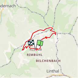

Longueur
10,5 km

Altitude max
1266 m

Dénivelé positif
409 m
Km-Effort
16 km

Altitude min
895 m

Dénivelé négatif
407 m
Boucle
Oui
Date de création :
2019-09-13 05:39:13.963
Dernière modification :
2019-09-13 05:49:49.681
--
Difficulté : Moyen

Application GPS de randonnée GRATUITE
 SityTrail
IGN / Instituts géographiques
SityTrail Plus
Le monde est à vous
À propos
Randonnée A pied de 10,5 km à découvrir à Grand Est, Haut-Rhin, Linthal. Cette randonnée est proposée par patrickbeyrath.
Localisation
Pays :
France
Région :
Grand Est
Département/Province :
Haut-Rhin
Commune :
Linthal
Localité :
Unknown
Départ:(Dec)
Départ:(UTM)
358879 ; 5314025 (32T) N.
Commentaires