Randonnée V.T.T. La Chapelle - 20191004 Yeyette à Givonne jour 1 - Photo

20191004 Yeyette à Givonne jour 1

Plus vî, plus sot

© OpenStreetMap contributors
Longueur
Longueur
26 km
Altitude max
Altitude max
440 m
Dénivelé positif
Dénivelé positif
521 m
Km-Effort
Km-Effort  
33 km
Altitude min
Altitude min
275 m
Dénivelé négatif
Dénivelé négatif
521 m
Boucle
Boucle
Oui
Date de création :
2019-10-04 12:09:36.0
Dernière modification :
2019-10-07 09:36:37.816

(0 Avis)

V.T.T.
V.T.T.
3h01
Difficulté : Difficile

Scannez ce code QR pour ouvrir la randonnée dans l'application SityTrail

Application GPS de randonnée GRATUITE

Logo SityTrail SityTrail

IGN / Instituts géographiques

Télécharger SityTrail sur l'App Store Télécharger SityTrail sur Google Play

Logo SityTrail SityTrail World

Le monde est à vous

Télécharger SityTrail sur l'App Store Télécharger SityTrail sur Google Play Télécharger SityTrail sur Huawei AppGallery

À propos

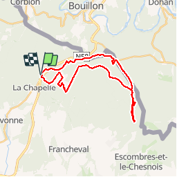
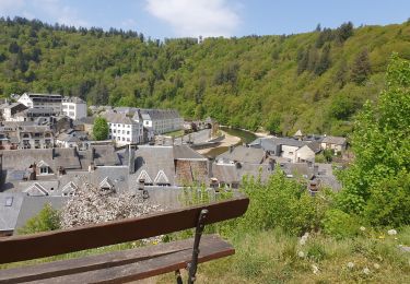
Randonnée V.T.T. de 26 km à découvrir à Grand Est, Ardennes, La Chapelle. Cette randonnée est proposée par Yeyette VTT team.

Description

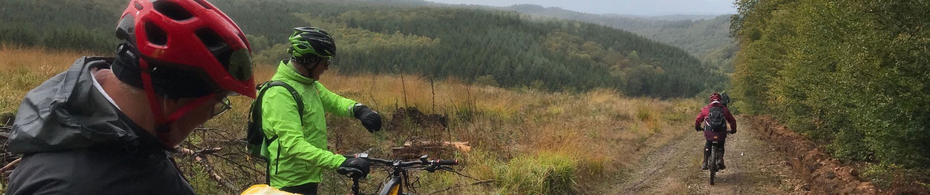
Bououououe le long de la frontière belge

Profil altimétrique

Photos

Localisation

Pays :
France
Région :
Grand Est
Département/Province :
Ardennes
Commune :
La Chapelle
Localité :
Unknown
Départ:(Dec)
Départ:(UTM)
645720 ; 5512813 (31U) N.

Randonnées à proximité

Randonnée Marche Bouillon - RB-Lu-13_Bouillon - Photo
Marche
PRO

Marche

Moyen
(8)
Bouillon, Wallonie, Luxembourg, Belgique
20 km | 30 km-effort
5h 55min
Oui
Randonnée Marche Bouillon - RB-Lu-13_Bouillon_via-racc - Photo
Marche
PRO

Marche

Moyen
(4)
Bouillon, Wallonie, Luxembourg, Belgique
16,7 km | 25 km-effort
4h 54min
Oui
Randonnée Marche Bouillon - Promenade vers la Passerelle de l’épine  - Photo
Marche
GUIDE+

Marche

Moyen
(6)
Bouillon, Wallonie, Luxembourg, Belgique
7,3 km | 11,2 km-effort
2h 33min
Oui
Randonnée Marche Illy - Chemin des contrebandiers - Illy - Photo
Marche
tracegps

Marche

Facile
(2)
Illy, Grand Est, Ardennes, France
7,9 km | 9,9 km-effort
1h 55min
Oui
Randonnée Marche Bouillon - Noordelijke bossen Bouillon 15 km - Photo
Marche
mavbelgium

Marche

Très difficile
(1)
Bouillon, Wallonie, Luxembourg, Belgique
16,2 km | 24 km-effort
3h 43min
Oui
Randonnée Marche Bouillon - De Bouillon vers Corbion par le Tombeau du Geant - Photo
Marche
GUIDE
Desrumaux

Marche

Difficile
(5)
Bouillon, Wallonie, Luxembourg, Belgique
20 km | 30 km-effort
5h 0min
Oui
Randonnée A pied Bouillon - Promenade de la Ramonette et arboretum 8 - Photo
A pied
PRO

A pied

Facile
(1)
Bouillon, Wallonie, Luxembourg, Belgique
3,9 km | 6,1 km-effort
1h 23min
Oui
Randonnée A pied Bouillon - Promenade gros chêne français et chêne des Mouches - Photo
A pied
GUIDE+

A pied

Facile
Bouillon, Wallonie, Luxembourg, Belgique
9,7 km | 13,3 km-effort
3h 1min
Oui
Randonnée A pied Bouillon - Promenade de la Sente aux Geais - Photo
A pied
GUIDE+

A pied

Facile
Bouillon, Wallonie, Luxembourg, Belgique
3,3 km | 4,2 km-effort
57min
Oui


Fermer
Mes abonnements