Randonnée Marche Vineuil - 23 km Vineuil-Montlivault - Photo
 domlecar
domlecar

Utilisateur

© OpenStreetMap contributors
Longueur
Longueur
23 km
Altitude max
Altitude max
86 m
Dénivelé positif
Dénivelé positif
129 m
Km-Effort
Km-Effort  
25 km
Altitude min
Altitude min
64 m
Dénivelé négatif
Dénivelé négatif
129 m
Boucle
Boucle
Oui
Date de création :
2014-12-10 00:00:00.0
Dernière modification :
2014-12-10 00:00:00.0

(0 Avis)

Marche
Marche
5h30
Difficulté : Facile

Scannez ce code QR pour ouvrir la randonnée dans l'application SityTrail

Application GPS de randonnée GRATUITE

Logo SityTrail SityTrail

IGN / Instituts géographiques

Télécharger SityTrail sur l'App Store Télécharger SityTrail sur Google Play

Logo SityTrail SityTrail World

Le monde est à vous

Télécharger SityTrail sur l'App Store Télécharger SityTrail sur Google Play Télécharger SityTrail sur Huawei AppGallery

À propos

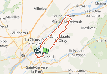
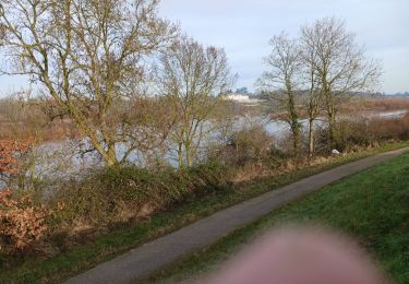
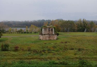
Randonnée Marche de 23 km à découvrir à Centre-Val de Loire, Loir-et-Cher, Vineuil. Cette randonnée est proposée par domlecar.

Description

23km
Bords de Loire jusqu'à Montlivault
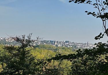
Retour par les villages

Profil altimétrique

Localisation

Pays :
France
Région :
Centre-Val de Loire
Département/Province :
Loir-et-Cher
Commune :
Vineuil
Localité :
Unknown
Départ:(Dec)
Départ:(UTM)
377700 ; 5271524 (31T) N.

Randonnées à proximité

Randonnée A pied Huisseau-sur-Cosson - Château de Nanteuil - Photo
A pied
PRO

A pied

Facile
Huisseau-sur-Cosson, Centre-Val de Loire, Loir-et-Cher, France
9,8 km | 10,8 km-effort
2h 27min
Oui
Randonnée Marche Vineuil - Loire 2 - Photo
Marche
domlecar

Marche

Très facile
(1)
Vineuil, Centre-Val de Loire, Loir-et-Cher, France
18,2 km | 19,5 km-effort
2h 46min
Oui
Randonnée Marche Vineuil - Vineuil le viaduc via la Noue Château de Ménard  - Photo
Marche
jouhan

Marche

Moyen
Vineuil, Centre-Val de Loire, Loir-et-Cher, France
11,9 km | 12,5 km-effort
2h 30min
Oui
Randonnée Marche Saint-Gervais-la-Forêt - Saint-Gervais-la-Forêt - Chailles - Photo
Marche
guydu41

Marche

Facile
Saint-Gervais-la-Forêt, Centre-Val de Loire, Loir-et-Cher, France
9,1 km | 11,4 km-effort
2h 43min
Oui
Randonnée Marche Saint-Claude-de-Diray - St Claude de diray - Photo
Marche
Gablier

Marche

Très facile
Saint-Claude-de-Diray, Centre-Val de Loire, Loir-et-Cher, France
12,6 km | 13,5 km-effort
2h 39min
Oui
Randonnée Marche Saint-Claude-de-Diray - St Claude de Diray  - Photo
Marche
Gablier

Marche

Très facile
Saint-Claude-de-Diray, Centre-Val de Loire, Loir-et-Cher, France
11,8 km | 12,7 km-effort
3h 2min
Oui
Randonnée V.T.C. Blois - Blois Chambord et retour - Photo
V.T.C.
tbrunet

V.T.C.

Facile
Blois, Centre-Val de Loire, Loir-et-Cher, France
49 km | 54 km-effort
5h 13min
Oui
Randonnée Marche Blois - blois - Photo
Marche
pistou

Marche

Moyen
Blois, Centre-Val de Loire, Loir-et-Cher, France
5,6 km | 6,4 km-effort
4h 10min
Non
Randonnée Marche Saint-Gervais-la-Forêt - La Chaussée St Victor  - Photo
Marche
mimilolo

Marche

Très facile
Saint-Gervais-la-Forêt, Centre-Val de Loire, Loir-et-Cher, France
13,5 km | 15,7 km-effort
2h 44min
Oui


Fermer
Mes abonnements