![](/images/other/stat-length.png)
- Randonnées
- Outdoor
- France
- Centre-Val de Loire
- Loir-et-Cher
Loir-et-Cher, Centre-Val de Loire : Les meilleures randonnées, itinéraires, parcours, balades et promenades
Loir-et-Cher : découvrez les meilleures randonnées : 2 071 pédestres, 243 à vélo ou VTT et 30 parcours équestres. Tous ces circuits, parcours, itinéraires et activités en plein air sont disponibles dans nos applications SityTrail pour smartphones et tablettes.
Les meilleurs parcours (2473)
![Randonnée Marche Saint-Martin-des-Bois - Saint-Martin-des-Bois - Entre plateau et vallée - 18.1km 225m 4h10 (30mn) - 2019 07 21 - Photo](https://media.geolcdn.com/t/350/260/ext.jpg?maxdim=2&url=https%3A%2F%2Fmedia.geolcdn.com%2Ff%2Fd4983462-7810-4ac7-979c-9bd62e7c40a3.jpg)
![Marche Marche](https://static1.geolcdn.com/sitytour/trail-icons/101.png)
Km
Marche
![](/images/other/stat-length.png)
![](https://static1.geolcdn.com/siteimages/upload/files/1508320355ic_sort_den_pos_24dp.png)
![](https://static1.geolcdn.com/siteimages/upload/files/1508320355ic_sort_den_neg_24dp.png)
![](https://static1.geolcdn.com/siteimages/upload/files/16400158638029165_repeat_loop_refresh_sync_direction_icon.png)
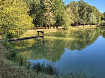
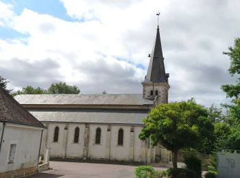
• Saint-Martin-des-Bois - Entre plateau et vallée - 18.1km 225m 4h10 (30mn) - 2019 07 21
![Randonnée Marche Valencisse - Circuit n°4 de Moulineuf - Photo](https://media.geolcdn.com/t/350/260/ext.jpg?maxdim=2&url=https%3A%2F%2Fservices.sitytrail.com%2FGeolivesWS%2FDownloadMedia.ashx%3FTrailID%3D317925%26Media%3D17343_6.jpg)
![Marche Marche](https://static1.geolcdn.com/sitytour/trail-icons/101.png)
Km
Marche
![](/images/other/stat-length.png)
![](https://static1.geolcdn.com/siteimages/upload/files/1508320355ic_sort_den_pos_24dp.png)
![](https://static1.geolcdn.com/siteimages/upload/files/1508320355ic_sort_den_neg_24dp.png)
![](https://static1.geolcdn.com/siteimages/upload/files/16400158638029165_repeat_loop_refresh_sync_direction_icon.png)
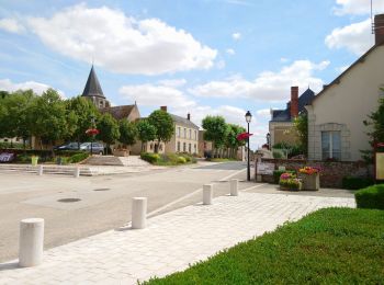
• Circuit proposé par l’association de randonnée La Molineuvoise. Départ de la mairie de Moilineuf. Retrouvez le circui...
![Randonnée V.T.T. Valloire-sur-Cisse - Vignoble et Cisse - Chouzy sur Cisse - Photo](https://media.geolcdn.com/t/350/260/ext.jpg?maxdim=2&url=https%3A%2F%2Fservices.sitytrail.com%2FGeolivesWS%2FDownloadMedia.ashx%3FTrailID%3D317889%26Media%3D17292_6.jpg)
![V.T.T. V.T.T.](https://static1.geolcdn.com/sitytour/trail-icons/202.png)
Km
V.T.T.
![](/images/other/stat-length.png)
![](https://static1.geolcdn.com/siteimages/upload/files/1508320355ic_sort_den_pos_24dp.png)
![](https://static1.geolcdn.com/siteimages/upload/files/1508320355ic_sort_den_neg_24dp.png)
![](https://static1.geolcdn.com/siteimages/upload/files/16400158638029165_repeat_loop_refresh_sync_direction_icon.png)
• Départ du parking en face de l'étang de Chouzy-sur-cisse, sortie bourg, direction Onzain. Seule difficulté 500 mètres...
![Randonnée Marche Mennetou-sur-Cher - Entre forêt et manoirs, sur le chemin des Barres - Photo](https://media.geolcdn.com/t/350/260/ext.jpg?maxdim=2&url=https%3A%2F%2Fservices.sitytrail.com%2FGeolivesWS%2FDownloadMedia.ashx%3FTrailID%3D311844%26Media%3Ddfdba42c-5716-4a31-b350-44153d9e554b.jpg)
![Marche Marche](https://static1.geolcdn.com/sitytour/trail-icons/101.png)
Km
Marche
![](/images/other/stat-length.png)
![](https://static1.geolcdn.com/siteimages/upload/files/1508320355ic_sort_den_pos_24dp.png)
![](https://static1.geolcdn.com/siteimages/upload/files/1508320355ic_sort_den_neg_24dp.png)
![](https://static1.geolcdn.com/siteimages/upload/files/16400158638029165_repeat_loop_refresh_sync_direction_icon.png)
• Au départ de la Cité Médiévale de Mennetou sur Cher, partez pour une visite complète du patrimoine de la SOLOGNE, côt...
![Randonnée Marche Mesland - MESLAND 15 km BBR 2023-09-13 - Photo](https://media.geolcdn.com/t/350/260/ext.jpg?maxdim=2&url=https%3A%2F%2Fmedia.geolcdn.com%2Ff%2Fa180ca5c-d4a2-4c00-914a-3cdd37329796.jpg)
![Marche Marche](https://static1.geolcdn.com/sitytour/trail-icons/101.png)
Km
Marche
![](/images/other/stat-length.png)
![](https://static1.geolcdn.com/siteimages/upload/files/1508320355ic_sort_den_pos_24dp.png)
![](https://static1.geolcdn.com/siteimages/upload/files/1508320355ic_sort_den_neg_24dp.png)
![](https://static1.geolcdn.com/siteimages/upload/files/16400158638029165_repeat_loop_refresh_sync_direction_icon.png)
• 28 participants
![Randonnée V.T.T. Souvigny-en-Sologne - De Souvigny-en-Sologne jusqu'aux Alicourts - Photo](https://media.geolcdn.com/t/350/260/ext.jpg?maxdim=2&url=https%3A%2F%2Fmedia.geolcdn.com%2Ff%2F1d5789d3-f1ff-44a8-a6a8-fb93048a99ef.png)
![V.T.T. V.T.T.](https://static1.geolcdn.com/sitytour/trail-icons/202.png)
Km
V.T.T.
![](/images/other/stat-length.png)
![](https://static1.geolcdn.com/siteimages/upload/files/1508320355ic_sort_den_pos_24dp.png)
![](https://static1.geolcdn.com/siteimages/upload/files/1508320355ic_sort_den_neg_24dp.png)
![](https://static1.geolcdn.com/siteimages/upload/files/16400158638029165_repeat_loop_refresh_sync_direction_icon.png)
• Belle randonnée VTT en boucle sur chemins variés partant du très beau village de Souvigny-en-Sologne et qui fait déco...
![Randonnée Marche Dhuizon - Dhuizon la Galoche 23 02 2021 3 - Photo](https://media.geolcdn.com/t/350/260/ext.jpg?maxdim=2&url=https%3A%2F%2Fmedia.geolcdn.com%2Ff%2Fb7decc0d-a259-469e-8a49-b20c84411014.jpg)
![Marche Marche](https://static1.geolcdn.com/sitytour/trail-icons/101.png)
Km
Marche
![](/images/other/stat-length.png)
![](https://static1.geolcdn.com/siteimages/upload/files/1508320355ic_sort_den_pos_24dp.png)
![](https://static1.geolcdn.com/siteimages/upload/files/1508320355ic_sort_den_neg_24dp.png)
![](https://static1.geolcdn.com/siteimages/upload/files/16400158638029165_repeat_loop_refresh_sync_direction_icon.png)
• depart salle des fêtes
![Randonnée Marche Saint-Georges-sur-Cher - Saint-Georges-sur-Cher - GRP Forêt Montrichard - 17.6km 165m 3h40 - 2023 12 27 - Photo](https://media.geolcdn.com/t/350/260/ext.jpg?maxdim=2&url=https%3A%2F%2Fmedia.geolcdn.com%2Ff%2F880c30e7-b6b6-4502-9fce-27a680430128.jpg)
![Marche Marche](https://static1.geolcdn.com/sitytour/trail-icons/101.png)
Km
Marche
![](/images/other/stat-length.png)
![](https://static1.geolcdn.com/siteimages/upload/files/1508320355ic_sort_den_pos_24dp.png)
![](https://static1.geolcdn.com/siteimages/upload/files/1508320355ic_sort_den_neg_24dp.png)
![](https://static1.geolcdn.com/siteimages/upload/files/16400158638029165_repeat_loop_refresh_sync_direction_icon.png)
• Saint-Georges-sur-Cher - GRP de Châteaux en Châteaux entre la Loire et le Cher - Forêt de Montrichard - Montrichard N...
![Randonnée Marche Authon - Authon - Monthodon - 13.6km 130m 3h00 (30mn) - 2023 07 19 - Photo](https://media.geolcdn.com/t/350/260/ext.jpg?maxdim=2&url=https%3A%2F%2Fmedia.geolcdn.com%2Ff%2F81a589f6-34b6-404b-9b26-b7d15bc13e45.jpg)
![Marche Marche](https://static1.geolcdn.com/sitytour/trail-icons/101.png)
Km
Marche
![](/images/other/stat-length.png)
![](https://static1.geolcdn.com/siteimages/upload/files/1508320355ic_sort_den_pos_24dp.png)
![](https://static1.geolcdn.com/siteimages/upload/files/1508320355ic_sort_den_neg_24dp.png)
![](https://static1.geolcdn.com/siteimages/upload/files/16400158638029165_repeat_loop_refresh_sync_direction_icon.png)
• Authon - Monthodon - 13.6km 130m 3h00 (30mn) - 2023 07 19
![Randonnée Marche Monteaux - Monteaux - Mesland Meuves GR3 - 15.4km 155m 3h30 (30mn) - 2023 07 05 - Photo](https://media.geolcdn.com/t/350/260/ext.jpg?maxdim=2&url=https%3A%2F%2Fmedia.geolcdn.com%2Ff%2F62239421-6598-407e-8eec-f8ccdd454ed1.jpg)
![Marche Marche](https://static1.geolcdn.com/sitytour/trail-icons/101.png)
Km
Marche
![](/images/other/stat-length.png)
![](https://static1.geolcdn.com/siteimages/upload/files/1508320355ic_sort_den_pos_24dp.png)
![](https://static1.geolcdn.com/siteimages/upload/files/1508320355ic_sort_den_neg_24dp.png)
![](https://static1.geolcdn.com/siteimages/upload/files/16400158638029165_repeat_loop_refresh_sync_direction_icon.png)
• Monteaux - Mesland Meuves GR3 - 15.4km 155m 3h30 (30mn) - 2023 07 05
![Randonnée Marche Veuzain-sur-Loire - Onzain - GR3 Chouzy-sur-Cisse GR353B - 24.7km 250m 5h45 (30mn) - 2022 09 18 - Photo](https://media.geolcdn.com/t/350/260/ext.jpg?maxdim=2&url=https%3A%2F%2Fmedia.geolcdn.com%2Ff%2F7be7e1ff-5ac8-493b-b202-21094f0fc660.jpg)
![Marche Marche](https://static1.geolcdn.com/sitytour/trail-icons/101.png)
Km
Marche
![](/images/other/stat-length.png)
![](https://static1.geolcdn.com/siteimages/upload/files/1508320355ic_sort_den_pos_24dp.png)
![](https://static1.geolcdn.com/siteimages/upload/files/1508320355ic_sort_den_neg_24dp.png)
![](https://static1.geolcdn.com/siteimages/upload/files/16400158638029165_repeat_loop_refresh_sync_direction_icon.png)
• Onzain - GR3 Chouzy-sur-Cisse GR353B Coulanges PR - 24.7km 250m 5h45 (30mn) - 2022 09 18
![Randonnée Marche Seigy - Seigy - GR41 Saint-Aignan - 15.3km 250m 3h50 - 2022 08 27 - Photo](https://media.geolcdn.com/t/350/260/ext.jpg?maxdim=2&url=https%3A%2F%2Fmedia.geolcdn.com%2Ff%2Fce233dd4-c4b8-4702-89cb-342a0e34bd99.jpg)
![Marche Marche](https://static1.geolcdn.com/sitytour/trail-icons/101.png)
Km
Marche
![](/images/other/stat-length.png)
![](https://static1.geolcdn.com/siteimages/upload/files/1508320355ic_sort_den_pos_24dp.png)
![](https://static1.geolcdn.com/siteimages/upload/files/1508320355ic_sort_den_neg_24dp.png)
![](https://static1.geolcdn.com/siteimages/upload/files/16400158638029165_repeat_loop_refresh_sync_direction_icon.png)
• Seigy - GR41 Saint-Aignan Château - 15.3km 250m 3h50 - 2022 08 27
![Randonnée Vélo de route Muides-sur-Loire - Itinéraire 12 - Au fil de Loire - Photo](https://media.geolcdn.com/t/350/260/ext.jpg?maxdim=2&url=https%3A%2F%2Fmedia.geolcdn.com%2Ff%2F47bcbb35-7685-4901-9cc8-e2f5b7c81fbb.jpg)
![Vélo de route Vélo de route](https://static1.geolcdn.com/sitytour/trail-icons/201.png)
Km
Vélo de route
![](/images/other/stat-length.png)
![](https://static1.geolcdn.com/siteimages/upload/files/1508320355ic_sort_den_pos_24dp.png)
![](https://static1.geolcdn.com/siteimages/upload/files/1508320355ic_sort_den_neg_24dp.png)
![](https://static1.geolcdn.com/siteimages/upload/files/16400158638029165_repeat_loop_refresh_sync_direction_icon.png)
![Randonnée Marche Mareuil-sur-Cher - Mareuil-sur-Cher - les Sables GR41 et PR - 15.7km 240m 4h00 - 2022 04 22 - Photo](https://media.geolcdn.com/t/350/260/ext.jpg?maxdim=2&url=https%3A%2F%2Fmedia.geolcdn.com%2Ff%2F9ff3c148-2d06-4258-887c-304935c254d0.jpg)
![Marche Marche](https://static1.geolcdn.com/sitytour/trail-icons/101.png)
Km
Marche
![](/images/other/stat-length.png)
![](https://static1.geolcdn.com/siteimages/upload/files/1508320355ic_sort_den_pos_24dp.png)
![](https://static1.geolcdn.com/siteimages/upload/files/1508320355ic_sort_den_neg_24dp.png)
![](https://static1.geolcdn.com/siteimages/upload/files/16400158638029165_repeat_loop_refresh_sync_direction_icon.png)
• Mareuil-sur-Cher - les Sables GR41 et PR - 15.7km 240m 4h00 - 2022 04 22
![Randonnée Marche Faverolles-sur-Cher - Montrichard - GR41 Forêt GRP - 13.9km 220m 3h30 - 2022 03 03 - Photo](https://media.geolcdn.com/t/350/260/ext.jpg?maxdim=2&url=https%3A%2F%2Fmedia.geolcdn.com%2Ff%2Fe0906f58-3286-4bdf-8af8-a43f3b5ae1bb.jpg)
![Marche Marche](https://static1.geolcdn.com/sitytour/trail-icons/101.png)
Km
Marche
![](/images/other/stat-length.png)
![](https://static1.geolcdn.com/siteimages/upload/files/1508320355ic_sort_den_pos_24dp.png)
![](https://static1.geolcdn.com/siteimages/upload/files/1508320355ic_sort_den_neg_24dp.png)
![](https://static1.geolcdn.com/siteimages/upload/files/16400158638029165_repeat_loop_refresh_sync_direction_icon.png)
• Montrichard - GR41 Forêt GRP - 13.9km 220m 3h30 - 2022 03 03
![Randonnée A pied Villiers-sur-Loir - Circuit des Côteaux - Photo](https://media.geolcdn.com/t/350/260/ext.jpg?maxdim=2&url=https%3A%2F%2Fmedia.geolcdn.com%2Ff%2F25cb373c-e85b-47b3-b4c8-0c4c4213b15c.jpeg)
![A pied A pied](https://static1.geolcdn.com/sitytour/trail-icons/100.png)
Km
A pied
![](/images/other/stat-length.png)
![](https://static1.geolcdn.com/siteimages/upload/files/1508320355ic_sort_den_pos_24dp.png)
![](https://static1.geolcdn.com/siteimages/upload/files/1508320355ic_sort_den_neg_24dp.png)
![](https://static1.geolcdn.com/siteimages/upload/files/16400158638029165_repeat_loop_refresh_sync_direction_icon.png)
• Randonnée créée par Mairie de Villiers-sur-Loir (FR-41). Symbole: blue_bar
![Randonnée A pied Huisseau-sur-Cosson - Château de Saumery - Photo](https://media.geolcdn.com/t/350/260/ext.jpg?maxdim=2&url=https%3A%2F%2Fmedia.geolcdn.com%2Ff%2Fbedd08a6-6d93-4dd0-95d2-3ce3489a580d.jpeg)
![A pied A pied](https://static1.geolcdn.com/sitytour/trail-icons/100.png)
Km
A pied
![](/images/other/stat-length.png)
![](https://static1.geolcdn.com/siteimages/upload/files/1508320355ic_sort_den_pos_24dp.png)
![](https://static1.geolcdn.com/siteimages/upload/files/1508320355ic_sort_den_neg_24dp.png)
![](https://static1.geolcdn.com/siteimages/upload/files/16400158638029165_repeat_loop_refresh_sync_direction_icon.png)
• Randonnée créée par CDRP41. Symbole: yellow dot
![Randonnée A pied Huisseau-sur-Cosson - Château de Nanteuil - Photo](https://media.geolcdn.com/t/350/260/ext.jpg?maxdim=2&url=https%3A%2F%2Fmedia.geolcdn.com%2Ff%2Fdce1a92a-5c09-4ef3-9a03-84d0153c372d.jpeg)
![A pied A pied](https://static1.geolcdn.com/sitytour/trail-icons/100.png)
Km
A pied
![](/images/other/stat-length.png)
![](https://static1.geolcdn.com/siteimages/upload/files/1508320355ic_sort_den_pos_24dp.png)
![](https://static1.geolcdn.com/siteimages/upload/files/1508320355ic_sort_den_neg_24dp.png)
![](https://static1.geolcdn.com/siteimages/upload/files/16400158638029165_repeat_loop_refresh_sync_direction_icon.png)
• Randonnée créée par CDRP41. Symbole: yellow bar
![Randonnée A pied Huisseau-sur-Cosson - La Plaine des Landes - Photo](https://media.geolcdn.com/t/350/260/ext.jpg?maxdim=2&url=https%3A%2F%2Fmedia.geolcdn.com%2Ff%2Fbedd08a6-6d93-4dd0-95d2-3ce3489a580d.jpeg)
![A pied A pied](https://static1.geolcdn.com/sitytour/trail-icons/100.png)
Km
A pied
![](/images/other/stat-length.png)
![](https://static1.geolcdn.com/siteimages/upload/files/1508320355ic_sort_den_pos_24dp.png)
![](https://static1.geolcdn.com/siteimages/upload/files/1508320355ic_sort_den_neg_24dp.png)
![](https://static1.geolcdn.com/siteimages/upload/files/16400158638029165_repeat_loop_refresh_sync_direction_icon.png)
• Randonnée créée par CDRP41. Symbole: yellow bar
![Randonnée Marche Saint-Georges-sur-Cher - Saint-Georges-sur-Cher - la Rabotière - 5.9km 50m 1h25 - 2021 12 26 - Photo](https://media.geolcdn.com/t/350/260/ext.jpg?maxdim=2&url=https%3A%2F%2Fmedia.geolcdn.com%2Ff%2Fbf0f4dfb-3021-439f-aae4-efd12cf3a4f1.jpg)
![Marche Marche](https://static1.geolcdn.com/sitytour/trail-icons/101.png)
Km
Marche
![](/images/other/stat-length.png)
![](https://static1.geolcdn.com/siteimages/upload/files/1508320355ic_sort_den_pos_24dp.png)
![](https://static1.geolcdn.com/siteimages/upload/files/1508320355ic_sort_den_neg_24dp.png)
![](https://static1.geolcdn.com/siteimages/upload/files/16400158638029165_repeat_loop_refresh_sync_direction_icon.png)
• Saint-Georges-sur-Cher - la Rabotière - 5.9km 50m 1h25 - 2021 12 26
20 randonnées affichées sur 2473
Application GPS de randonnée GRATUITE
Activités
Régions proches
- Angé
- Areines
- Artins
- Autainville
- Authon
- Avaray
- Averdon
- Azé
- Baillou
- Bauzy
- Beauce la Romaine
- Beauchêne
- Billy
- Binas
- Blois
- Boisseau
- Bonneveau
- Bouffry
- Boursay
- Bracieux
- Brévainville
- Briou
- Busloup
- Candé-sur-Beuvron
- Cellé
- Cellettes
- Chailles
- Chambord
- Champigny-en-Beauce
- Chaon
- Châteauvieux
- Châtillon-sur-Cher
- Châtres-sur-Cher
- Chaumont-sur-Loire
- Chaumont-sur-Tharonne
- Chauvigny-du-Perche
- Chémery
- Cheverny
- Chissay-en-Touraine
- Chitenay
- Choue
- Choussy
- Conan
- Cormenon
- Cormeray
- Couddes
- Couëtron-au-Perche
- Couffy
- Coulommiers-la-Tour
- Cour-Cheverny
- Cour-sur-Loire
- Courbouzon
- Courmemin
- Crouy-sur-Cosson
- Crucheray
- Danzé
- Dhuizon
- Droué
- Épiais
- Épuisay
- Faverolles-sur-Cher
- Faye
- Fontaine-les-Coteaux
- Fontaines-en-Sologne
- Fortan
- Fossé
- Françay
- Fresnes
- Fréteval
- Gièvres
- Gombergean
- Gy-en-Sologne
- Herbault
- Houssay
- Huisseau-en-Beauce
- Huisseau-sur-Cosson
- Josnes
- La Chapelle-Enchérie
- La Chapelle-Montmartin
- La Chapelle-Saint-Martin-en-Plaine
- La Chapelle-Vendômoise
- La Chapelle-Vicomtesse
- La Chaussée-Saint-Victor
- La Ferté-Beauharnais
- La Ferté-Imbault
- La Ferté-Saint-Cyr
- La Madeleine-Villefrouin
- La Marolle-en-Sologne
- La Ville-aux-Clercs
- Lamotte-Beuvron
- Lancé
- Lancôme
- Landes-le-Gaulois
- Langon-sur-Cher
- Lassay-sur-Croisne
- Lavardin
- Le Controis-en-Sologne
- Le Gault-du-Perche
- Le Plessis-Dorin
- Le Plessis-l'Échelle
- Le Temple
- Les Hayes
- Les Montils
- Les Roches-l'Évêque
- Lestiou
- Lignières
- Lisle
- Loreux
- Lorges
- Lunay
- Maray
- Marchenoir
- Marcilly-en-Beauce
- Marcilly-en-Gault
- Mareuil-sur-Cher
- Marolles
- Maslives
- Maves
- Mazangé
- Méhers
- Menars
- Mennetou-sur-Cher
- Mer
- Mesland
- Meslay
- Meusnes
- Millançay
- Mondoubleau
- Mont-près-Chambord
- Monteaux
- Monthou-sur-Bièvre
- Monthou-sur-Cher
- Montlivault
- Montoire-sur-le-Loir
- Montrichard Val de Cher
- Montrieux-en-Sologne
- Morée
- Muides-sur-Loire
- Mur-de-Sologne
- Naveil
- Neung-sur-Beuvron
- Neuvy
- Nouan-le-Fuzelier
- Nourray
- Noyers-sur-Cher
- Oisly
- Orçay
- Oucques-la-Nouvelle
- Périgny
- Pezou
- Pierrefitte-sur-Sauldre
- Pontlevoy
- Pouillé
- Pray
- Prunay-Cassereau
- Pruniers-en-Sologne
- Rahart
- Renay
- Rilly-sur-Loire
- Rocé
- Romilly
- Romorantin-Lanthenay
- Rougeou
- Ruan-sur-Egvonne
- Saint-Aignan
- Saint-Amand-Longpré
- Saint-Arnoult
- Saint-Bohaire
- Saint-Claude-de-Diray
- Saint-Denis-sur-Loire
- Saint-Dyé-sur-Loire
- Saint-Étienne-des-Guérets
- Saint-Firmin-des-Prés
- Saint-Georges-sur-Cher
- Saint-Gervais-la-Forêt
- Saint-Hilaire-la-Gravelle
- Saint-Jacques-des-Guérets
- Saint-Jean-Froidmentel
- Saint-Julien-de-Chédon
- Saint-Julien-sur-Cher
- Saint-Laurent-Nouan
- Saint-Laurent-des-Bois
- Saint-Loup
- Saint-Lubin-en-Vergonnois
- Saint-Martin-des-Bois
- Saint-Ouen
- Saint-Rimay
- Saint-Romain-sur-Cher
- Saint-Sulpice-de-Pommeray
- Saint-Viâtre
- Sainte-Anne
- Salbris
- Sambin
- Santenay
- Sargé-sur-Braye
- Sasnières
- Sassay
- Savigny-sur-Braye
- Seigy
- Selles-Saint-Denis
- Selles-sur-Cher
- Selommes
- Séris
- Seur
- Soings-en-Sologne
- Souesmes
- Sougé
- Souvigny-en-Sologne
- Suèvres
- Talcy
- Ternay
- Theillay
- Thésée
- Thoré-la-Rochette
- Thoury
- Tour-en-Sologne
- Trôo
- Valencisse
- Vallée-de-Ronsard
- Vallières-les-Grandes
- Valloire-sur-Cisse
- Veilleins
- Vendôme
- Vernou-en-Sologne
- Veuzain-sur-Loire
- Vievy-le-Rayé
- Villavard
- Villebarou
- Villebout
- Villechauve
- Villedieu-le-Château
- Villefranche-sur-Cher
- Villefrancœur
- Villeherviers
- Villeny
- Villeporcher
- Villerable
- Villerbon
- Villermain
- Villiers-sur-Loir
- Villiersfaux
- Vineuil
- Vouzon
- Yvoy-le-Marron