Randonnée Marche Guebwiller - Sandgrube - Murbach 14/11/2019 - Photo

Sandgrube - Murbach 14/11/2019

 Richard68500
Richard68500

Utilisateur

© OpenStreetMap contributors
Longueur
Longueur
13,6 km
Altitude max
Altitude max
677 m
Dénivelé positif
Dénivelé positif
637 m
Km-Effort
Km-Effort  
22 km
Altitude min
Altitude min
310 m
Dénivelé négatif
Dénivelé négatif
639 m
Boucle
Boucle
Oui
Date de création :
2019-11-14 08:02:24.63
Dernière modification :
2022-03-18 14:05:12.144

(0 Avis)

Marche
Marche
4h23
Difficulté : Facile

Scannez ce code QR pour ouvrir la randonnée dans l'application SityTrail

Application GPS de randonnée GRATUITE

Logo SityTrail SityTrail

IGN / Instituts géographiques

Télécharger SityTrail sur l'App Store Télécharger SityTrail sur Google Play

Logo SityTrail SityTrail World

Le monde est à vous

Télécharger SityTrail sur l'App Store Télécharger SityTrail sur Google Play Télécharger SityTrail sur Huawei AppGallery

À propos

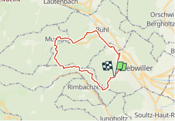
Randonnée Marche de 13,6 km à découvrir à Grand Est, Haut-Rhin, Guebwiller. Cette randonnée est proposée par Richard68500.

Description

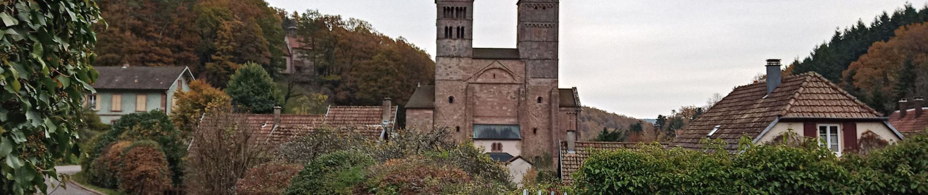
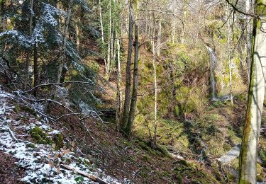
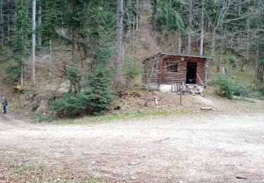
Départ de la "Sandgrube à Guewiller. L'abbaye de Murbach est située en Alsace, au fond de la vallée vosgienne de Guebwiller après la commune de Buhl, où une bifurcation mène vers le vallon de Murbach. Depuis ce site sont visibles les deux hautes tours de grès, vestiges d'une célèbre abbaye romane.  

Profil altimétrique

Photos

Localisation

Pays :
France
Région :
Grand Est
Département/Province :
Haut-Rhin
Commune :
Guebwiller
Localité :
Unknown
Départ:(UTM)
365292 ; 5307305 (32T) N.

Randonnées à proximité

Randonnée Marche Soultz-Haut-Rhin - Rando Marcheurs..04/04_2025 - Photo
Marche
boubou68

Marche

Très difficile
Soultz-Haut-Rhin, Grand Est, Haut-Rhin, France
21 km | 35 km-effort
4h 42min
Oui
Randonnée Marche Jungholtz - Rando Retrouvailles...01/03/2024.par Jean Marc - Photo
Marche
boubou68

Marche

Très difficile
Jungholtz, Grand Est, Haut-Rhin, France
11,3 km | 19,2 km-effort
1h 35min
Oui
Randonnée Marche Murbach - La
Marche
boubou68

Marche

Très difficile
Murbach, Grand Est, Haut-Rhin, France
14,7 km | 28 km-effort
4h 3min
Oui
Randonnée Marche Murbach - Murbach - Photo
Marche
oscar1

Marche

Difficile
Murbach, Grand Est, Haut-Rhin, France
15,4 km | 25 km-effort
4h 25min
Oui
Randonnée Marche Soultz-Haut-Rhin - Rando avec 0mar et Mouloud..18/02/2023 - Photo
Marche
boubou68

Marche

Très difficile
Soultz-Haut-Rhin, Grand Est, Haut-Rhin, France
12 km | 20 km-effort
3h 9min
Oui
Randonnée Marche Orschwihr - Boucle pour Soultzmatt - Photo
Marche
GuyVachet

Marche

Moyen
Orschwihr, Grand Est, Haut-Rhin, France
12,4 km | 16,5 km-effort
4h 4min
Oui
Randonnée Marche Soultz-Haut-Rhin - Wuenheim -  Kohlschlag  (18/03/2021) - Photo
Marche
Richard68500

Marche

Moyen
Soultz-Haut-Rhin, Grand Est, Haut-Rhin, France
15,9 km | 26 km-effort
4h 8min
Oui
Randonnée Marche Buhl - Wolfsgrube (4/3/2021) - Photo
Marche
Richard68500

Marche

Moyen
Buhl, Grand Est, Haut-Rhin, France
12 km | 19 km-effort
3h 39min
Oui
Randonnée Marche Guebwiller - Col du Dreibannstein (25/02/2021) - Photo
Marche
Richard68500

Marche

Moyen
Guebwiller, Grand Est, Haut-Rhin, France
12 km | 17,5 km-effort
3h 42min
Oui


Fermer
Mes abonnements