Randonnée Marche Vingrau - chemin des contrebandiers - Photo
 mickael66600
mickael66600

Utilisateur

© OpenStreetMap contributors
Longueur
Longueur
16,4 km
Altitude max
Altitude max
551 m
Dénivelé positif
Dénivelé positif
490 m
Km-Effort
Km-Effort  
23 km
Altitude min
Altitude min
143 m
Dénivelé négatif
Dénivelé négatif
491 m
Boucle
Boucle
Oui
Date de création :
2014-12-10 00:00:00.0
Dernière modification :
2014-12-10 00:00:00.0

(0 Avis)

Marche
Marche
3h46
Difficulté : Facile

Scannez ce code QR pour ouvrir la randonnée dans l'application SityTrail

Application GPS de randonnée GRATUITE

Logo SityTrail SityTrail

IGN / Instituts géographiques

Télécharger SityTrail sur l'App Store Télécharger SityTrail sur Google Play

Logo SityTrail SityTrail World

Le monde est à vous

Télécharger SityTrail sur l'App Store Télécharger SityTrail sur Google Play Télécharger SityTrail sur Huawei AppGallery

À propos

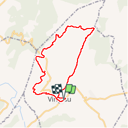
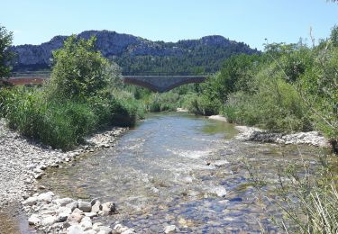
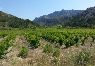
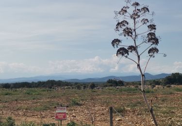
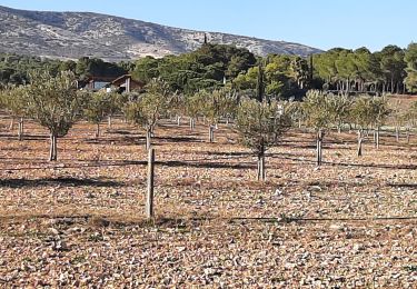
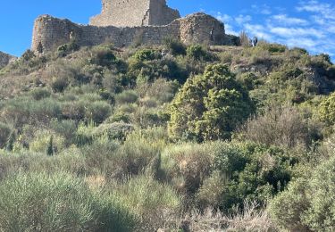
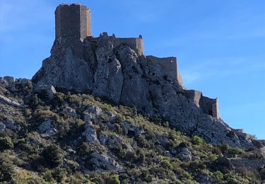
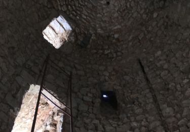
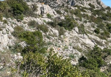
Randonnée Marche de 16,4 km à découvrir à Occitanie, Pyrénées-Orientales, Vingrau. Cette randonnée est proposée par mickael66600.

Description


bien

Profil altimétrique

Photos

Localisation

Pays :
France
Région :
Occitanie
Département/Province :
Pyrénées-Orientales
Commune :
Vingrau
Localité :
Unknown
Départ:(Dec)
Départ:(UTM)
482175 ; 4744009 (31T) N.

Randonnées à proximité

Randonnée Marche Tautavel - Tautavel chemin des bacs - Photo
Marche
jcmartin

Marche

Facile
(3)
Tautavel, Occitanie, Pyrénées-Orientales, France
9,5 km | 12,4 km-effort
2h 30min
Oui
Randonnée Marche Vingrau - Chemin des Contrebandiers Vingrau variante - Photo
Marche
force

Marche

Moyen
(2)
Vingrau, Occitanie, Pyrénées-Orientales, France
10,4 km | 16 km-effort
3h 30min
Oui
Randonnée Marche Vingrau - Vingrau - Photo
Marche
GUIDE
Ada11

Marche

Moyen
Vingrau, Occitanie, Pyrénées-Orientales, France
15,5 km | 22 km-effort
4h 20min
Oui
Randonnée Marche Espira-de-l'Agly - espira montpins - Photo
Marche
66Gribouille83

Marche

Moyen
Espira-de-l'Agly, Occitanie, Pyrénées-Orientales, France
9,2 km | 11,3 km-effort
2h 48min
Oui
Randonnée Marche Paziols - Paziols château d’aguilra - Photo
Marche
ombrabella

Marche

Très facile
Paziols, Occitanie, Aude, France
15,1 km | 18,8 km-effort
4h 4min
Oui
Randonnée Marche Tuchan - 20211007 Tuchan-Padern-Queribus-Cucugnan - Photo
Marche
ThonyM

Marche

Moyen
Tuchan, Occitanie, Aude, France
25 km | 37 km-effort
5h 58min
Non
Randonnée Marche Tautavel - TAUTAVEL la Tour del Far A/R - Photo
Marche
MarieFrancoise

Marche

Moyen
Tautavel, Occitanie, Pyrénées-Orientales, France
6,3 km | 11,4 km-effort
3h 55min
Oui
Randonnée Marche Tautavel - Tautavel -Torre del Far - Photo
Marche
robertperello

Marche

Moyen
(1)
Tautavel, Occitanie, Pyrénées-Orientales, France
9,5 km | 15,4 km-effort
3h 1min
Oui
Randonnée Marche Tautavel - La torre del far Tautavel - Photo
Marche
ombrabella

Marche

Tautavel, Occitanie, Pyrénées-Orientales, France
9,6 km | 15,6 km-effort
3h 11min
Oui


Fermer
Mes abonnements