Randonnée Marche Reinhardsmunster - 2020-06-13 Marche Ditschelkopf Schweizerberg - Photo

2020-06-13 Marche Ditschelkopf Schweizerberg

 holtzv
holtzv

Utilisateur GUIDE

© OpenStreetMap contributors
Longueur
Longueur
14,5 km
Altitude max
Altitude max
520 m
Dénivelé positif
Dénivelé positif
554 m
Km-Effort
Km-Effort  
22 km
Altitude min
Altitude min
269 m
Dénivelé négatif
Dénivelé négatif
547 m
Boucle
Boucle
Oui
Date de création :
2020-06-13 09:24:21.063
Dernière modification :
2020-06-15 10:08:21.072

(0 Avis)

Marche
Marche
4h52
Difficulté : Très facile

Scannez ce code QR pour ouvrir la randonnée dans l'application SityTrail

Application GPS de randonnée GRATUITE

Logo SityTrail SityTrail

IGN / Instituts géographiques

Télécharger SityTrail sur l'App Store Télécharger SityTrail sur Google Play

Logo SityTrail SityTrail World

Le monde est à vous

Télécharger SityTrail sur l'App Store Télécharger SityTrail sur Google Play Télécharger SityTrail sur Huawei AppGallery

À propos

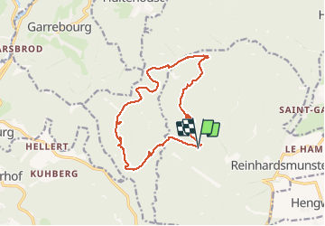
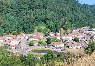
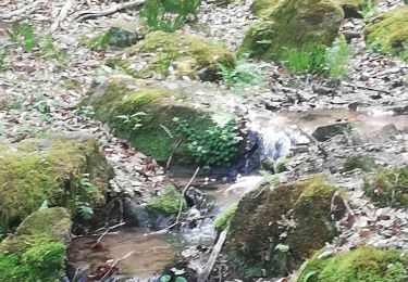
Randonnée Marche de 14,5 km à découvrir à Grand Est, Bas-Rhin, Reinhardsmunster. Cette randonnée est proposée par holtzv.

Description

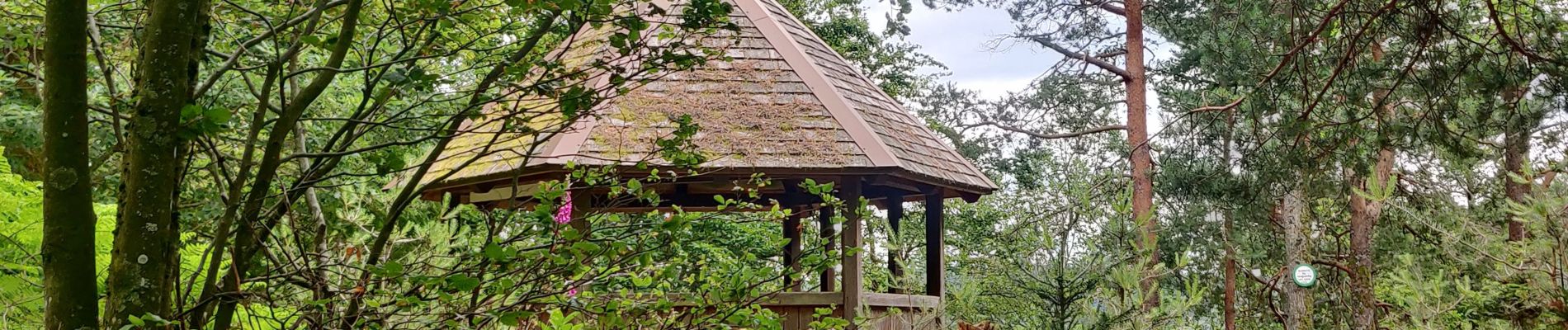
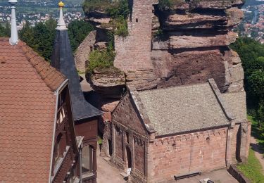
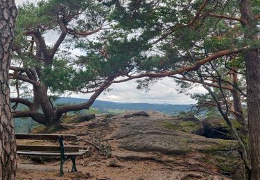
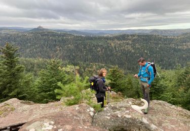
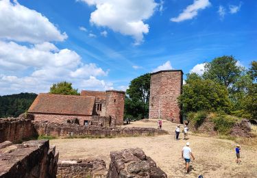
Marche en boucle depuis Reinhardsmunter avec la découverte du Schoenfels (idéal pour faire de l'escalade en block),  la M.F. de Kempel, le Pfannenfels avec la vue sur Dabo, le Kelchfels, le rocher Marguerite, la grotte des Francs-Tireurs, la gloriette du Neubaufels et le Seebfels.

Profil altimétrique

Photos

Localisation

Pays :
France
Région :
Grand Est
Département/Province :
Bas-Rhin
Commune :
Reinhardsmunster
Localité :
Unknown
Départ:(UTM)
373853 ; 5393400 (32U) N.

Randonnées à proximité

Randonnée Marche Reinhardsmunster - 2021-09-01 Marche Reinhardsmunster Haut Barr - Photo
Marche
GUIDE
holtzv

Marche

Très difficile
Reinhardsmunster, Grand Est, Bas-Rhin, France
21 km | 32 km-effort
6h 39min
Oui
Randonnée Marche Reinhardsmunster - 2019-08-15 Marche Schaerferplatz Geissfels Ochsenstein - Photo
Marche
GUIDE
holtzv

Marche

Très difficile
Reinhardsmunster, Grand Est, Bas-Rhin, France
15 km | 23 km-effort
4h 49min
Oui
Randonnée Marche Haegen - Haut Barr-Obersteigen-Haut Barr - Photo
Marche
edouard_bieber

Marche

Moyen
(2)
Haegen, Grand Est, Bas-Rhin, France
27 km | 40 km-effort
6h 7min
Oui
Randonnée V.T.T. Dabo - Balcon de Dabo 2010 - Photo
V.T.T.
tracegps

V.T.T.

Très difficile
(1)
Dabo, Grand Est, Moselle, France
39 km | 54 km-effort
4h 30min
Oui
Randonnée Marche Dabo - 2022-11-01 Marche Dabo et ses Rochers - Photo
Marche
GUIDE
holtzv

Marche

Très difficile
Dabo, Grand Est, Moselle, France
26 km | 38 km-effort
7h 8min
Oui
Randonnée Marche Henridorff - lutzbourg - Photo
Marche
didier cornelius

Marche

Moyen
Henridorff, Grand Est, Moselle, France
16,1 km | 23 km-effort
6h 26min
Oui
Randonnée Marche Henridorff - lutzelbourg - Photo
Marche
didier cornelius

Marche

Moyen
Henridorff, Grand Est, Moselle, France
16,8 km | 24 km-effort
4h 33min
Oui
Randonnée Marche Reinhardsmunster - Schuetzenfelsen - Photo
Marche
apa

Marche

Moyen
Reinhardsmunster, Grand Est, Bas-Rhin, France
12,4 km | 17 km-effort
3h 21min
Oui
Randonnée Marche Reinhardsmunster - table des Géants  - Photo
Marche
apa

Marche

Facile
(1)
Reinhardsmunster, Grand Est, Bas-Rhin, France
10,4 km | 14,7 km-effort
3h 6min
Oui


Fermer
Mes abonnements