Randonnée Marche Saint-Dié-des-Vosges - ormont - Photo
 lacote
lacote

Utilisateur

© OpenStreetMap contributors
Longueur
Longueur
13,5 km
Altitude max
Altitude max
888 m
Dénivelé positif
Dénivelé positif
519 m
Km-Effort
Km-Effort  
20 km
Altitude min
Altitude min
516 m
Dénivelé négatif
Dénivelé négatif
521 m
Boucle
Boucle
Oui
Date de création :
2020-06-16 07:10:18.752
Dernière modification :
2020-06-16 14:03:23.696

(1 Avis)

Marche
Marche
6h52
Difficulté : Facile

Scannez ce code QR pour ouvrir la randonnée dans l'application SityTrail

Application GPS de randonnée GRATUITE

Logo SityTrail SityTrail

IGN / Instituts géographiques

Télécharger SityTrail sur l'App Store Télécharger SityTrail sur Google Play

Logo SityTrail SityTrail World

Le monde est à vous

Télécharger SityTrail sur l'App Store Télécharger SityTrail sur Google Play Télécharger SityTrail sur Huawei AppGallery

À propos

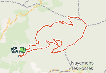
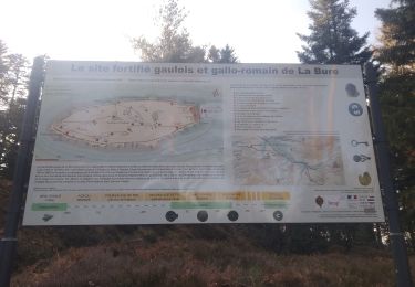
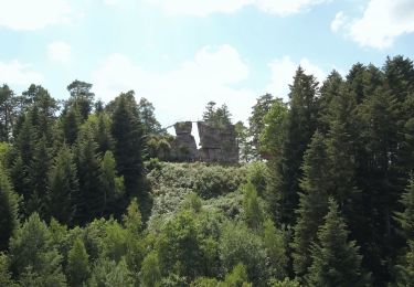
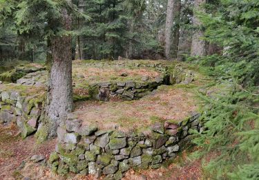
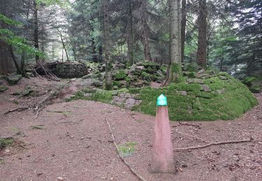
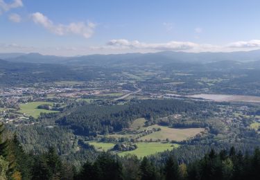
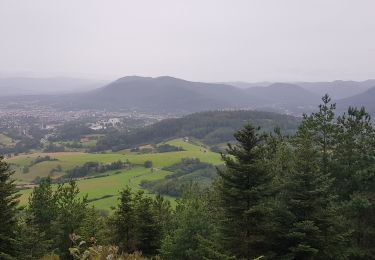
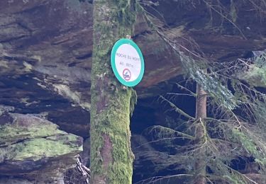
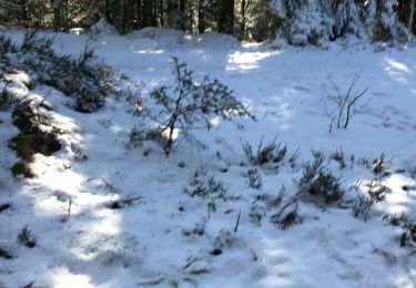
Randonnée Marche de 13,5 km à découvrir à Grand Est, Vosges, Saint-Dié-des-Vosges. Cette randonnée est proposée par lacote.

Profil altimétrique

Localisation

Pays :
France
Région :
Grand Est
Département/Province :
Vosges
Commune :
Saint-Dié-des-Vosges
Localité :
Unknown
Départ:(UTM)
349329 ; 5351781 (32U) N.

Commentaires

Veuillez vous connecter pour laisser un commentaire ou une note


Randonnées à proximité

Randonnée V.T.T. Saint-Dié-des-Vosges - vtt la voivre La Bure 29-03-19 - Photo
V.T.T.
vathi54

V.T.T.

Difficile
(2)
Saint-Dié-des-Vosges, Grand Est, Vosges, France
20 km | 28 km-effort
2h 48min
Oui
Randonnée A pied Taintrux - GR de Pays de Déodatie - Photo
A pied
PRO

A pied

Facile
Taintrux, Grand Est, Vosges, France
7,9 km | 12,5 km-effort
2h 49min
Non
Randonnée Marche Saint-Dié-des-Vosges - 2019-03-07 Marche Montée des Schlitteurs - Photo
Marche
GUIDE
holtzv

Marche

Très facile
Saint-Dié-des-Vosges, Grand Est, Vosges, France
11,3 km | 19,6 km-effort
4h 35min
Oui
Randonnée Marche Saint-Dié-des-Vosges - Massif de l'Ormont et ses rochers remarquables - Photo
Marche
Bart2015

Marche

Très difficile
Saint-Dié-des-Vosges, Grand Est, Vosges, France
15,9 km | 25 km-effort
5h 38min
Oui
Randonnée Marche Saint-Dié-des-Vosges - 2021-10-08 Marche St Die Metzeral Jour 1 - Photo
Marche
GUIDE
holtzv

Marche

Très difficile
Saint-Dié-des-Vosges, Grand Est, Vosges, France
26 km | 39 km-effort
7h 40min
Non
Randonnée Marche Saint-Dié-des-Vosges - Balade autour du Col de la Crenée - Photo
Marche
Jullido1

Marche

Facile
(1)
Saint-Dié-des-Vosges, Grand Est, Vosges, France
11,4 km | 17 km-effort
3h 48min
Oui
Randonnée Marche Saint-Dié-des-Vosges - Marche 15km Ormont 07-05-21 - Photo
Marche
1957

Marche

Très difficile
Saint-Dié-des-Vosges, Grand Est, Vosges, France
13,5 km | 25 km-effort
4h 3min
Oui
Randonnée Randonnée équestre Ban-de-Sapt - Boucle BanDeSapt Quatre Bornes - Photo
Randonnée équestre
GUIDE+

Randonnée équestre

Moyen
Ban-de-Sapt, Grand Est, Vosges, France
18,9 km | 26 km-effort
3h 13min
Oui
Randonnée Marche Saint-Dié-des-Vosges - Ormont 16kM - Photo
Marche
1957

Marche

Très difficile
Saint-Dié-des-Vosges, Grand Est, Vosges, France
14,6 km | 27 km-effort
5h 20min
Oui


Fermer
Mes abonnements