Randonnée Marche Tintigny - La Rando du Bian: Autour de Lahage  - Photo

La Rando du Bian: Autour de Lahage

 bian69
bian69

Utilisateur

© OpenStreetMap contributors
Longueur
Longueur
18,8 km
Altitude max
Altitude max
378 m
Dénivelé positif
Dénivelé positif
274 m
Km-Effort
Km-Effort  
22 km
Altitude min
Altitude min
292 m
Dénivelé négatif
Dénivelé négatif
274 m
Boucle
Boucle
Oui
Date de création :
2020-06-27 11:31:12.0
Dernière modification :
2020-06-28 21:58:07.736

(1 Avis)

Marche
Marche
3h58
Difficulté : Facile

Scannez ce code QR pour ouvrir la randonnée dans l'application SityTrail

Application GPS de randonnée GRATUITE

Logo SityTrail SityTrail

IGN / Instituts géographiques

Télécharger SityTrail sur l'App Store Télécharger SityTrail sur Google Play

Logo SityTrail SityTrail World

Le monde est à vous

Télécharger SityTrail sur l'App Store Télécharger SityTrail sur Google Play Télécharger SityTrail sur Huawei AppGallery

À propos

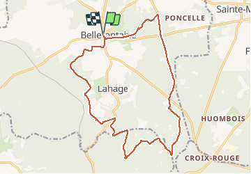
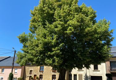
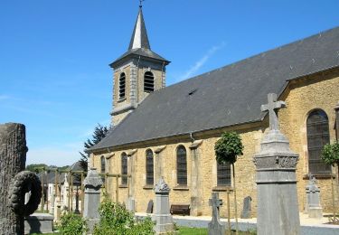
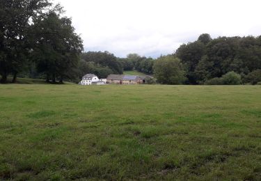
Randonnée Marche de 18,8 km à découvrir à Wallonie, Luxembourg, Tintigny. Cette randonnée est proposée par bian69.

Profil altimétrique

Photos

Localisation

Pays :
Belgique
Région :
Wallonie
Département/Province :
Luxembourg
Commune :
Tintigny
Localité :
Bellefontaine
Départ:(Dec)
Départ:(UTM)
680085 ; 5504364 (31U) N.

Commentaires

Veuillez vous connecter pour laisser un commentaire ou une note


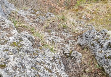
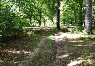
Très belle randonnée; assez diversifée. Attention néanmoins, il y a un problème dans le tracé GPX. En effet, au niveau du km 13.3 - 13.4, à la sortie du lieudit "Le Trite", la randonnée pique tout droit à travers une bute qui n'est pas forcément franchissable en sécurité. Une solution est de redescendre la route jusqu'au Rau de Lahage et d'emprunter un sentier forestier remontant la pente et raccrochant sur le tracé original. Une solution alternative (non testée mais probablement plus optimale) est de remonter la route et de piquer sur la gauche avant d'arriver au moulin de Lahage.


Randonnées à proximité

Randonnée Marche Tintigny - À l’ombre de la forêt gaumaise  - Photo
Marche
Vagabond gaumardennais

Marche

Facile
(4)
Tintigny, Wallonie, Luxembourg, Belgique
14,6 km | 17 km-effort
2h 49min
Oui
Randonnée Marche Chiny - 1-Prouvy-8Km - Photo
Marche
Dom62

Marche

Facile
(1)
Chiny, Wallonie, Luxembourg, Belgique
8,3 km | 9,7 km-effort
2h 12min
Oui
Randonnée Marche Meix-devant-Virton - Gerouville 060723 - Photo
Marche
guyernage25

Marche

Moyen
Meix-devant-Virton, Wallonie, Luxembourg, Belgique
17,9 km | 22 km-effort
4h 28min
Oui
Randonnée Marche Meix-devant-Virton - Gerouville - Photo
Marche
BrigitteBertrand

Marche

Très difficile
Meix-devant-Virton, Wallonie, Luxembourg, Belgique
22 km | 27 km-effort
6h 3min
Oui
Randonnée A pied Tintigny - Promenade Tintigny-Han - Photo
A pied
GUIDE+

A pied

Facile
Tintigny, Wallonie, Luxembourg, Belgique
4,4 km | 5 km-effort
1h 7min
Oui
Randonnée Marche Tintigny - Bellefontaine,  Gros Cron, Baraque Payat - Photo
Marche
fdenardin

Marche

Moyen
Tintigny, Wallonie, Luxembourg, Belgique
19,2 km | 23 km-effort
4h 56min
Oui
Randonnée Marche Tintigny - Bellefontaine _ Marche Privée  - Photo
Marche
jeangulu

Marche

Facile
Tintigny, Wallonie, Luxembourg, Belgique
20 km | 24 km-effort
5h 8min
Oui
Randonnée Marche Tintigny - Bellefontaine 020720 - Photo
Marche
guyernage25

Marche

Facile
Tintigny, Wallonie, Luxembourg, Belgique
18,6 km | 23 km-effort
3h 58min
Oui
Randonnée Marche Tintigny - Lahage 15 septembre 2018 - Photo
Marche
patrismichel

Marche

Moyen
Tintigny, Wallonie, Luxembourg, Belgique
8 km | 10,2 km-effort
2h 19min
Oui


Fermer
Mes abonnements