Randonnée Marche Cavillargues - 30 - CAVILLARGUES - 17.8Km - 06h00 - D 350 m - Photo

30 - CAVILLARGUES - 17.8Km - 06h00 - D 350 m

 dansmabulle
dansmabulle

Utilisateur

© OpenStreetMap contributors
Longueur
Longueur
17,8 km
Altitude max
Altitude max
242 m
Dénivelé positif
Dénivelé positif
368 m
Km-Effort
Km-Effort  
23 km
Altitude min
Altitude min
119 m
Dénivelé négatif
Dénivelé négatif
368 m
Boucle
Boucle
Oui
Date de création :
2014-12-10 00:00:00.0
Dernière modification :
2014-12-10 00:00:00.0

(0 Avis)

Marche
Marche
4h50
Difficulté : Moyen

Scannez ce code QR pour ouvrir la randonnée dans l'application SityTrail

Application GPS de randonnée GRATUITE

Logo SityTrail SityTrail

IGN / Instituts géographiques

Télécharger SityTrail sur l'App Store Télécharger SityTrail sur Google Play

Logo SityTrail SityTrail World

Le monde est à vous

Télécharger SityTrail sur l'App Store Télécharger SityTrail sur Google Play Télécharger SityTrail sur Huawei AppGallery

À propos

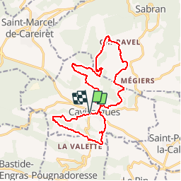
Randonnée Marche de 17,8 km à découvrir à Occitanie, Gard, Cavillargues. Cette randonnée est proposée par dansmabulle.

Description

Départ randonnée :
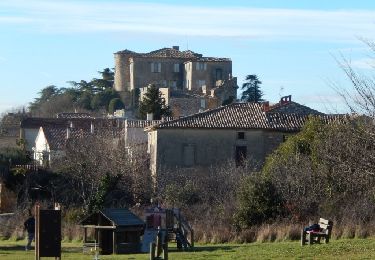
Village de Cavillargues (Gard 30) 
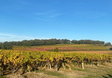
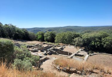
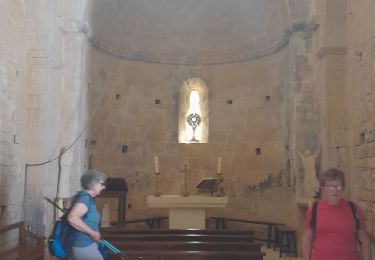
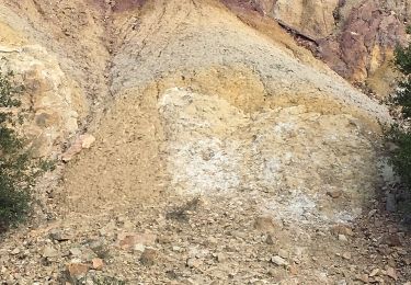
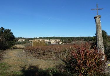
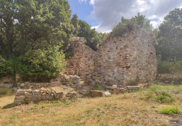
Voici deux boucles au départ de Cavillargues, la plus courte au sud (6.5km) et l'autre au nord (11km). Départ du "parking des randonneurs". Coin pique-nique possible, à la chapelle St Sépulcre. En chemin la chapelle st sépulcre, quelques croix et le moulin d'Auzigue, ainsi qu'un parcours forestier. Rando facile sur de bons chemins, quelques beaux lavoirs à visiter en cours de route.Bonne randonnée 

Profil altimétrique

Localisation

Pays :
France
Région :
Occitanie
Département/Province :
Gard
Commune :
Cavillargues
Localité :
Unknown
Départ:(Dec)
Départ:(UTM)
621475 ; 4885671 (31T) N.

Randonnées à proximité

Randonnée Marche Cavillargues - Cavillargues  - Photo
Marche
GUIDE
Roger Philippe Wallez

Marche

Très difficile
Cavillargues, Occitanie, Gard, France
22 km | 27 km-effort
7h 2min
Oui
Randonnée Marche Le Pin - Le pin , la Garbie et oppidum - Photo
Marche
jcguew

Marche

Moyen
Le Pin, Occitanie, Gard, France
6,3 km | 8,3 km-effort
2h 42min
Non
Randonnée Marche Sabran - Sabran marche vigneronne - Photo
Marche
poisson1103

Marche

Moyen
Sabran, Occitanie, Gard, France
14,3 km | 19,1 km-effort
3h 27min
Oui
Randonnée Autre activité Saint-Laurent-la-Vernède - Saint Laurent la Vernède - Photo
Autre activité
cpiton

Autre activité

Très facile
Saint-Laurent-la-Vernède, Occitanie, Gard, France
21 km | 24 km-effort
2h 48min
Non
Randonnée V.T.T. La Bastide-d'Engras - Chapelle St-Jean - La Bastide d'Engras - Photo
V.T.T.
tracegps

V.T.T.

Moyen
La Bastide-d'Engras, Occitanie, Gard, France
17,6 km | 21 km-effort
2h 0min
Oui
Randonnée Marche La Bastide-d'Engras - Chapelle St-Jean - La Bastide d'Engras - Photo
Marche
tracegps

Marche

Difficile
La Bastide-d'Engras, Occitanie, Gard, France
17,6 km | 21 km-effort
4h 30min
Oui
Randonnée V.T.T. Cavillargues - Randonnée autour de Cavillargues - Photo
V.T.T.
tracegps

V.T.T.

Moyen
Cavillargues, Occitanie, Gard, France
17,8 km | 23 km-effort
2h 0min
Oui
Randonnée Marche Cavillargues - Randonnée autour de Cavillargues - Photo
Marche
tracegps

Marche

Moyen
Cavillargues, Occitanie, Gard, France
17,8 km | 23 km-effort
5h 0min
Oui
Randonnée Marche Gaujac - Gaujac - Oppidum - Photo
Marche
rando30129

Marche

Difficile
Gaujac, Occitanie, Gard, France
11,2 km | 14,3 km-effort
2h 59min
Oui


Fermer
Mes abonnements