![](/images/other/stat-length.png)
![Randonnée Marche Houyet - Nature - Promenade de Payenne - VTT - Photo](https://media.geolcdn.com/t/1900/400/ext.pjpeg?maxdim=2&url=https%3A%2F%2Fservices.sitytrail.com%2FGeolivesWS%2FDownloadMedia.ashx%3FTrailID%3D247221%26Media%3D4a1116e4-3cc3-4f81-a279-87cb261b0cef.jpg)
Nature - Promenade de Payenne - VTT
Maison du Tourisme Famenne - Ardenne Ourthe & Lesse
Randonnées de la Maison du Tourisme Famenne - Ardenne Ourthe & Lesse PRO
![Longueur](/images/other/stat-length.png)
![Altitude max](https://static1.geolcdn.com/siteimages/upload/files/1508320355ic_sort_altitude_max_24dp.png)
![Dénivelé positif](https://static1.geolcdn.com/siteimages/upload/files/1508320355ic_sort_den_pos_24dp.png)
![Km-Effort](/images/other/stat-length.png)
![Altitude min](https://static1.geolcdn.com/siteimages/upload/files/1508320355ic_sort_altitude_min_24dp.png)
![Dénivelé négatif](https://static1.geolcdn.com/siteimages/upload/files/1508320355ic_sort_den_neg_24dp.png)
![Boucle](https://static1.geolcdn.com/siteimages/upload/files/16400158638029165_repeat_loop_refresh_sync_direction_icon.png)
![Marche](https://static1.geolcdn.com/sitytour/trail-icons/101.png)
4h18
Difficulté : Difficile
![V.T.T.](https://static1.geolcdn.com/sitytour/trail-icons/202.png)
2h30
Difficulté : Moyen
![Randonnée équestre](https://static1.geolcdn.com/sitytour/trail-icons/301.png)
2h29
Difficulté : Facile
![Scannez ce code QR pour ouvrir la randonnée dans l'application SityTrail](https://capi.geolives.com/qq0zvz2zws4bq2lad0pu/sitytour/trails/247221/qr.png?size=200)
Application GPS de randonnée GRATUITE
À propos
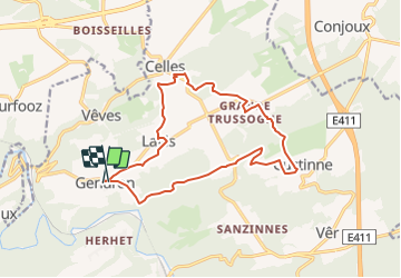
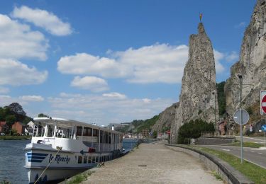
Randonnée Marche de 14,3 km à découvrir à Wallonie, Namur, Houyet. Cette randonnée est proposée par Maison du Tourisme Famenne - Ardenne Ourthe & Lesse.
Description
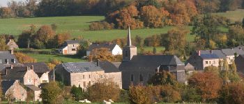
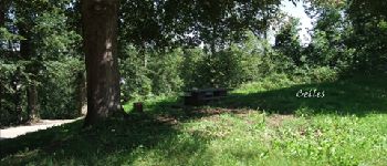
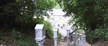
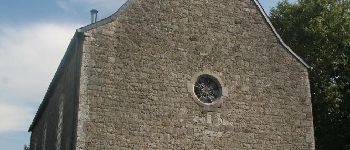
Magnifique randonnée au départ du village de Celles, un des 'Plus Beaux Villages de Wallonie”, village qui peut se targuer d'une sublime église romane, un magnifique chemin de croix et, sur ses hauteurs, l'Ermitage Saint-Hadelin qui veille sur ce charmant village. Explorez les hameaux et villages de Grande Trussogne, Payenne, Gendron et Lavis avant de revenir au village pour une petite dégustation de Saint-Hadelin (la bière!) ou la spécialité locale, le chausson cellois !
Points d'intérêt
Localisation
Commentaires
Randonnées à proximité
![Randonnée Marche Houyet - Nature - Promenade du Parc d'Ardenne à Houyet - Photo](https://media.geolcdn.com/t/375/260/ext.jpg?maxdim=2&url=https%3A%2F%2Fservices.sitytrail.com%2FGeolivesWS%2FDownloadMedia.ashx%3FTrailID%3D193546%26Media%3D0a2a8593-cf69-475f-a9b0-b2a4af4f959b.jpg)
![Marche Marche](https://static1.geolcdn.com/sitytour/trail-icons/101.png)
Marche
![](/images/other/stat-length.png)
![](https://static1.geolcdn.com/siteimages/upload/files/16400158638029165_repeat_loop_refresh_sync_direction_icon.png)
![Randonnée Marche Houyet - Houyet - Nature - Pî-sinte po tortos - Pédestre, cyclo, équestre, PMR - Photo](https://media.geolcdn.com/t/375/260/ext.jpg?maxdim=2&url=https%3A%2F%2Fservices.sitytrail.com%2FGeolivesWS%2FDownloadMedia.ashx%3FTrailID%3D193539%26Media%3D6b85272b-deee-4a79-9526-05b6bf74491c.jpg)
![Marche Marche](https://static1.geolcdn.com/sitytour/trail-icons/101.png)
Marche
![](/images/other/stat-length.png)
![](https://static1.geolcdn.com/siteimages/upload/files/16400158638029165_repeat_loop_refresh_sync_direction_icon.png)
![Randonnée Marche Houyet - La Lesse, Natura 2000 - Des sites qui valent le détour, Na07 - Photo](https://media.geolcdn.com/t/375/260/ext.jpg?maxdim=2&url=https%3A%2F%2Fservices.sitytrail.com%2FGeolivesWS%2FDownloadMedia.ashx%3FTrailID%3D188163%26Media%3Df0b29f0e-e19a-4fa8-a869-5ab27b1769d7.JPG)
![Marche Marche](https://static1.geolcdn.com/sitytour/trail-icons/101.png)
Marche
![](/images/other/stat-length.png)
![](https://static1.geolcdn.com/siteimages/upload/files/16400158638029165_repeat_loop_refresh_sync_direction_icon.png)
![Randonnée Marche Houyet - RB-Na-05-Celles - Photo](https://media.geolcdn.com/t/375/260/ext.jpg?maxdim=2&url=https%3A%2F%2Fservices.sitytrail.com%2FGeolivesWS%2FDownloadMedia.ashx%3FTrailID%3D179631%26Media%3D95d7547e-2b07-4681-8a2a-4a37901ae9c7.jpg)
![Marche Marche](https://static1.geolcdn.com/sitytour/trail-icons/101.png)
Marche
![](/images/other/stat-length.png)
![](https://static1.geolcdn.com/siteimages/upload/files/16400158638029165_repeat_loop_refresh_sync_direction_icon.png)
![Randonnée Marche Houyet - Nature - Houyet, commune royale - Photo](https://media.geolcdn.com/t/375/260/ext.jpg?maxdim=2&url=https%3A%2F%2Fservices.sitytrail.com%2FGeolivesWS%2FDownloadMedia.ashx%3FTrailID%3D166040%26Media%3D0a2a8593-cf69-475f-a9b0-b2a4af4f959b.jpg)
![Marche Marche](https://static1.geolcdn.com/sitytour/trail-icons/101.png)
Marche
![](/images/other/stat-length.png)
![](https://static1.geolcdn.com/siteimages/upload/files/16400158638029165_repeat_loop_refresh_sync_direction_icon.png)
![Randonnée Marche Houyet - RB-Na-05_Celles_via-racc-1 - Photo](https://media.geolcdn.com/t/375/260/ext.jpg?maxdim=2&url=https%3A%2F%2Fservices.sitytrail.com%2FGeolivesWS%2FDownloadMedia.ashx%3FTrailID%3D213753%26Media%3D8bab1d47-4651-4050-8b88-78bf90d52eb5.jpg)
![Marche Marche](https://static1.geolcdn.com/sitytour/trail-icons/101.png)
Marche
![](/images/other/stat-length.png)
![](https://static1.geolcdn.com/siteimages/upload/files/16400158638029165_repeat_loop_refresh_sync_direction_icon.png)
![Randonnée Marche Houyet - Nature & patrimoine à Celles, un des Plus Beaux Villages de Wallonie - Photo](https://media.geolcdn.com/t/375/260/ext.jpg?maxdim=2&url=https%3A%2F%2Fmedia.geolcdn.com%2Ff%2Fac9d387c-3f8d-401d-bffe-044b71ce3eff.jpg)
![Marche Marche](https://static1.geolcdn.com/sitytour/trail-icons/101.png)
Marche
![](/images/other/stat-length.png)
![](https://static1.geolcdn.com/siteimages/upload/files/16400158638029165_repeat_loop_refresh_sync_direction_icon.png)
![Randonnée Marche Houyet - Nature et patrimoine - Promenade du Château de Vêves - Photo](https://media.geolcdn.com/t/375/260/ext.jpg?maxdim=2&url=https%3A%2F%2Fservices.sitytrail.com%2FGeolivesWS%2FDownloadMedia.ashx%3FTrailID%3D193554%26Media%3D89a5bf6a-392e-4b4e-aa1f-d6a80dc2ba50.JPG)
![Marche Marche](https://static1.geolcdn.com/sitytour/trail-icons/101.png)
Marche
![](/images/other/stat-length.png)
![](https://static1.geolcdn.com/siteimages/upload/files/16400158638029165_repeat_loop_refresh_sync_direction_icon.png)
![Randonnée Marche Houyet - RL-GG-20_Gendron_Dinant - Photo](https://media.geolcdn.com/t/375/260/ext.jpg?maxdim=2&url=https%3A%2F%2Fmedia.geolcdn.com%2Ff%2Fab939ff5-5b33-43fd-b036-e462abc33a68.jpg)
![Marche Marche](https://static1.geolcdn.com/sitytour/trail-icons/101.png)
Marche
![](/images/other/stat-length.png)
![](https://static1.geolcdn.com/siteimages/upload/files/16400158638029165_repeat_loop_refresh_sync_direction_icon.png)
dommage que le fléchage n'est pas à la hauteur
le fléchage et le guide ne se suivent pas toujours.On s'est très souvent trompés de chemin.
Très bien.