![](/images/other/stat-length.png)
![Randonnée Marche Somme-Leuze - RB-Na-04_Nettinne_via-racc - Photo](https://media.geolcdn.com/t/1900/400/ext.pjpeg?maxdim=2&url=https%3A%2F%2Fservices.sitytrail.com%2FGeolivesWS%2FDownloadMedia.ashx%3FTrailID%3D252171%26Media%3Dc5d56e41-95c8-4990-91cc-1ec916893014.jpg)
RB-Na-04_Nettinne_via-racc
GR Rando
Randonnez sur et autour des GR ® wallons (Sentiers de Grande Randonnée). PRO
![Longueur](/images/other/stat-length.png)
![Altitude max](https://static1.geolcdn.com/siteimages/upload/files/1508320355ic_sort_altitude_max_24dp.png)
![Dénivelé positif](https://static1.geolcdn.com/siteimages/upload/files/1508320355ic_sort_den_pos_24dp.png)
![Km-Effort](/images/other/stat-length.png)
![Altitude min](https://static1.geolcdn.com/siteimages/upload/files/1508320355ic_sort_altitude_min_24dp.png)
![Dénivelé négatif](https://static1.geolcdn.com/siteimages/upload/files/1508320355ic_sort_den_neg_24dp.png)
![Boucle](https://static1.geolcdn.com/siteimages/upload/files/16400158638029165_repeat_loop_refresh_sync_direction_icon.png)
![Marche](https://static1.geolcdn.com/sitytour/trail-icons/101.png)
5h03
Difficulté : Facile
![Scannez ce code QR pour ouvrir la randonnée dans l'application SityTrail](https://capi.geolives.com/qq0zvz2zws4bq2lad0pu/sitytour/trails/252171/qr.png?size=200)
Application GPS de randonnée GRATUITE
À propos
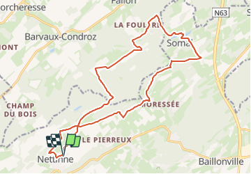
Randonnée Marche de 18,7 km à découvrir à Wallonie, Namur, Somme-Leuze. Cette randonnée est proposée par GR Rando.
Description
Nettinne – Somal – Moressée – Nettinne
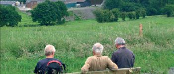
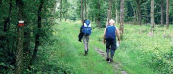
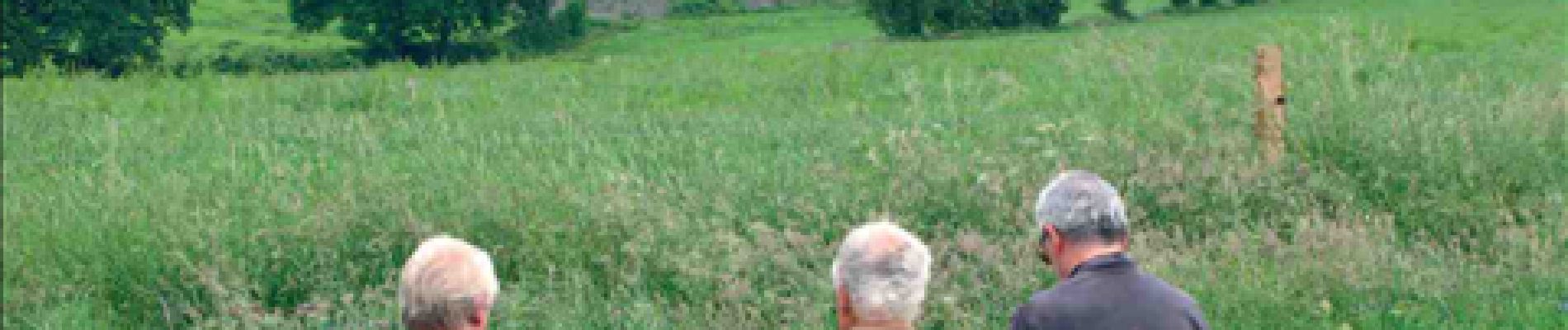
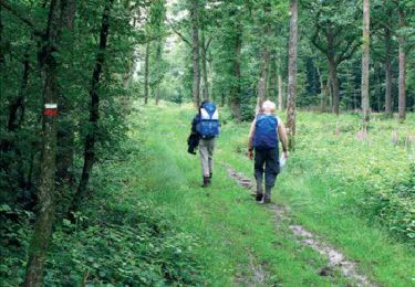
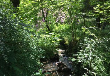
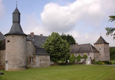
Cet itinéraire vous promène dans une Famenne fort paisible. Alors que le Condroz voisin, volontiers aristocratique, s’enorgueillit d’un chapelet de châteaux, vous écouvrirez, ici, un coin bien discret. Au détour d’un sentier, on côtoie bien un vieux domaine ; au hasard d’une clairière, on entrevoit les toitures d’un château; mais la randonnée se déroule surtout à l’écart de lieux fréquentés et de sites courus. En dehors de Nettinne, vous traverserez un seul petit village et frôlerez deux hameaux. Vous naviguerez donc au cœur de la nature, à travers forêts et prairies. Pas le moindre bistrot en cours de route!
Cartographie et documentation:
Carte IGN au 1 : 20 000, 54/3-4 « Maffe – Somme-Leuze ».
Carte topographique au 1 : 25 000 « Somme–Leuze », réalisée par l’IGN et éditée par le S.I. et du Tourisme de la commune de Somme–Leuze.
Topo-guide du GR 577: "Tour de la Famenne" : Marche – Rochefort – Ciney – Durbuy – Hotton ».
Topo-guide du GR 575/576 "A travers le Condroz" : Ciney - Spontin - Mozet - Huy - Esneux - Remouchanps - Hamois - Les Avins - Ciney
Où se désaltérer et se restaurer :
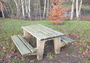
Près du lieu de départ en vue d'un réconfort après la balade : "Délices Fermiers" où l'on peut acheter de quoi consommer en terrasse à partir de 14 h 30. Pour les groupes, il est possible de commander à l'avance des sandwiches garnis. 0474 200 112 info@délicesfermiers.be
Localisation
Commentaires
Randonnées à proximité
![Randonnée Marche Hamois - HAMOIS- Scy (Mohiville)- Promenade du Berceau du Bocq - Photo](https://media.geolcdn.com/t/375/260/ext.jpg?maxdim=2&url=https%3A%2F%2Fservices.sitytrail.com%2FGeolivesWS%2FDownloadMedia.ashx%3FTrailID%3D250701%26Media%3D514f4968-57f7-4b3e-aef8-c121b3f2a3eb.jpg)
![Marche Marche](https://static1.geolcdn.com/sitytour/trail-icons/101.png)
Marche
![](/images/other/stat-length.png)
![](https://static1.geolcdn.com/siteimages/upload/files/16400158638029165_repeat_loop_refresh_sync_direction_icon.png)
![Randonnée Marche Somme-Leuze - RB-Na-04_Nettinne - Photo](https://media.geolcdn.com/t/375/260/ext.jpg?maxdim=2&url=https%3A%2F%2Fservices.sitytrail.com%2FGeolivesWS%2FDownloadMedia.ashx%3FTrailID%3D179630%26Media%3D2ccb572a-0d57-4973-8026-20e9cbf116e6.jpg)
![Marche Marche](https://static1.geolcdn.com/sitytour/trail-icons/101.png)
Marche
![](/images/other/stat-length.png)
![](https://static1.geolcdn.com/siteimages/upload/files/16400158638029165_repeat_loop_refresh_sync_direction_icon.png)
![Randonnée Marche Somme-Leuze - Sentiers d'Art : Boucle16 - Somal - Photo](https://media.geolcdn.com/t/375/260/ext.jpg?maxdim=2&url=https%3A%2F%2Fmedia.geolcdn.com%2Ff%2Feae3e58a-34ce-48df-b7e8-8306bccbd31f.JPG)
![Marche Marche](https://static1.geolcdn.com/sitytour/trail-icons/101.png)
Marche
![](/images/other/stat-length.png)
![](https://static1.geolcdn.com/siteimages/upload/files/16400158638029165_repeat_loop_refresh_sync_direction_icon.png)
![Randonnée A pied Somme-Leuze - Sentiers d'Art : Boucle 17 - Heure - Photo](https://media.geolcdn.com/t/375/260/ext.jpg?maxdim=2&url=https%3A%2F%2Fmedia.geolcdn.com%2Ff%2Fd3b600c0-617d-4b9c-b782-c930c89e279c.jpg)
![A pied A pied](https://static1.geolcdn.com/sitytour/trail-icons/100.png)
A pied
![](/images/other/stat-length.png)
![](https://static1.geolcdn.com/siteimages/upload/files/16400158638029165_repeat_loop_refresh_sync_direction_icon.png)
![Randonnée Marche Havelange - Bois, Rivière et champs - Photo](https://media.geolcdn.com/t/375/260/ext.jpg?maxdim=2&url=https%3A%2F%2Fmedia.geolcdn.com%2Ff%2F71798de8-0a71-47ba-81bf-636f8514053b.jpg)
![Marche Marche](https://static1.geolcdn.com/sitytour/trail-icons/101.png)
Marche
![](/images/other/stat-length.png)
![](https://static1.geolcdn.com/siteimages/upload/files/16400158638029165_repeat_loop_refresh_sync_direction_icon.png)
![Randonnée Marche Hamois - La Promenade du Berceau du Bocq - Photo](https://media.geolcdn.com/t/375/260/ext.jpg?maxdim=2&url=https%3A%2F%2Fmedia.geolcdn.com%2Ff%2Fc1ecebef-4dce-4991-920f-3cf80ab64a6d.jpg)
![Marche Marche](https://static1.geolcdn.com/sitytour/trail-icons/101.png)
Marche
![](/images/other/stat-length.png)
![](https://static1.geolcdn.com/siteimages/upload/files/16400158638029165_repeat_loop_refresh_sync_direction_icon.png)
![Randonnée A pied Hamois - Promenade du Berceau du Bocq - Photo](https://media.geolcdn.com/t/375/260/ext.jpg?maxdim=2&url=https%3A%2F%2Fpivotmedia.tourismewallonie.be%2FOTH-A0-001E-0END%2FOTH-A0-001E-0END.jpg)
![A pied A pied](https://static1.geolcdn.com/sitytour/trail-icons/100.png)
A pied
![](/images/other/stat-length.png)
![](https://static1.geolcdn.com/siteimages/upload/files/16400158638029165_repeat_loop_refresh_sync_direction_icon.png)
![Randonnée A pied Somme-Leuze - Nettinne.. Bob 2020.. - Photo](https://media.geolcdn.com/t/375/260/ext.jpg?maxdim=2&url=https%3A%2F%2Fstatic1.geolcdn.com%2Fsiteimages%2Fupload%2Ffiles%2F1545311037marcheuse_200dpi.jpg)
![A pied A pied](https://static1.geolcdn.com/sitytour/trail-icons/100.png)
A pied
![](/images/other/stat-length.png)
![](https://static1.geolcdn.com/siteimages/upload/files/16400158638029165_repeat_loop_refresh_sync_direction_icon.png)
![Randonnée Marche Hamois - À la source du Bocq - Photo](https://media.geolcdn.com/t/375/260/ext.jpg?maxdim=2&url=https%3A%2F%2Fstatic1.geolcdn.com%2Fsiteimages%2Fupload%2Ffiles%2F1553511878bg_sport_marche.png)
![Marche Marche](https://static1.geolcdn.com/sitytour/trail-icons/101.png)
Marche
![](/images/other/stat-length.png)
![](https://static1.geolcdn.com/siteimages/upload/files/16400158638029165_repeat_loop_refresh_sync_direction_icon.png)
Trop de goudron mais de très beaux endroits